Curated OER
Insects A-Z!
Alphabet insects! Who has ever heard of such a thing? Get ready because your class is going to research insects that start with a specific letter of the alphabet. In small groups, they'll use the Internet and reference texts to locate...
Illustrative Mathematics
Overlapping Rectangle
Challenge young mathematicians' ability to compose and decompose shapes with this fun geometry puzzle. The goal is simple, locate all of the rectangles shown in a picture of three overlapping rectangles. Perform this activity as a whole...
Curated OER
Plate Tectonics: Second Grade Lesson Plans and Activities
Second graders explore convection currents and how they relate to the movement of tectonic plates. Then, young geologists reconstruct Pangaea with a worksheet and pinpoint plate boundaries on a map...
Math Centre UK
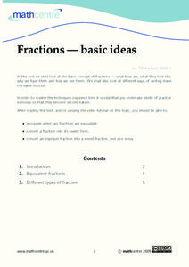
Fractions—Basic Ideas
What are fractions? Find out using a reference page and video that goes in depth on how to make fractions equivalent, write fractions in simplest form, convert improper fractions into mixed numbers, and vice versa. Following...
K12 Reader
Valentine’s Day Word Search
Planning a Valentine's Day activity? A themed word search will fit right in. Learners locate the listed words amidst heart-adorned letters.
US Holocaust Museum
Ripples of Genocide: Journey through Eastern Congo
Could you locate the Democratic Republic of Congo on a map? Scholars investigate the genocide taking place in Eastern Congo. Groups explore web-based evidence as well as the Ripples in Genocide source to take a closer look at the issue....
PBS
Rain Shadows
Satellite images from NASA help scholars focus on the similarities on the planet rather than the differences. The photos from the installment of a larger PBS series exploring weather and climate compare geological formations in the...
Newseum
Compare Coverage of Brown v. Board Ruling
Young journalists analyze how The Topeka State Journal, the Jackson Daily News, and The Providence Journal reported on the 1954 Supreme Court decision in Brown v Board of Education. Scholars scrutinize the headlines, photographs,...
Curated OER
Travels With Charley By John Steinbeck
A paragraph from John Steinbeck's Travels with Charley provides English language learners with an opportunity to practice strategies for answering guiding questions about the academic text. Class members locate keywords in the annotated...
Curated OER
Geography from Space
Young scholars explore geography as seen from space. In this web-based instructional activity, students brush up on geography skills by identifying geographic locations based on satellite or aerial images and a brief clue.
Curated OER
Disney's Mickey Mouse Clubhouse "Daisy Bo Peep"
Students watch an episode of Mickey Mouse's clubhouse, "Daisy Bo Peep". As a class, they are introduced to the proper words to describe location. They also identify the circle, square and triangle shapes and end the lesson plan by...
Curated OER
Analysis and Compare and Contrast
Students study images to analyze their content and complete a compare and contrast study of the pictures. In this image analysis activity, students complete two worksheets of images with captions. Students compare and contrast the images...
Roy Rosenzweig Center for History and New Media
Continental Differences
Students break into groups and closely investigate primary sources associated with the seven different continents. After deciding which continent their primary sources relate to, representatives from each group present their...
University City High School
Metabolism Lesson Plan
Not a lesson in the traditional sense, this is a collection of resources with which you can craft a lesson on metabolic processes. It includes an outline of topics, some brief discussion, and a large array of animations, images, and...
Curated OER
How Can We Locate Specific Places On Earth?
Second graders discover how to use longitude and latitude to locate specific sites on Earth. They compare old and new ways of locating specific places, and discover how latitude and longitude coordinates are used to locate places on Earth.
Curated OER
Put Me in My Place: Using Alphanumeric Grids to Locate Places
Learners practice locating points on a large wall grid and create and label a neighborhood map. For this geography lesson, students spell and discuss places as the teacher places them on the map. They discuss the concept of an...
Curated OER
Measuring Distance and Area in Satellite Images (College Level)
Pupils are able to download, install, and use Image J image analysis software to quantify change over time in satellite images. They access and download satellite images for specific locations and times. Students set a scale (spatial...
Curated OER
Japan: Images of a People
Learners learn the geography of Japan and its location in reference to the United States.
Curated OER
Locating The Cold War
Students identify major players in the Cold War and place them on a world map. They identify the two superpowers location on the map as well as their allies. Students analyze how the world divided itself.
Curated OER
Optical Images
Ninth graders study optics and the law of reflection. In this optical images lesson plan students use a laser and conceptualize the law of reflection.
Curated OER
Downloading and Viewing Images from the Internet
Twelfth graders demonstrate that they can locate and download an image from a web page.
Curated OER
Image Processing in the Classroom
Twelfth graders determine how scientists study the universe and particular astronomical objects using Internet research, images and NIH software. They work in groups to examine and use imaging software as they study astronomical objects.
University of Wisconsin
Noting Notable Features for Rain Gardens
Eight groups in your class are each responsible for a different aspect of surveying the campus for a suitable rain garden location. Features to consider include water flow, topography, sun/shade patterns, land surface, vegetation,...
Curated OER
A Bird's Eye View Of Your Community
Students locate and identify their community by using a satellite image from the Internet. Students locate and identify common land structures within their community. You may want to include structures such as roads/streets, houses and...


