Curated OER
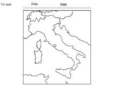
Italy Outline Map
In this outline map worksheet, students examine the political boundaries of the European nation of Italy. The map may be used in variety of activities that individual teachers create to accompany it.
Curated OER
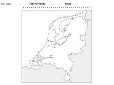
Netherlands Outline Map
In this outline map worksheet, students examine the political boundaries of the European nation of the Netherlands. The map may be used in variety of activities that individual teachers create to accompany it.
Curated OER
Europe Outline Map (Labled)
In this blank outline map worksheet, students study the political boundaries of the labeled European nations.
Curated OER
European Integration: Who and Why?
This French IV-V instructional activity addresses European integration into the European Union. French language learners research, discuss, and present in the target language. Online research, discussion, and presentations will take...
Curated OER
European Country Map
In this Europe political map worksheet, students examine the national boundaries. The country names are labeled on the map.
Curated OER
European Map
In this blank outline map activity, students explore the political boundaries of the continent of Europe and those of the countries located there.
Curated OER
Europe: Political Map
In this Europe political map worksheet, students examine each country's boundaries. The map also highlights each of the nation's capitals with a star.
Curated OER
Europe Labeled Map
In this Europe political map worksheet, students examine the national boundaries. The map also highlights each of the nation's capitals with a star. The countries and capital cities in this map are labeled.
Curated OER
Early European Explorers Map
Fifth graders create an explorer's map. In this explorers activity students use a map of the world as reference to draw their own map of Europe, North America, Central America, and the Caribbean Islands. The students use their maps to...
Curated OER
EU and Turkey
Should Turkey be admitted to the European Union? Before debating this question, class members research the background and stated purpose of the EU, read articles of Turkey's bid to become a member of the EU, and the concerns other...
Core Knowledge Foundation
Year 2: Northern Europe
How is life in Northern Europe different from other areas of the world? Historians journey through the various regions of Northern Europe discovering what type of climate, animals, and lifestyles exist in that section of the world. They...
Curated OER
European Explorer's Photo Journal
Students study early European explorers. They choose one to research and complete a photo journal of his explorations, which includes maps, articles, etc.
Curated OER
Mapping the Prairie
Fifth graders study maps of the Chicago area looking at defining characteristics and place names. They investigate settlement patterns by looking at the maps.
Curated OER
What They Left Behind: Early Multi-National Influences in the United States
Students examine how the European voyages of discovery influence American culture even today. They map eighteenth century Europe's impact on the United States.
Curated OER
China - the Geography of European Imperialism - Spheres of Influence in China
Ninth graders create a map of China. They identify the various spheres of influence carved out by the Imperialist powers of Europe as well as locating geographical features of china and major cities. They explain the global impact of...
Boston University
Scramble for Africa
In this fantastic simulation, your young historians take on the roles of imperialistic European countries in the nineteenth century and then "scramble" to carve up the continent of Africa! This is a very hands-on activity that will help...
Core Knowledge Foundation
The United Kingdom
Scotland, Northern Ireland, Wales, and England are four countries united by more than a monarchy. Academics explore the geography of the nations that make up the United Kingdom. The resource is broken into six lessons focusing on...
Curated OER
European Integration: Who and Why?
Young scholars use the internet to research facts about the members of the European Union. In groups, they use their information to develop a presentation and a fact sheet. They must identify the positives and negatives of their...
Curated OER
Immigration: Creating Change
Students explore how immigration has changed the culture of America. After identifying the foods and diets of Europeans and Native cultures, students create a map indicating where foods came from. Students design a restaurant menu,...
Curated OER
The Early Peoples
Students, after studying The Early Peoples, explain and give examples of how Native Americans and Europeans adapted to living in certain environments. They give examples of early cultures and settlements that existed in North America...
Curated OER
Product Line
Learners research products imported from Europe and use a map to show the routes the products might have followed to reach this country. They take a field trip to a store that carries imported products and take note of how many come from...
California Polytechnic State University
Australian Geography Unit
At the heart of this resource is a beautifully detailed PowerPoint presentation (provided in PDF form) on the overall physical geography of Australia, basic facts about the country, Aboriginal history, and Australia culture and lifestyle.
Curated OER
Northwest Ordinance
Students examine the area where the Northwest Territory was located. They discover the steps territories need to follow to become states. They create a map of the Northwest Territory and label the states that came out of that region.
Curated OER
The Countries of Slave Trade
Students create graphs, routes, and write an essay based on their research of the slave trade. In this slave trade lesson plan, students research the Middle Passage and how slave trade happened in the United States.
