Curated OER
Orienteering: Map Skills
Students use a map to locate six specific landmarks on a course using a map. They identify how maps can help us and write a paragraph describing how to get from one landmark to another on the map.
PBS
Arthur's World Neighborhood: Building Global and Cultural Awareness
Kids become global anthropologists as they explore commonalities and differences both in their classroom and expanding across the globe. Throughout several activities, learners conduct partner interviews that culminate in Venn diagrams,...
Curated OER
Going, Going, Ghost
Third graders research ghost towns. In this geography instructional activity, 3rd graders locate ghost towns on a map and choose one location to research. Students construct a research paper and present it to the class.
Curated OER
Where In the World Am I?
Learners identify their location in the world after studying latitude, longitude, relative location, and absolute location. They use assigned web site to find information to make a flipbook that answers questions about their location in...
Curated OER
BOUND TO BE NEW HAMPSHIRE
Students identify neighborhood, town, and state boundaries. They distinguish between natural and man-made boundaries. They identify major state geological features and explain how NH boundaries have changed over time.
Curated OER
Weather Report Chart
Students complete a weather report chart after studying weather patterns for a period of time. In this weather report instructional activity, students measure temperature, precipitation, cloud cover, wind speed, and wind direction for a...
Curated OER
GPS Treasure Hunt
Students explore geography by participating in a treasure hunt activity. In this Global Positioning System lesson, students define the terms latitude and longitude while utilizing an electronic GPS device. Students view a PowerPoint...
Curated OER
Maps
Maps, globes, and computer software aid young explorers as they locate state capitols, major cities, geographic features, and attractions for states they are researching. They then use desktop publishing software to create a map to share...
Curated OER
Geography: Islands and Alcatraz
Students, in groups, create maps of islands including map keys and compass roses. They compare and contrast their island communities with that of the island prison, Alcatraz. Students select from a series of projects, including writing...
Curated OER
State Research
Students apply previous knowledge of the United States to label a classroom map and then work independently to complete an online scavenger hunt. This lesson is intended for an upper-elementary classroom studying American History and/or...
Curated OER
Chinese Inventions A Selected History of Science and Invention in China
Students study the history of Chinese technology by identifying when and where items were invented or discovered.
Curated OER
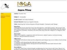
Exploring the Various Regions of Boyle Heights: Continuity and Change
Student study the local landscape of Boyle Heights, California and draw a sketch of the area. Students use map making skills in this activity. Studient make a portfolio of information and photographs they accumulate over time on the area.
Curated OER
Cartography
Students research about cartography and how to be a cartographer. In this math lesson, students draw a map of their classroom. They use a robot to explore navigation using a compass rose.
Curated OER
A Class Census
Students recognize that data represents specific pieces of information about real-world activities, such as the census. In this census lesson, students take a class and school-wide census and construct tally charts and bar graphs to...
Curated OER
U.S. Geography: The Northeast
Students investigate U.S. Geography by creating a map in class. In this natural resource lesson, students create a map of the United States and research the Northeast based on their resources and recyclable materials. Students...
Curated OER
Digital Values: Internet Safety
Students explore digital communication by participating in a critical thinking activity. For this Internet safety lesson, students discuss ways to protect their identity on the Internet as well as preserving friendships. Students...
Curated OER
Microsoft Publisher Country Brochure
Students explore geographic information. In this geography and technology lesson, students choose a county and answer related questions on a Webquest. Students create a word web and design a country brochure.
Curated OER
The Legend of the Indian Paintbrush: Native American Life
Students read," The Legend of the Indian Paintbrush" by Tomie dePaola and discuss the way legends are passed down orally. They then create their own legend and illustrate it on a simulated "Buffalo Skin" made from brown paper.
Curated OER
Ben Franklin Half Dollar
Young scholars research contributions to American culture and technological progress through Benjamin Franklin's quotes and inventions. They also analyze research in order to design a coin honoring Ben Franklin's contributions.
Curated OER
Galloping Who?
Third graders do an Internet search to find out about Galloping Gertie and what caused the bridge to fail.
Curated OER
Landscape Observation: How Portland Has Changed
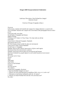
Students read The Lorax and discuss how populations change the environment. Using given photos, students use a Venn Diagram to compare and contrast the Portland of yesterday to present day Portland. They write a comparison paper and...
Curated OER
Our State Road Trip
Students take a virtual tour of the country of China instead of a state. Using the Internet, they examine the differences between a political and physical map and use latitude and longitude to locate specific places. They also research...
Other popular searches
- Compass Skills Worksheets
- Compass Skills 3rd Grade
- Compass Skills First Grade
- Compass Skills Elementary
- Map and Compass Skills
- Compass Skills Lesson Plans
- Map Compass Skills
- Math Compass Skills
- Tecahing Compass Skills
- Decaying Compass Skills
- Compass Skills Yr 10
- Math Compass Skills Triangle


