Curated OER
Creating a Thematic Map
Students create and analyze a weather-related data table and a thematic map based upon information provided.
Howard Hughes Medical Institute
Gorongosa: Making Observations Activity
Do you have young scientists wanting to make new discoveries rather than just completing the same experiments? Young scientists use their observational skills to identify animals and patterns in animal behavior. Through tracking...
Annenberg Foundation
America's History in the Making: Using Digital Technologies
How can digital technology of today link us to the events of the past? Scholars use technology to uncover the vast number of historical resources available in lesson 12 of a 22-part America's History in the Making series. Using databases...
Howard Hughes Medical Institute
Building Ecological Pyramids
Looking for a fresh take on traditional food/energy pyramids? Conduct an innovative activity where pupils build their own! The lesson uses research data from Gorongosa National Park in Mozambique for a real-life safari touch. Scholars...
Polar Trec
Mini-Ocean Bathymetric Mapping Research Cruise
Middle or high schoolers transform into oceanographers in a week-long simulation. To begin, each group follows directions to create a model of the ocean floor with specified features. Next, the groups prepare to set sail on a research...
Curated OER
E-mailing the Chamber of Commerce
Encourage effective internet research and e-mail correspondence as scholars investigate a US capital city they've never visited to find pertinent and relevant information. They begin by picking a city, then visit that city's chamber of...
Curated OER
Gopher It! Exploring German Cyberspace
Students are introduced to the Gopher research tools. In groups, they compare and contrast English and German services on the gopher servers. They create their own dictionary of computer related terms and spend time downloading picture...
Baylor College
Pre-Assessment Activity: What Do You Know About Microbes?
In an introductory lesson, youngsters take a pre-assessment quiz, get a grasp of a gram of mass, and then estimate the mass of microorganisms that live within a human body. Using Glo Germ™, a material that allows you to simulate the...
Curated OER
European Explorers: Research Project
What will your students choose to include in their explorer's treasure chest? Youngsters research an early European explorer and gather items to reflect their research, such as a detailed map of the explorer's voyages, portrait,...
Curated OER
Road Map to Success
Using three different graphic organizers, learners create a road map describing how they'll meet their future career goals. They research the career they are interested in, then use their findings to construct a time line, road map, and...
Curated OER
Bears and Panthers Aplenty: Early Settlers Make a Home in Arkansas
Young historians research the Southwest Trail, which ran through Arkansas back in the 19th century. Pupils are divided into four groups. Each group researches a pioneer who blazed the Southwest Trail. Then, the group presents an oral or...
Curated OER
Mapping Puerto Rico
Students use maps to discover where Puerto Rico is located. In groups, they use the internet to research the vegetation. They also compare and contrast the relationship between the United States and Puerto Rico's government.
Curated OER
Weather, Data, Graphs and Maps
Students collect data on the weather, graph and analyze it. In this algebra instructional activity, students interpret maps and are able to better plan their days based on the weather reading. They make predictions based on the type of...
Curated OER
Map Skills
Students examine the nations, battlefields, troop movement of the Germans through Belgium and the location of both fronts during World War I by creating a map. They visualize the strength of the Germans early in the war.
Curated OER
The Crash Scene
Fifth graders explore geography by participating in a mapping activity. In this engineering instructional activity, 5th graders identify the differences between latitude and longitude and practice locating precise points on a globe or...
Curated OER
Agriculture: It Doesn't Just Happen
After reading an informational text on the Agricultural Research Service, learners research the role of the ARS in Oklahoma. Using reputable online sources, they label a map of the state with relevant areas. Researchers focus on one of...
National Museum of the American Indian
The A:Shiwi (Zuni) People: A Study in Environment, Adaptation, and Agricultural Practices
Discover the connection of native peoples to their natural world, including cultural and agricultural practices, by studying the Zuni people of the American Southwest. This lesson includes examining a poster's photographs, reading...
Columbus City Schools
Experiencing Eclipses
Don't be caught in the dark! Young scientists investigate the causes of both solar and lunar eclipses using an interactive to help them understand the development of an eclipse over time. They then research facts and characteristics...
Curated OER
World War II New Guinea Campaign
Although the big picture for this lesson on the New Guidea Campaign of WWII is taking a field trip to the Douglas MacArthur Memorial, you can easily use it as a guide to an independent or group research project as well. However, if you...
Curated OER
Geography of Canada
All about Canada! Learners explore the geography and providences of Canada by watching videos, studying maps and conducting internet research. By the end of this lesson, your class should be able to locate major areas and compare and...
Mathematics Assessment Project
“Ponzi” Pyramid Schemes
Use mathematics to show your classes the power of a good model. Young mathematicians analyze the famous Ponzi pyramid scheme using an exponential pattern. They make conclusions on the reliability of the plan and why it is illegal.
Howard Hughes Medical Institute
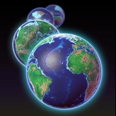
EarthViewer
Can you imagine Washington DC and London as close neighbors occupying the same continent? Learners will be fascinated as they step back in time and discover the evolution of the earth's continents and oceans from 4.5 billion...
Curated OER
Topographic Map Unit Plan
Learners examine topographic maps and discover how to decipher contour intervals, use contour lines and apply information to complete a topographic map lab. Working in groups, they identify the scale of the map, latitude and longitude,...
BrainPOP
World History Lesson Plan: Uncovering Essential Questions
Have you ever noticed a news story revolves around an essential question? Scholars research methods of reporting historical events. Working in groups, they use an interactive module to gather information on a historical topic, uncovering...


