Curated OER
What Do Maps Show?
This teaching packet is for grades five through eight, and it is organized around geographic themes: location, place, relationships, movement, and regions. There are four full lessons that are complete with posters, weblinks, and...
Space Awareness
Let's Map the Earth
Before maps went mobile, people actually had to learn how to read maps. Pupils look at map elements in order to understand how to read them and locate specific locations. Finally, young cartographers discover how to make aerial maps.
Curated OER
Geography and Culture of China
Take out a map, a paper, a ruler, and those coveted colored pencils for a lesson on Chinese culture and geography. This is a multifaceted approach to basic geography skills that incorporate story telling, class discussion, primary source...
Macmillan Education
Understanding Your Skills and Talents
Skills, talents, and personal qualities are the focus of the fourth session in a 23-lesson series of life skills exercises. Participants build a mind map of all the skills and talents in the class, and then groups work together to...
EngageNY
Reading Maps: Locating the Countries We Have Been Reading About
Show your class how to read a map and decipher all of the markings and features. Start out by connecting maps to their homework from the night before and their current reading, in this case That Book Woman, and a related informational...
Education World
Edible Resource Maps!
Young scholars discuss resource maps and examine examples from library resources. Working in groups, they create edible resource maps by drawing examples, such as popcorn on the border of Iowa and Nebraska. Then they use cookies in the...
Curated OER
Great Lakes Homepage for Kids
Here are some outstanding lessons on the geology and history of the Great Lakes. These lessons are divided into Grade 4 -6, and Grade 7 - 8 activities. The activities all use the background information, maps, graphs, data, and Great...
Curated OER
Tiles, Blocks, Sapphires & Gold: Designing a Treasure Map
Young cartographers in groups hide treasure at school and then create a map to find it using pattern blocks and tiles. They make paintings with clues to create a visual representation of the location of their treasure. Groups present...
Brigham Young University
Rosencrantz and Guildenstern Are Dead: Fishbowl Discussion
After reading through Act II of Rosencrantz and Guildenstern Are Dead, take some time to discuss the references to death in the play. For this fishbowl discussion, learners prepare questions, practice answering individually and with...
Curated OER
John Smith’s Map of the Chesapeake Bay
Young geographers travel back through time with primary source and map analysis and envision Captain John Smith's arrival at the Chesapeake Bay.
Curated OER
Orienteering - Lesson 1 - Maps & Map Scales
Lesson 1 of 10 lessons in this orienteering unit is about maps and map scales. After all, orienteering is all about maps, compasses, and finding ones' way around. It is imperative to be able to read maps and understand the relevance of...
Curated OER
Orienteering - Lesson 2 - Topographical Maps
One of the most important skills in orienteering is being able to read a topographical map. Understanding the contour lines and symbols and the scale of the map will make planning your route so much better. In this lesson, partners get...
Royal Geographical Society
An Introduction to Maps
First graders are introduced to a variety of maps such as globes, street maps, atlases, and different types of floor plans. The focus of the lesson plan requires individuals to create their own plan of the classroom using the PowerPoint...
BrainPOP
Latitude and Longitude Differentiated Lesson Plan
Scholars warm-up their map skills with a discussion using location words to describe familiar places. An engaging video informs class members about latitude and longitude. Three leveled activities extend the learning experience for...
Curated OER
Story Mapping
Fill-out a story map to help your scholars with pre-writing. They will use a story map template to pre-write. They also organize their ideas into steps which become the foundation for their first draft. Concrete objects are brought in to...
Just Health Action
Environmental Justice Matters: Mapping Cumulative Impacts (Part 2)
A case study enables class members to confirm whether different geographic parts of Seattle, Washington have disproportionate environmental burdens and benefits. Groups use the EPA's Cumulative Health Impact Analysis formula and...
Curated OER
Mapping the Aegean Seafloor
Earth science learners create a two-dimensional topographic map of the floor of the Aegean Sea. They use it to then create a three-dimensional model of the ocean floor features. This comprehensive resource delivers strong background...
Curated OER
Fossil Fuels (Part I), The Geology of Oil
Junior geologists work through three mini-lessons that familiarize them with the formation and location of fossil fuels. Part one involves reading about petroleum and where it comes from via a thorough set of handouts. A lab activity...
Edgate
Why Map a Map?
After brainstorming reasons why Native Americans mapped their lands, your young critical thinkers will work together to review their ideas and determine the definition of a map. With today's extensive use of mapping technology and GPS...
Academy of American Poets
Teach This Poem: "Maps" by Yesenia Montilla
After examining a physical map of the world, learners conduct a close reading of Yesenia Montilla's poem "Maps." They note the interesting words and phrases, the way the poem is structured, and list questions they might have. After...
Polar Trec
Playground Profiling—Topographic Profile Mapping
The Kuril islands stretch from Japan to Russia, and the ongoing dispute about their jurisdiction prevents many scientific research studies. Scholars learn to create a topographic profile of a specific area around their schools. Then they...
Just Health Action
Environmental Justice Matters: Mapping Environmental Justice Impacts (Part 1)
A case study of Seattle, Washington permits class members to compare and rank how different areas of Seattle are impacted by environment burdens. Groups investigate different zip codes, collect data on five categories, and color-code a...
Curated OER
Three Dimensional Geology
Here is a fine lesson plan on geology designed for high schoolers. Learners use rocks, fossils, and other geological clues to determine the geology of an area. Then, they make recommendations to a fictitious city council about the...
NASA
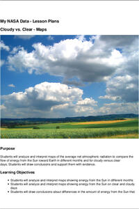
Cloudy vs. Clear - Maps
Find out the science of how clouds keep Earth cooler on hot days. Using guided discussions, investigators analyze and interpret maps of how much solar energy Earth receives at different times of the year. Participants draw conclusions...
Other popular searches
- Map Skills Lesson Plans
- Map Skills Worksheets
- Elementary Map Skills
- Geography Map Skills
- Basic Map Skills
- Social Studies Map Skills
- Globe and Map Skills
- Beginning Map Skills
- United States Map Skills
- Map Skills, Continents
- Early Explorers Map Skills
- Free Map Skills Worksheets


