Curated OER
Enchanting Egypt
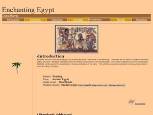
After reading the Magic Tree House book Mummies in the Morning, learners talk about Ancient Egypt. They identify the plot, characters, setting, etc., explore vocabulary terms, and construct a pyramid. This will motivate your class to...
Curated OER
Touring Ancient Egypt
Students study the geography and resources available to the ancient Egyptians and create a multimedia tour that demonstrates this learning to others.
Annenberg Foundation
Teaching Geography: Workshop 4—North Africa/Southwest Asia
Can Jerusalem be equitably organized? Can Israel and Palestine be successfully partitioned? Part one of a two-part workshop looks at the geo-political history of Jerusalem while Part two investigates Egypt's dependence of the Nile River...
Curated OER
"Egypt, Gift of Nile"
Sixth graders are introduced to the basics of ancient Egypt focusing on the Nile River and the necessity of the river. The students work in small groups and
become "experts" on the given topic and then present the information that
was...
Prairie Public Broadcasting
Egyptian Pyramids Virtual Field Trip!
A virtual field trip takes enthusiastic travelers to the pyramids of Giza. Using Google, scholars explore the grounds of the ancient pyramids found in Egypt then complete three worksheets: a photo analysis page, a reflection sheet, and a...
Curated OER
A Celebration of Africa
Students investigate early African civilizations. They create Kufi hats, musical instruments, pottery and African masks, sing songs, play African studenT games, and participate in a feast and tour of a museum where their artwork is...
Curated OER
Comparing and Contrasting Three Civilizations
Sixth graders compare and contrast ancient civilizations. In this research skills lesson plan, 6th graders use SMART Board programs to compare and contrast the economies, cultures, and geography of Mesopotamia, Egypt, and India.
Curated OER
The Gifts of the Nile
Get your class thinking about the geography that shaped the Egyptian landscape and culture. They compare ancient climate zones and geogrpahical fetures, locate evidence of plate tectonics, take and quiz, and write a short essay. The...
Curated OER
Ancient River Civilizations Jigsaw PowerPoint
Ninth graders use captions to determine an artifact's function and to list the features of a civilization. They classify artifacts according to the 8 Features of Civilization and for each Feature of Civilization they locate one artifact...
Curated OER
Arabia: Educator's Resource and Activity Guide
MacGillivray Freeman's film Arabia presents viewers with remarkable images and insights into this ancient and mysterious land. An educator's guide is designed to provided teachers with the materials they need to support a showing of the...
Curated OER
The Roman Empire-Map Activity
In this Roman Empire worksheet, students complete a map activity in which they label and color civilizations, countries and physical features as instructed. There are no maps included.
Curated OER
History and Culture of the Middle East
The Middle East provides a rich history for students to delve into.
Curated OER
Africa Test Study Guide
In this Africa study guide worksheet, students respond to 27 short answer questions about the geography and history of the continent.
Curated OER
A Tale of Two Cities
Students research and compare Thebes to their hometown to explain how a city's geography, economy, climate, and culture affect its inhabitants.
Curated OER
Location of Cities 201
Students work in pairs to locate the ancient cities on a world atlas using the longitude and latitude measurements. They examine the physical and human futures that explain their locations.


