Curated OER
A World of Information
Students analyze data and statistics about countries around the world. They read graphs and charts, color a world map to illustrate the top ten statistics about the world, and write a paragraph to summarize their information.
Curated OER
Scaling it Down: Caves Have Maps, Too
Measurement and map skills are the focus of this lesson, where students crawl through a "cave" made out of boxes, desks and chairs, observing the dimensions. Your young geographers measure various aspects of the cave and practice math...
Curated OER
Earth from Space Maps
Students use photo images from space to create a large map of the United States or the world, find where they live and label other places they know. They are exposed to a Web resource that allows them to view photo images of Earth taken...
AGSSS
World Regions
Help your learners to visualize where historical events have taken place around the globe with a map that details the major regions of the seven continents.
Space Awareness
Let's Map the Earth
Before maps went mobile, people actually had to learn how to read maps. Pupils look at map elements in order to understand how to read them and locate specific locations. Finally, young cartographers discover how to make aerial maps.
Random House
Mapping Skills
Spark interest and enhance your pupils' map skills using Matteo Pericoli's book, See the City: the Journey of Manhattan Unfurled. Through Pericoli's illustrations and text, learners explore the East and West side of Manhattan. Then,...
Curated OER
Map Skills
Thirds graders reinforce that a map is a drawing that shows what a place looks like from above. They use a map key and symbols to create a map of the school and its neighborhood.
Education World
Edible Resource Maps!
Young scholars discuss resource maps and examine examples from library resources. Working in groups, they create edible resource maps by drawing examples, such as popcorn on the border of Iowa and Nebraska. Then they use cookies in the...
EngageNY
Reading Maps: Locating the Countries We Have Been Reading About
Show your class how to read a map and decipher all of the markings and features. Start out by connecting maps to their homework from the night before and their current reading, in this case That Book Woman, and a related informational...
Curriculum Corner
Holidays Around the World
Let's focus on a holiday from around the world! Young researchers choose a holiday from somewhere around the world, and conduct research to answer questions about the holiday. It can be used anytime during the year!
Curated OER
My World
Students study maps. In this social studies activity, students draw a map of either their room at home or the route they take to school. Students label items on their maps.
National Wildlife Federation
Where In the World Is the Arctic?
Exactly how far away is the Arctic? Learners use maps to orient themselves to their locations on the globe. They then make calculations to describe how their location relates to the location of the Arctic regions.
Curated OER
Where Did Foods Originate? (Foods of the New World and Old World)
What do papayas, peanuts, pineapples, and potatoes have in common? Why, they are foods explorers brought back to the Old World. Young researchers use the Internet to investigate how New World explorers helped change the Old World's diet....
PBS
Around the Block
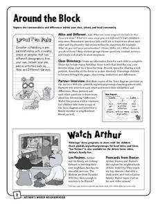
Arthur and his friends help children explore the concepts of family, community, and diversity in a fun series of activities. From performing peer interviews to mapping out the different places students have lived or visited, this...
PBS
Make a Balloon Globe
"We've got the whole world in our hands," is what your students will be singing after completing this fun geography activity. Using the included templates for the seven continents and a balloon, they create their very own globes.
NASA
Air Temperatures Around the World: Student Activity
Check out climate anomalies just like NASA climatologists! Investigators use a GISTEMP map from NASA to analyze one month of climate anomalies. Scientists look for data extremes and generate possible explanations for observable patterns.
Curated OER
Countries of the World
Learners define the meaning of the word country. In this countries of the world map lesson, students identify boundaries, countries, and symbols within countries on the map. Learners distinguish the words country and continent.
Curated OER
Mapping Perceptions of China
Students discuss what types of things are included on a map. They compare and contrast maps of China with a map they create and practice using different types of maps. They write analysis of their classmates maps.
Curated OER
Where in the World is Hawaii?
Students compare a globe and a two-dimensional world map and explore how they both represent the planet Earth. They locate the Hawaiian Islands on the globe or the world map and describe how the geographical position is unique.
Curated OER
A Month of Mapping Literature
Explore the world through literature! With push pins to mark where each story came from, learners examine cultural differences, geographical location, and how those elements affect story content. This lesson could use deeper development,...
Curated OER
Maps and the Pictures in Our Heads
Geographers of all ages examine different types of maps. They draw maps of their environment, utilizing both three-dimensional and picture maps. They interpret map information, noting how it can sometimes be misleading. Some good...
Curated OER
Map Skills
Do you need to practice map skills? Children with a range of abilities will complete a KWL chart about maps, practice important map vocabulary and then read a few pages from their textbook. They will use their vocabulary words and...
Curated OER
Investigating the Countries of the World
Explore world geography by creating presentations for different countries around the world. Researchers identify many different countries on a globe and select one for which they will create a presentation. They share their research and...
Curated OER
State Map of Utah
In this social studies worksheet, students examine a state map of Utah and answer 7 questions, using the map as a reference. The map includes freeways and bodies of water. There is no compass rose.
Other popular searches
- World War Ii Map
- World War I Map
- World War 2 Map
- World War I Outline Map
- World Climate Map
- World Biomes Map
- World Outline Map
- Blank Map of the World
- World Political Map
- Ancient World Greece Map
- World Time Zone Map
- Deciduous Forests Map World


