Pictorial Map Teacher Resources
Find Pictorial Map lesson plans and worksheets
Showing 403 resources
Curated OER
Types of Transportation
Young scholars identify and describe various modes of transportation. In this transportation lesson, students discuss the types of transportation shown in the Landscape Picture and discuss the purpose of that vehicle. Young scholars...
Curated OER
Natural Features
Students identify natural features on a map. In this geography instructional activity, students identify six physical features and create pictorial definitions for each term. The terms which are listed in this instructional activity are...
Curated OER
Landscape Picture Map
Students explore pollution of water sources. In this ecology lesson plan, students define and identify natural resources. Students use map skills to locate local rivers and lakes used for recreation. Students brainstorm ways in which to...
Curated OER
Maps and the Pictures in Our Heads
Geographers of all ages examine different types of maps. They draw maps of their environment, utilizing both three-dimensional and picture maps. They interpret map information, noting how it can sometimes be misleading. Some good...
Curated OER
The Fall of Rome and the Beginning of the Middle Ages
A major turning point in world history is the focus of this presentation. Rome has fallen, and with its descent comes the Dark Ages. With pictures, maps, and important information about the Middle Ages, this slideshow would be a great...
Smithsonian Institution
Lexington and Concord: Historical Interpretation
Learners view and analyze three different images related to the Battle of Lexington and Concord. They also answer a variety of questions in a graphic organizer to help keep the information straight.
Rainforest Alliance
Knowing the Essential Elements of a Habitat
To gain insight into the many different types of habitats, individuals must first get to know their own. Here, scholars explore their school environment, draw a map, compare and contrast their surroundings to larger ones. They then...
Rainforest Alliance
Protecting the Critical Habitat of the Manatee and Loggerhead Turtle
Explore ocean habitats with a instructional activity that showcases the home of manatees and loggerhead turtles in Belize. Here, pupils compare and contrast the homes of ocean animals to those of humans, listen to an original...
Random House
Mapping Skills
Spark interest and enhance your pupils' map skills using Matteo Pericoli's book, See the City: the Journey of Manhattan Unfurled. Through Pericoli's illustrations and text, learners explore the East and West...
Space Awareness
Valleys Deep and Mountains High
Sometimes the best view is from the farthest distance. Satellite imaging makes it possible to create altitude maps from far above the earth. A three-part activity has your young scientists play the role of the satellite and then use...
Concord Consortium
The Six Faces of Amzora
Here's a task that is out of this world! Given a description of a fictional cube-shaped planet, scholars answer a set of questions about the planet. They create a two-dimensional map and consider the distances between locations on the map.
Howard Hughes Medical Institute
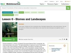
Lesson 6: Biomes and Landscapes
Aside from the amazing animals in Gorongosa National Park, what else is there to discover? The sixth installment in an eight-part themed series contains an interactive map where scholars can learn more about the geographic features of...
Radford University
The Roanoke Adventure!
Travel about town. Pupils work in pairs to find the distances between landmarks with a map. The teams determine how far to travel on the streets and the length between the landmarks with the distance formula and compare the two. Learners...
National Wildlife Federation
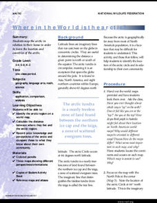
Where In the World Is the Arctic?
Exactly how far away is the Arctic? Learners use maps to orient themselves to their locations on the globe. They then make calculations to describe how their location relates to the location of the Arctic regions.
Curated OER
Slavery and Abolition: Three Unforgettable Names
Students research the people and events involved in the abolitionist movement prior to the U.S. Civil War. They read about and discuss the roles of Nat Turner, Harriet Tubman, and John Brown. Students complete a word splash, Venn...
Curated OER
Travel-Tracer-Literature Circles
In this travel tracer literature circle worksheet, learners track where the action of a story takes place by recording where the action begins, where key events happened, and where the events ended. They describe the settings in detail...
Curated OER
The Earth's Surface
Students identify the characteristics of places. In this communities lesson, students discuss what they observe when they travel and construct a list of places in their neighborhood. Students use a Landscape Picture Map to circle...
Curated OER
Lesson Nine: Size and Scale
Students investigate scale as it is related to maps. In this map lesson, students read Jack and the Beanstalk by Carol North. Students then compare the setting in the story to a landscape picture map to help them study scale.
Curated OER
Lesson Eight: Depending on Others
Students consider what real needs are and how people meet them. In this community lesson plan, students read A New Coat for Anna and utilize a landscape picture map to help them discuss community.
Library of Congress
Investigating the Building Blocks of Our Community’s Past, Present, and Future
As Ken Jennings said, "There's just something hypnotic about maps." Certainly, the longer you look at them the more you can learn. In this project-based learning lesson, individuals study both historic and present-day maps of...
US Civil Rights Trail
Explore the Civil Rights Trail—Interactive Map
An interactive map equipped with images, text, and clickable links takes history buffs on a journey through the Civil Rights trail. Scholars discovery locations including Atlanta, Georgia, Jackson, and Mississippi as part of an...
Livaudais-Baker English Classroom
Kindred Unit Project
To conclude a unit study of Octavia E. Butler's Kindred, groups use MovieMaker or the class website to publish an original story about slavery in America. The detailed project assignment sheet includes a list of possible topics,...
Curated OER
Where Does Water Come From: The Water Cycle
Students explore the water cycle. In this water cycle lesson, students read the book The Magic School Bus Wet All Over and summarize the steps of the water cycle. Students label a picture map of the water cycle.
Curated OER
Causes of WWI-Introductory Lesson
Sixth graders identify the causes of World War I. In this World War I history lesson, 6th graders view a Powerpoint to develop background knowledge about World War I. Students make a picture map of the events that led to war and...


