Grid Systems Teacher Resources
Find Grid Systems lesson plans and worksheets
Showing 104 resources
Achieve
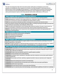
Framing a House
If members of your class wonder where they can use the math they learn in middle school, let them discover the answer. Learners apply geometry concepts of scale and measure to calculate the costs of framing a house addition.
Curated OER
Plotting A Hurricane Using latitude and Longitude
High schoolers explore map and plotting skills by tracing the movement s of hurricanes through the Earth's systems. a hurricane map is developed from daily media reports.
Curated OER
Choose a Number
A quick description of a classroom management technique that allows a teacher to choose participants at random. Assigning grid locations is an easy way to reinforce grid structure as well as giveing an easy way to complete tidying tasks,...
Curated OER
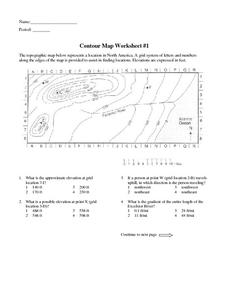
Contour Map Worksheet #1
Being able to read a topographic map is a standard in middle school earth science units and imperative for outdoor enthusiasts. As you introduce learners to this skill, you can assign this as an assessment or reinforcement. Pupils view a...
Curated OER
Plotting a Hurricane Using Latitude and Longitude
Learners define and use "absolute location," latitude, and longitude. They locate on a map or globe the Earth's poles, circles, tropics, and beginning points of measurements for latitude and longitude.
Curated OER
Electronic Mapping
Young scholars identify countries, oceans, and capitals by building an electronic map.
Curated OER
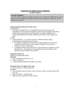
Exploring Wyoming Species Habitats
Students are introduced to the concept of species habitats and ranges. They introduced to ArcView GIS as a tool for mapping. Pupils use query data for species withina county, elevation, range, rivers and streams, land cover, and etc....
Curated OER
Design Your Own Building
Students explore the use of design principles in the real world. They evaluate how problems can be solved using design principles. In groups, students design the floor plan for a building of their choice.
Curated OER
Treasure Hunters
Students design an on campus treasure hunt to find various architectural vocabulary words which they then create definitions for on the blog page on the Environmental Design website.
Curated OER
Sam Houston for President...Again
Fourth graders discover the political career of Sam Houston. In this Texas history lesson, 4th graders research primary resources and create a modern-day version of Sam Houston's political campaign of the 1840s.
Curated OER
My Own Private Idaho; Using Social Studies to Explore Idaho
Students engage in several activities to explore Idaho and Social Studies themes. Using an variety of media, students become familiar with Idaho's geography and geology.
Curated OER
"Yarning" About Latitude and Longitude
Students identify various locations using latitude and longitude. In this map skills lesson, students use yarn and labels to create a "human globe." Students identify the Prime Meridian, the Equator, and Northern and Southern Hemisphere.
Curated OER
But Where Is It On This Modern Map? A problem-solving, mind-boggling experience!
Trace Columbus' voyages by locating them on 21st Century maps. Using a navigators instructional activity, 4th graders will examine the Age of Exploration and trace Columbus's routes accurately on laminated world maps using...
Curated OER
Texas Regions and Native Americans of Texas
Fourth graders research to find the regions of Texas. In this technology lesson, 4th graders create a Kid Pix project showing the location of various regions of Texas. Students show where in those regions Native American...
Curated OER
Shipwreck Mystery
Students draw inferences about a shipwreck. In this marine archaeologist instructional activity, students examine historical and archaeological data to draw inferences about the age and identity of shipwrecks.
Curated OER
Lewis and Clark: Prized Possessions
Students consider the role of Sacagawea as part of the Corps of Discovery. In this Lewis and Clark expedition instructional activity, students discover details about Sacagawea's wampum belt and then create their own wampum belts using...
Curated OER
From Where to Where?
Students find locations based upon their latitude and longitude coordinates. In this latitude and longitude activity, students locate points on a grid and learn how to use an astrolabe.
Curated OER
MAP GRIDS, CLIMATES AND HEMISPHERES
Students compare/contrast the grid and latitude/longitude system used on a globe. They describe the areas which are considered to be a tropical, temperate, and polar, based on knowledge of climates.
Curated OER
Where Am I?
Students apply map reading skills by locating places through the use of latitude and longitude.
Curated OER
The Plains Indians
Learners have a better understanding of another culture other than their own. This help them to see that there were other people living in this region before us.
Curated OER
Creating a Database: Africa, Technology, Social Studies
Students use technology to create a database demonstrating their knowlede (in the case) of the African Continent. This project could be applied to almost any other concept studied.
Curated OER
Native Americans and Topography at Rose Bay
Students visit a wetland ecosystem. While they are there, students explore how to read topography maps of Rose Bay.
Curated OER
Looking at the World Through the Eyes of Chuck Close
First graders examine and analyze various works of art by Chuck Close. They listen to a book about Chuck Close, discuss images of his artwork, and create original paintings in the style of Chuck Close.
Curated OER
Labeling a Map of Australia
Third graders label a map of Australia. Using the internet, they research the history and maps of the continent and print a blank map. They review on how to use a compass rose and legend. In groups, they create a brochure to share...
Other popular searches
- Global Grid System
- Grid System Drawing
- Mapping Grid System
- Grid System Art
- Drawing With a Grid System
- Texas Grid System
- Grid System Worksheets
- Map Features Grid Systems
- Map Features "Grid Systems
- Map Features "Grid Systems"
- Alphanumeric Grid Systems


