Curated OER
Ocean Impacts of an El Nino Event
Students study sea surface height and temperature and other characteristics of an El Nino. In this ocean impacts lesson students examine the factors that influence an El Nino or La Nina.
PBS
Regional Patterns of Climate: Pacific Northwest
Climate systems involve sunlight, ocean, atmosphere, ice, land forms, and many other factors. Scholars explore each of these variables related to the Pacific Northwest rain forest. They use an online interactive to investigate the polar...
Centers for Ocean Sciences
Ocean and Great Lakes Literacy: Principle 1
Is your current lesson plan for salt and freshwater literacy leaving you high and dry? If so, dive into part one of a seven-part series that explores the physical features of Earth's salt and freshwater sources. Junior hydrologists...
NOAA
A Laboratory Simulation of Ocean Surface Currents
Stimulate interest in ocean currents with a simulation. The first installment of a five-part middle school series teaches future oceanographers about the forces that interact to cause ocean currents. A simulation shows how wind and...
Curated OER
Wind Circulation, Surface Currents and Climate
Students describe connections between wind patterns, surface currents, and ocean climate zones. In small groups, they color the ocean climate zones in four different shades of blue. Students then answer questions like what four...
Curated OER
Winds Go Spinning Around
High schoolers simulate the Coriolis Effect to comprehend why winds in the Westerlies are prone to cyclonic and anti-cyclonic motion. They arrive at an explanation of processes that drive world wind patterns
Curated OER
Ocean Currents
Students determine how water and wind affect ocean currents. In this science investigation lesson, students follow the provided steps to enable them to consider how explorers may have used ocean currents to their advantage.
NOAA
Currents
A deep ocean current circles the globe at a force that is greater than 16 times all the world's rivers combined. Groups analyze the effects of submarine topography on deep ocean current speed. They then determine how this speed affects...
Curated OER
Ocean Currents
Fourth graders work in groups to research ocean currents and create posters with their findings. They locate the patterns and names of major ocean currents and identify them on a map. Students also use red pencil to show ocean currents...
Curated OER
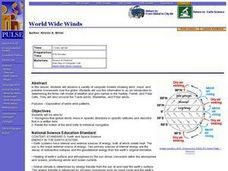
World Wide Winds
Learners recognize that global winds move in specific directions in specific latitudes and describe that in a written form. They relate the motion of the wind belts to historical navigation.
Curated OER
Climate Patterns across the United States
Young scholars articulate differences between climate and weather using examples in a written statement. Using climate data from across the country, they describe climate patterns for various parts of the United States on a map. Students...
Curated OER
Monterey Bay
Young scholars read background information about Monterey Bay, California, and conduct related experiments. In this ocean in motion lesson, students read information about the location, wildlife, and characteristics of Monterey Bay. They...
Curated OER
Ocean Currents and Sea Surface Temperature
Students use satellite data to explore sea surface temperature. They explore the relationship between the rotation of the Earth, the path of ocean current and air pressure centers. After studying maps of sea surface temperature and ocean...
Curated OER
El Nino
Explore the properties of water and the affects of El Nino. Middle schoolers will learn about the devastation an El Nino can cause as well as the definition of El Nino. Additionally, they will discover the cause of El Nino along with the...
Curated OER
The Inside Current
Eighth graders explore ocean currents and wind patterns. They discover the concept of systems to show how change in one component of a body of water, causes change in other components in that system. Students describe positive and...
Curated OER
Ocean Currents
Young scholars discover the geography of Earth by analyzing water currents. In this oceanography lesson, students create visual references on a map of the globe where and why major ocean currents are moving water. Young...
Curated OER
SURFACE CURRENTS
Students identify five major ocean currents and identify the correlation between ocean circulation and prevailing winds.
Curated OER
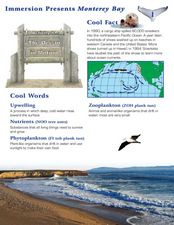
Immersion Presents Monterey Bay
Students study Monterey Bay. In this Monterey Bay instructional activity, students create a model of upwelling around Monterey Bay. Students simulate surface water movement relative to prevailing winds.
Curated OER
Winds of Change
Students investigate extreme weather patterns. In this current events lesson, students visit selected websites to study hurricanes and their causes. Students write reports on their findings.
Curated OER
Fallout!
High schoolers plot the locations of fallout from two disasters that polluted much of the world's air. They plot the ash fallout from the 1980 Mt. St. Helen's eruption to see what the wind patterns in the United States look like overall....
Chicago Botanic Garden
Climate Change Around the World
It is unknown if cloud cover increases in response to carbon dioxide levels changing, helping climate change slow down, or if cloud cover decreases, allowing Earth to warm faster. Part four in the series of five lessons has classes...
Curated OER
Estuarine Currents
Students explore an estuarine system to gather data on density driven currents. This type of current is contrasted with temperature and wind driven currents.
Curated OER
Convection
Students experiment with the cyclic process of convection and apply the principal to everyday events.
Curated OER
1492: Using Data to Explain a Journey
Students examine how Christopher Columbus made his way across the Atlantic. For this data lesson students use an Internet program to navigate like Columbus.


