Gfletchy
Deep Freeze
Warm up to the idea of subtracting integers. After watching a video where the contents of a cup instantly freeze when tossed into the air, pupils estimate the air temperature of Duluth, Minnesota (where the video was made). They then use...
Province of Manitoba
The Outdoors Camping and Survival Skills
Equip young campers with the tips and strategies for a safe trip to the outdoors with a series of lessons. They learn how to start fires with and without firewood, keep warm in snowy weather, and purify water to make it safe for drinking.
Curated OER
European Explorers: Research Project
What will your students choose to include in their explorer's treasure chest? Youngsters research an early European explorer and gather items to reflect their research, such as a detailed map of the explorer's voyages, portrait,...
Curated OER
State or Region Project
Invite your youngsters to learn about a state or region through their choice of a creative project. The resource lists 15 project options that range from a 3-D map of the area, to a puppet show about the region. Pupils can also propose...
Rainforest Alliance
How Do Jaguars and Howler Monkeys in Belize Depend on Us?
How does weather play a role in the lives of land and sea creatures? Find out with a lesson plan focused on habitats and the ways animals from different homes are connected. Here, learners explore how the life of a jaguar and...
US Apple Association
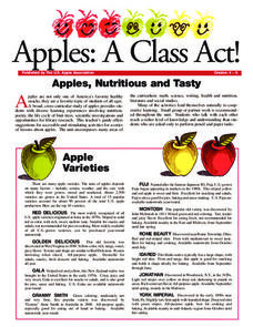
Apples: A Class Act! (Grades 4–6)
Middle schoolers have a bushel of fun as they engage in activities and research core facts about apples. Packed with suggestions for in-class activities and out-of-class research, the colorful 6-page packet is sure to satisfy hungry...
Prestwick House
The Grapes of Wrath
At over 450 pages, John Steinbeck's Pulitzer Prize winning novel The Grapes of Wrath can be a challenging choice for full-class, book circle, or independent reading. The activities in a 10-page sample The Grapes of Wrath...
NASA
Erosion and Landslides
A professional-quality PowerPoint, which includes links to footage of actual landslides in action, opens this moving lesson. Viewers learn what conditions lead to erosion and land giving way. They simulate landslides with a variety of...
Wild BC
Connecting Ecosystems & Climate
Collaborators sort a set of cards into biotic and abiotic categories. Then, as a class, they discuss their work and relate each of the abiotic components to climate change. Finally, they form a web of components by connecting those that...
Discovery Education
Satellite Telemetry
Satellites require rockets to launch, but it doesn't take a rocket scientist to understand them. Future engineers learn about how satellites send data to Earth and how to interpret satellite images. They see how radio waves play a role...
Environmental Education in Wisconsin
Biome Travel Guide
In a perfect marriage of social studies and science, groups work together to research and create a travel guide presentation to share with the class. Not only do kids learn about the climate and geography of a biome, but also the...
Rocklin Unified School District
Spanish Speaking Countries Project
Ask your class members to provide a tour of a Spanish speaking country with a brochure and flag project. Learners research their assigned country, making sure to check off each of the required pieces of information listed on the first...
National Geographic
National Geographic: Create a Weather Map
Students will learn about symbols that are used to represent weather and then use the day's weather to create a weather map for their state. Includes handouts and website links, as well as links to downloadable coloring books full of...
Science Buddies
Science Buddies: Using Weather Balloon Data to Map Atmospheric Temperature
Snow-capped mountains make a picturesque scene, especially in summertime when the peaks are in such contrast to the warmth below. This project shows you a way to see how temperature changes with altitude using data collected twice daily...
Other
West Virginia Storm: Activity Giving a Weather Report
Forecasting the weather and delivering the forecast to the many people who turn on the nightly news is not an easy task. Now that you know some of the jobs in meteorology and know how to read a weather map, you and your team are ready to...
Scholastic
Scholastic: Analyze: Forecast the Weather
Choose a weather-related topic, view the map, then make your own weather forecast.
Science Buddies
Science Buddies: Dry Spells, Wet Spells: How Common Are They?
Here's a project that looks at what the weather was like for over a hundred years. The goal of the project is to compare long-term precipitation patterns in different regions of the country. You will work with historical climate data,...
TeachEngineering
Teach Engineering: How Predictable!
Students follow weather forecasts to gauge their accuracy and produce a weather report for the class. They develop skills of observation, recording and reporting.
Science Buddies
Science Buddies: Mapping Troposhperic Ozone Levels Over Time
Ozone in the stratosphere protects the earth by absorbing harmful ultraviolet radiation from the sun. However, when ozone occurs in the troposphere, it is harmful to health. In this project you can use data from EPA monitoring stations...
Science Buddies
Science Buddies: Ozone Depletion
The ozone layer is important for blocking most of the harmful radiation that comes from the sun. You can find maps of the ozone layer and compare different regions of the globe for ozone coverage. Some scientists think that aerosols in...
Other
France, All You Need to Know
It's not easy to describe an entire country and teach the language on one website, but this publisher has managed pretty well. They cover everything such as general information about France, French language lessons, regional and...
Other popular searches
- Reading Weather Maps
- Interpreting Weather Maps
- Interpret Weather Maps
- Surface Weather Maps
- Creating Weather Maps
- Weather Maps With Fronts
- Pressure and Weather Maps
- Analyzing Weather Maps
- Construct Weather Maps
- Winds and Weather Maps
- Interactive Weather Maps
- Just Interpret Weather Maps


