Curated OER
Lesson Plan: Using Maps and Scales to Get to the Basketball Hall of Fame
Students view a quicktime video of basketball players going from Atlanta to Springfield, Mass. In this scaling lesson, students use a map to calculate the distance of the trip and the length of travel time. Students apply ratio and...
Space Awareness
Let's Map the Earth
Before maps went mobile, people actually had to learn how to read maps. Pupils look at map elements in order to understand how to read them and locate specific locations. Finally, young cartographers discover how to make aerial maps.
Richmond Community Schools
Map Skills
Young geographers will need to use a variety of map skills to complete the tasks required on this worksheet. Examples of activities include using references to label a map of Mexico, identify Canadian territories and European...
abcteach
Street Mapping
What's around the block? Or down the street? Ask your pupils to tap into their map skills by drafting the area around their home and school.
Curated OER
Mapping It Out: Social Studies Online
A great way to introduce 2nd graders to map skills would be to use this presentation. The visuals are inviting and the layout is easy to understand. This would be a terrific way to cover the basics on how to read a map. There is also a...
Museum of Science
Make a Map
It's important to know the final destination. Scholars first measure distances in a region of interest using a standard measuring device or by counting steps. They then use an appropriate scale and graph paper to create a map of the...
Curated OER
Scaling it Down: Caves Have Maps, Too
Measurement and map skills are the focus of this lesson, where students crawl through a "cave" made out of boxes, desks and chairs, observing the dimensions. Your young geographers measure various aspects of the cave and practice...
Owl Teacher
Introduction to World of Geography Test
Assess your learners on the five themes of geography and the most important key terms and concepts from an introductory geography unit. Here you'll find an assessment with 15 fill-in-the-blank and 14 multiple-choice questions, sections...
Curated OER
Magical Maps
Second graders discuss the importance of using maps and how they are used. After they listen to a folktale, they develop their own story line maps and write their own folktale to accompany a map. They also identify and locate the seven...
Curated OER
Electronic Mapping
Students identify countries, oceans, and capitals by building an electronic map.
Curated OER
Customized Topographic Maps and Models
Students explore the information depicted on topographic maps. They construct a 3-D topographic map of a local area. They go on a field trip to the depicted area and compare the 'real world' with their models.
Curated OER
Mapping
Introduce middle or high schoolers to topographic maps with this PowerPoint. After a review of longitude and latitude, display and describe contour lines and intervals. Also explain map scale. This is a useful presentation for a social...
Curated OER
Map Adventures
Young scholars explore the relationship between a scale drawing and actual distance. In this mapping lesson, students use an amusement park map to determine distances and what they would be like in real life.
Curated OER
Playground Mapping
Students convert their physical models of a playground from a previous lesson into a map of the playground that includes a scale and key. They examine and discuss examples of maps, view an image to map photo essay, and create a map using...
Civil War Trust
Map the Civil War
Mapmaking was a very important element in successfully planning attacks on enemies during the Civil War. Guide pupils through the process of pacing to find the average length of their steps, measure the distance between one object...
National Endowment for the Humanities
Lesson 3: On the Road with Marco Polo: From Hormuz to Kashgar
Young explorers examine the route that Marco Polo and his father traveled to reach China. They examine online maps of the Silk Road and harsh terrain of Afghanistan to determine challenges that may have been encountered during travel.
Curated OER
Some Things You Need to Know to Read a Map
Students study things the you need to know to read a map and explain location.
Maths Revisions
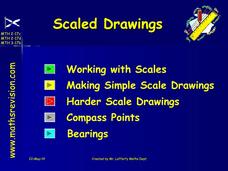
Scaled Drawings
Your carpenters will enjoy learning scaled drawing techniques and applying their new knowledge to make some real-life scale drawings of gardens. Your carpenter scholars will be reviewing some basic skills in a warm-up section of problems...
National Geographic
Mapping the Americas
Celebrate the geography of the Americas and develop map skills through a series of activities focused on the Western Hemisphere. Learners study everything from earthquakes and volcanoes of the Americas and the relationship...
Royal Geographical Society
An Introduction to Maps
First graders are introduced to a variety of maps such as globes, street maps, atlases, and different types of floor plans. The focus of the lesson plan requires individuals to create their own plan of the classroom using the...
Curated OER
Where Am I: How to Read a Map
Third graders develop an understanding of maps. They explore what a map is, who uses maps, and how to use maps. Students investigate the compas rose. They create a compose rose which illustrates the cardinal directions. Students practice...
Curated OER
North Carolina Salt Dough Map Social Studies Project
In this lesson, North Carolina Salt Dough Map, 4th graders create a salt dough map of North Carolina, Students use dough to form the shape of the state of North Carolina. Students label the three regions of North Carolina and all of...
Curated OER
Scale Skills
In this mapping skills learning exercise, students read an excerpt that describes three different types of scales and how to calculate distance on a map. They respond to two short answer questions using the map provided on the sheet and...
Compton Unified School District
How Can We Locate Places?
How can we locate places? Maps, of course! Expose second graders to the tools available in maps and discuss how these tools can help people find locations. Students also look at communities, including what makes a community and the...


