Hi, what do you want to do?
Curated OER
Work And Resistance In America
Young scholars investigate the history and events that surround the industrial revolution. They conduct research using secondary sources. They look reflectively at the history in order to build an idea of how the arts could have...
Curated OER
Battle of the Bulge
Students identify the date and location of the Battle of the Bulge and the sides battling in it and who the military leaders were. They identify what each side did in the battle, who the victor was, and the condition each side was in...
Curated OER
Selling Warfare - Propaganda Posters
Learners examine the use and purpose of propaganda posters during World War I. They work in groups to create a propaganda poster supporting a nation's war effort.
Curated OER
Humanitarian Aid in Iraq
High schoolers research the impact of the Iraqi war on the civilian population in Iraq. They read an article, participate in class discussion and consider efforts that are being made to alleviate difficult conditions.
Curated OER
Ralph McGill: the "Conscience of the South"
Students view a film, "Dawn's Early Light: Ralph McGill and the Segregated South." As groups of students observe the movie, they list key dates, significant persons interviewed, and cultural characteristics. Upon completion of the movie,...
Curated OER
I Had To Tell This Story
Tenth graders analyze the video "Berga: Soldiers of Another War." In this World History lesson plan, 10th graders read a quote and discuss the meaning of the quote. Students read and answer questions based on a video
Curated OER
A Trip Back in Time
Second graders, through the following 10 lessons, develop an understanding of what life was like in Ancient Greece.
Curated OER
Lead Up to World War II
Twelfth graders examine Hitler's rise to power leading up to World War II. and how the Treaty of Versailles contributed to Hitler's rise to power in Germany. They identify the important countries involved in the beginning of World War II.
Curated OER
Race and Genetics: An Integrated Approach
Students analyze racial issues related to the Human Genome Project. They participate in a mock symposium and write a reflection/position paper based on specific ethical principals.
Curated OER
Breaking Up is Hard To Do
Students study the geographical issues related to the conflict in the Caucasus while identifying and discussing other key issues. They investigate methods of conflict resolution while analyzing both sides of the conflict including those...
Curated OER
The Former Yugoslavia
Learners examine the conflict between the Serbs and Albanians in Kosovo. They define ethnic cleansing, read and discuss handouts, apply the three elements of ethnic conflict to the Kosovo Crisis of 1998-99, conduct research, and write a...
Curated OER
Alaska Trade
Students spend two days traveling throughout Alaska, trading as they go. They explore universal principles related to trade and commerce while studying about Alaska's geography and indigenous people. At the end of the lesson, students...
Curated OER
Passport to the Eastern Hemisphere
Seventh graders create a time line of significant dates in the history of their nation. This requires students to examine the entire history of a country and make informed judgments based on their historical knowledge.
Curated OER
Banpo Village: Gone, But Not Forgotten
Sixth graders plan a trip to China and prepare yourself for the Banpo excavation site competition by studying prehistoric and ancient Chinese history.
Curated OER
Oregon City: A Convergence of Endings
Students describe the activities that occurred in the Willamette Valley before the establishment of the Oregon Trail and agricultural settlement and explain the impact that American settlement had on the landscape and native groups who...
Other
United States Naval Academy: Papacy and Empire
This comprehensive summary details the history of the strained relationship between the kings and popes during the time period of 955-1356. Their fight for dominance is outlined by date with primary source documents, pictures, artwork,...
ClassFlow
Class Flow: Maps of the United States
[Free Registration/Login Required] This is a collection of physical and political maps of the United States broken up by region.
The Newberry Library
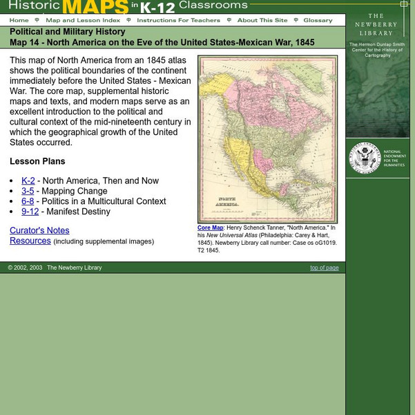
Newberry: Political and Military History: Map 14: u.s. Mexican War, 1845
Lessons for students in K-12 depicting North America prior to the United States and Mexico War, 1845. Students explore the mid-century political and cultural context in which the U.S. experienced growth and expansion.
University of Illinois
University of Illinois: Modern American Poetry: The Depression in the United States an Overview
Learn about the agricultural, political, and economical effects of the American Great Depression.
University of Oregon
Mapping History Project: Mexican Cession: Political Boundaries
Click on this map to see the boundaries of Mexico, Texas, and the United States before the Mexican Cession, and then click again to see the land ceded to the U.S. after the Treaty of Guadalupe Hidalgo. Be sure to click to see the key...
University of Oregon
Mapping History: American History
Interactive and animated maps and timelines of historical events and time periods in American history from pre-European times until post-World War II.
Curated OER
Etc: Post Civil War United States, 1865 1892
A map of the United States after the American Civil War showing political facts, boundaries, and conflicts regarding the post-Civil War reconstruction (1865-1892).
Virginia History Series
Virginia History Series: Virginia State History Wwii Era (1940 1948) [Pdf]
WWII awakened a massive development in Virginia from manufacturing to naval bases. Follow the course of the war through pictures, maps, charts and political cartoons. Visualize life in America and abroad during the war.
The Dirksen Congressional Center
Congress for Kids: Elections: The Electoral Map
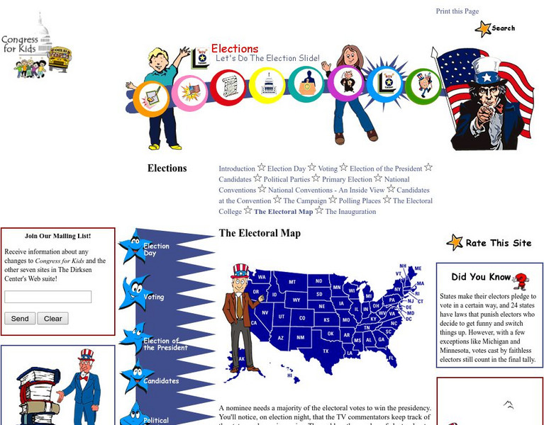
Find out how the United States Electoral College map is determined every ten years by the official Census.


