Curated OER
Projects For USA Units
Students study different regions of the United states through interdisciplinary activities. This lesson presents very creative, artistic ways for students to explore the variety of regions found in the United States.
Curated OER
Mapping the News
Students explore cartography. In this map skills and map making lesson, Students work in groups to create wall size world maps including legends, compass roses, latitude and longitude, and physical features. Students collect...
Curated OER
Capitals, Oceans, And Border States
Students investigate geography by completing games with classmates. In this United States of America instructional activity, students examine a map of North America and identify the borders of Mexico and Canada as well as the Pacific and...
Curated OER
People Change the Landscape
Students examine ways in which humans have brought change to the natural environment. In this ecology and literacy lesson, students listen to the book Island Boy by Barbara Cooney. Students observe and define map-reading vocabulary as...
Curated OER
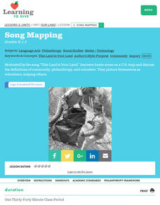
Song Mapping
Young scholars explore locations on the United States map. In this map skills lesson, students recite the song This Land Is Your Land and locate various places listed in the song on the map.
Curated OER
Our Land Lesson 2: Song Mapping
Students study the meaning of philanthropy as giving of time. talent, and treasures. They sing This Land Is Your Land while locating five of the places on a map of the United States showing that relief office are everywhere. They decide...
Curated OER
Midwestern States
In this United States geography activity, learners study the image of the Midwestern states. Student then label the states with the following choices: Missouri, Iowa, South Dakota, Minnesota, Nebraska, Illinois, North Dakota, Kansas,...
Curated OER
Map Skills
Students examine the nations, battlefields, troop movement of the Germans through Belgium and the location of both fronts during World War I by creating a map. They visualize the strength of the Germans early in the war.
Curated OER
Maps Can Help Us
First graders explore the geography of Montana by analyzing geographic maps of the area. In this Native American reservation lesson, 1st graders discuss the similarities and differences between reservations in the state of Montana....
Curated OER
N is for Natural State
For any pupils who live in the state of Arkansas, this would be a fabulous educational experience to help them get to know their state better. Through the use of activities in literature, art, mathematics, science, social studies, and...
Curated OER
A Place of My Own: A Study of Maps
Students investigate maps. They demonstrate their knowledge about maps and place landforms in the proper place as they create salt dough maps. They create a geography folder as well.
Curated OER
Where in the Latitude Are You? A Longitude Here.
Students distinguish between latitude and longitude on the map. In this mapping lesson, students participate in mapping skills to recognize spatial relationships, and where to find natural resources on the map. Students create...
Curated OER
Immigration to the United States
Third graders search TDC database for images of immigration from other countries, maps, and diaries. They identify why immigrants came to the United States and engage in a role-play simulating an experience the immigrants might have had.
Curated OER
Empire State-Building
Students explore how empires around the globe have impacted the world in which they have existed. They analyze whether or not the United States is an imperialist nation and create their own empires based on their understanding of empires...
Curated OER
A High-Interest Novel Helps Struggling Readers Confront Bullying in Schools
Bully, bullied, or bystander? Paul Langan's The Bully is the anchor text in a unit that examines bullying and violence. After a close reading of the text, readers imagine themselves as the characters and consider how they would react in...
Curated OER
Mapmaker, Make Me a Map!
Learners are introduced to the state quarter program and examine the Colorado state quarter. They locate Colorado on a map and create a map with a key. They discuss the state motto and examine pictures of the state's geographical features.
Curated OER
States And Shapes
Students work together and investigate the shapes of 50 states. They identify the states that they find hardest to recognize. The group then list the states in order from most difficult to just difficult to recognize and create a...
Curated OER
U.S. Geography: The Northeast
Students investigate U.S. Geography by creating a map in class. In this natural resource lesson, students create a map of the United States and research the Northeast based on their resources and recyclable materials. Students...
Curated OER
We the People: 270 out of 538
Students engage in a lesson that helps them better explain the quadrennial ritual surrounding the election of a president in the United States of America.
Curated OER
Texas, Our Texas
Students explore U.S. geography by completing a coloring activity in class. In this Texas history lesson, students utilize the web to locate Texas on a map of the U.S. Students view a PowerPoint presentation which showcases the state...
Curated OER
Where is Kansas?
Students explore U.S. Geography by analyzing a map. For this state vs. country lesson, students utilize a U.S. map and locate the state of Kansas before researching the history and customs of the state. Students collaborate as a class to...
Curated OER
Landmarks of the Underground Railroad
Students explore Civil Rights by reading several books in class. In this Underground Railroad lesson, students discuss The Story of Henry Box Brown and identify the location and functionality of the Underground Railroad. Students answer...
Curated OER
States with Attitude, Latitude and Longitude Dude
Sixth graders identify states whose boundaries are formed by lines of latitude and longitude or natural borders such as rivers. They trace a map of the U.S., and fill in borders, rivers and lines of latitude and longitude.
Curated OER
The Desert Alphabet Book
Young scholars explore world geography by researching a science book with their classmates. In this desert identification lesson, students utilize a U.S. map to locate the geographical locations of deserts. Young scholars create an oral...


