Curated OER
States/Capitals L-N: Matching
In this geography practice worksheet, students match the 17 listed states to the appropriate 17 listed capital cities located in the United States.
CHPCS
The United States in the 1920s: The New Negro Movement and the Harlem Renaissance
Music, writing, and activism all tell the story of history! The resource uses these elements and more in a presentation to discuss the Jazz Age and Harlem Renaissance. Your class views biographies, discusses important events, and...
Curated OER
City, County, Community
Learners explore issues and situations that make for a city and its local environments. In this local government instructional activity, students design maps, define issues and create brochures that illustrate their understandings of...
Constitutional Rights Foundation
Special Order 40
The city of Los Angeles' 1979 Special Order 40 states: "LAPD officers shall not initiate police action with the objective of discovering the alien status of a person." After reading a fact sheet that details the history of Special Order...
Curated OER
Big Business & Industrial Cities
This is a true gem. This PowerPoint is well-organized, has bullet points you control (which gives you time for discussion), has sound effects, and covers several aspects of American industrialization after 1900. The presentation begins...
Curated OER
United States Map
Students describe cities they are familiar with. In this United States Map lesson, students understand how cities are listed on a map. Students become aware of a map legend and the information in it.
Curated OER
Map Memory
Fifth graders, working in a whole class setting, label a United States map with the names of all the states that they know. They transfer the names of the states to an individual map and color it. Next, they receive directions on how to...
Curated OER
U.S. Political Map
For this political map worksheet, students use the map of the United States and the 7 cities to measure the straight-line distance between the cities. Students add the total number of miles traveled and write their answers in the spaces.
Curated OER
The Gold Rush
Students identify the routes involved in the Gold Rush on a map. In this map skills lesson, students use a United States map to locate the routes used to travel to California during the Gold Rush. Students demonstrate how to use the map...
Curated OER
Pennsylvania Cities Word Jumble
In this Pennsylvania cities worksheet, students unscramble the letters to spell Pennsylvanian cities. Students spell 10 cities and use the word box.
Curated OER
Where the Parks Are
Students research major league baseball in United States and Canada. In this baseball history lesson, students use a map of the United States and Canada to find and label each major league team. Students then color the home cities of the...
Curated OER
Memorable Maps
Learners draw an assigned map from memory about the United States or any other region they are studying. In this maps lesson plan, students draw a map from their memory at the beginning of the year, and do the same assignment at the end...
Curated OER
Facts, Fictions and Perceptions of Regions
Students examine the different characteristics of the regions of the United States. They discuss places they have visited in the U.S., and in small groups conduct research on a selected region of the U.S. Each group labels a map of...
Curated OER
Lights On ! Lights Off! Exploring Human Settlement Patterns
Third graders write informational paragraphs based on the settlement patterns of the United States. In this settlement lesson plan, 3rd graders read about population and how it affects where people settle next.
Curated OER
State Visual Report
In this state report worksheet, teachers choose a developmental appropriate report for young scholars to complete about a particular state. This worksheet has a template for Texas. Students research the state to tell it capital,...
Curated OER
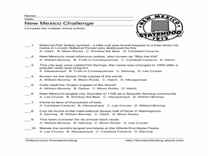
New Mexico Challenge
In this state facts worksheet, students read the clues associated with New Mexico. Students select the correct answer for the 10 statements.
Curated OER
Take Me Out To the Ball Game
Students use a map to graph and locate major league teams of different sports. In groups, they analyze the population data of the United States and compare it with the amount and location of the major league teams. They share their...
Student Handouts
Geography of Dr. Martin Luther King, Jr.
Young geographers follow Dr. Martin Luther King's journey during the civil rights movement by identifying major events on a map of the eastern United States, such as his birth in Atlanta, Georgia and his famous "I Have a Dream" speech in...
Freecloud Design
Stack the States™
Kids have fun learning US geography and state facts, including capitals, nicknames, major cities, and landmarks. They can choose between the game, or informational flashcards for each state.
Scholastic
Volleyball Road Trip
Review coordinate mapping with your young geographers by matching cities on a volleyball team's road trip itinerary to their appropriate coordinate locations.
ESRI
Juneteenth: An American History through Maps
An interactive website traces the history of Juneteenth celebrations from their origin in Galveston, Texas, on June 19th to the present day. Using interactive maps, learners can find information about the African-American population...
Curated OER
The Rise of the City States in Greece
Sixth graders examine Ancient Greece and its development of democracy. In this Greek History lesson, 6th graders explore the rise of city-states in Greece and its overall effect on the development of democracy. The class continues with...
Curated OER
Construction: A Thematic Unit
High schoolers research different city departments and organizations that make up a city and choose a type of house to model. In this construction lesson students build their own city and present it to the class.
Curated OER
Dictating the Future
Read the article "Bush Lays Out Goals for Iraq: Self-Rule and Stability" and examine the keys points from President Bush's speech. Whether presented in written text or as an audio bite students will work in groups to research world...


