Curated OER
Vocab Grabbing the Preamble to the U.S. Constitution
Students identify concrete and abstract nouns in the preamble to the Constitution, and complete Frayer Model graphic organizers using history and current events as examples of American values. In this preamble lesson plan, students use...
Curated OER
United States Map - Lesson 9
Learners explore the concept of cardinal directions. In this geography lesson, students identify the compass rose on a large U. S. map and then discuss the cardinal directions.
Curated OER
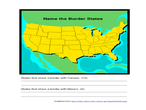
Identifying Border States of the U.S.
In this identifying border states of the U.S. worksheet, 3rd graders visually identify then write the names of the states that border Canada and Mexico; page 1 is a lesson, page 2 is the worksheet.
Happy Housewife
State Notebooking Pages
When learning about US geography, it can hard to remember facts about 50 different states. Help your young scholars organize all of this information with a collection of easy-to-use note-taking guides.
Curated OER
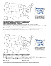
Mystery State # 39
Which state will be the answer to the five clues today? After considering each clue, learners will name the mystery state. If your class can determine which state was home to Chief Sitting Bull, they'll be able to answer South Dakota.
Smithsonian Institution
Borders with the World: Mexican-American War and U.S. Southern Borderlands
The Mexican-American War created social borders—not just physical ones. Scholars learn about the effects of the Mexican-American War on the people living in the borderlands using text excerpts, maps, and partnered activities. Academics...
Curated OER
What do Maps Show: How to Read a Topographic Map
Middle schoolers identify the characteristics of topographical maps. Using examples, they practice reading them and describing the information they gather from them. They also discover how to use the website from the U.S. Geological Survey.
Education World
Edible Resource Maps!
Young scholars discuss resource maps and examine examples from library resources. Working in groups, they create edible resource maps by drawing examples, such as popcorn on the border of Iowa and Nebraska. Then they use cookies in the...
CK-12 Foundation
Regular and Irregular Polygons: Polygon States
Colorado would probably object if Wyoming enlarged its borders. Scholars use an interactive map to change the borders of U.S. states to see how angles change. They then answer questions about regular and irregular polygons.
American Battle Monuments Commission
The Great War: U.S. Division Under Allied Command
The victory of Allied forces in World War I is due in large part to the continued collaboration and support of the Allied divisions themselves. Learn more about the ways Australia, Britain, France, and the United States worked together...
K20 LEARN
Manifest Destiny: U.S. Territorial Expansion
A close examination of John Gast's painting "American Progress" launches a study of the concept of Manifest Destiny used to justify United States' policy of westward expansion. Young historians read statements from persons with different...
Curated OER
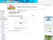
Kansas State Map
In this map of Kansas activity, students color and label major cities and physical features of this state. Students also study the location of Kansas in relation to the other states in the U.S. by studying the background map.
Curated OER
Tennessee State Map
For this Tennessee state geography worksheet, students color and label major cities and physical features on the map. Students also study a second map of the U.S. that shows the location of the state of Tennessee.
Curated OER
Spanish Influence on United States Currency: The Origins of the "Dollar"
Sixth graders research the Spanish influence on early colonial America and the process of establishing the present U.S. currency. They read and discuss an informational handout in small groups, and take a short quiz. Students then...
Curated OER
Our States, My State
Here is a very nice lesson on the shape of the United States, and the shapes of the individual states for your young geographers. They utilize worksheets embedded in the plan to color in a variety of states and to become familiar with...
Curated OER
U.S. Puzzle Map Bulletin Board
Learners create cutouts of each state. They research different states noting their similarities and differences. They describe each state's location in relation to the state's surrounding them.
Curated OER
Biggest Cities in Each State Quiz
In this online interactive geography quiz worksheet, students examine the chart that includes the names of 50 U.S. states. Students identify the names of the two largest cities in each state in 8...
Curated OER
From Claws to Jaws: Atlantic Regions of the United States
Students explore New England, Mid-Atlantic, and southeastern regions of the United States. In this social studies thematic unit, students research a state and make a regional quilt. Students wrte a book report and read two novels...
Curated OER
200 Years and Counting: How the U.S. Census Tracks Social Trends
Students examine the process of census taking in the United States. In this "200 Years and Counting" lesson, students examine the data collection process, look at an example of a census form, analyze data, and learn what the information...
Curated OER
What's In a Name?
Students examine the origins of the names of U.S. states, focusing on names that were derived from Native American words. They are provided with lists of the names of the 50 states, and then research online or in library resources the...
National Endowment for the Humanities
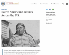
Native American Cultures Across the U.S.
Middle schoolers examine how American Indians are represented in today's society. They read stories, analyze maps, and complete a chart and create an illustration about a specific tribe.
Curated OER
U.S. Geography for Children: The Northeast
In this map skills of the northeastern United States learning exercise, learners observe an outline map, locate and label the states, and designated landforms and bodies of water; and create symbols and a map key for sources of economy...
Curated OER
Spanish Influence in the U.S.
Eighth graders research the role of the first Spanish conquistadors who explored the now United States. Using the internet, they gather information on different explorers and write a paper about why he is important in American history. ...
Curated OER
US: Midwest Region Map
In this U. S. outline map worksheet, students examine boundaries of the Midwest Region states and the placement of the capital cities. This map is labeled.


