Curated OER
Colonial Vacation Planner
Students plan a family vacation to states that were among the original 13 colonies. The groups determine which state they visit, map their route, calculate the mileage, and determine how much money they spend on gasoline.
Curated OER
Quarters from the Coast
Students discuss Fifty State Quarters Program, compare and contrast location of land and water on map of United States, while also becoming aware of physical shape of nation and home state, and explore coastal areas in United States.
Curated OER
Take Me Out To the Ball Game
Young scholars use a map to graph and locate major league teams of different sports. In groups, they analyze the population data of the United States and compare it with the amount and location of the major league teams. They share their...
Curated OER
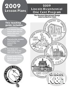
In Mr. Lincoln's Shoes
Students demonstrate basic map skills. In this US history lesson, students review cardinal directions and use a compass rose while at the same time discuss what life was like for Abraham Lincoln.
Curated OER
Mediterranean Lands: A Pilgrimage Through Time and Space
Young scholars will use context clues and examine several maps to answer series of short answer questions over range of geographical topics, identify specific places, practice using GoogleEarth to compare satellite views to those...
Curated OER
Opening Doors to Social Studies with Children's Literature: The Desert Alphabet Book
Students explore the geography of the United States. In this social studies lesson, students identify the major deserts on a map of the United States.
Curated OER
Civil War
Students explore the Civil War. In this U.S. Civil War U.S. history instructional activity, students participate in a cubing activity in which a variety of Civil War projects are described on a paper cube. Students roll the...
Curated OER
Backseat Travelers
Fourth graders investigate the geography of the Southeast regions of the United States. They conduct Internet research, listen to the book "No Star Nights," and plan and write a trip through this regions.
Curated OER
Document Based Question: Erie Canal
Fourth graders read the provided documents about the Erie Canal to discover the impact that this transportation systems had on the New York community. In this history lesson, 4th graders first analyze the documents and answer the...
Curated OER
Turning the Tide in the Pacific, 1941-1943
Students analyze the Japanese strategy for the Pacific and compare it to the Allied strategy. They identify on a map the sites that were important the early war in the Pacific, and identify key military engagements.
Curated OER
Early Presidents and Politics
Students investigate early presidents of the United States. Students complete a series of lessons in which they research the contributions and political climate during the terms of U.S. presidents from George Washington to Andrew Jackson.
Curated OER
Galveston 1900: Storm of the Century
Seventh graders comprehend the effect the 1900 Hurricane, the deadliest natural disaster in United States history, had on Galveston by examining period accounts and photographs. They comprehend how the devastation of the hurricane lead...
Curated OER
Cruciferous Crusaders Connection
Young scholars explore the agriculture of the United States. In this leafy green vegetables instructional activity, students complete an activity that requires them to identify the locations where the vegetables are grown.
New York State Education Department
US History and Government Examination: January 2018
It's time to test those skills! Assess pupils' knowledge of US history and government with short answer questions, multiple-choice items, and essays. The resource serves as a standardized test that functions well for a final exam....
International Technology Education Association
Become a Weather Wizard
Accurate weather forecasting is something we take for granted today, making it easy to forget how complex it can be to predict the weather. Learn more about the terms and symbols used to forecast the weather with an earth science lesson...
Curated OER
Real World Investigation- Math and Geography- Elevation Changes
For this math and geography real world investigation, 6th graders plan a driving trip to a city that is located several states away from their home while recording the elevations of three cities that are included in the trip. They use...
National Museum of the American Indian
The A:Shiwi (Zuni) People: A Study in Environment, Adaptation, and Agricultural Practices
Discover the connection of native peoples to their natural world, including cultural and agricultural practices, by studying the Zuni people of the American Southwest. This lesson includes examining a poster's photographs, reading...
Curated OER
Transportation's affect on the Growth of Cities in the United States
Eighth graders identify the major advancements that have been made in transportation throughout U.S. history (waterways, horses, steam power, railroads, automobiles, etc.) They access websites imbedded in this plan and answer questions...
Curated OER
Tracing Our Own Family Pilgrimages
Pupils observe a world map and are introduced to vocabulary like: cities, continents, rivers, lakes, and oceans. They discuss the names of the cities they live in and locate them on the map; then using a colored pushpin indicate: the...
Curated OER
Unite These States
Young scholars explore the historical events and people associated with the 13 colonies. The geographic locations of the 13 colonies and ultimately, of all 50 states are investigated.
Curated OER
The Weather Page: Comparing Data
Students analyze data from maps. In this comparing data lesson plan, students use comparative and superlative statements to draw comparisons among the weather in different American cities based on USA Today weather maps.
Curated OER
Biome Map
For this biomes worksheet, learners color the map of North America according to the biome clues. Students then answer questions about the North American biomes.
Curated OER
The Role of Geography -- The United States and the Republic of Turkey
Preteens review the five themes of geography. In groups, they examine the United States and Turkey to discover how geography can impact the way people live. They create a foldable for each country, listing information for each of the...
Curated OER
Immigration to the United States
Third graders search TDC database for images of immigration from other countries, maps, and diaries. They identify why immigrants came to the United States and engage in a role-play simulating an experience the immigrants might have had.


