California Academy of Science
Tropical Belt
Where in the world is the equator? Explore a world map with your class, coloring in oceans, continents, and rainforests while locating the three major lines of latitude: the equator, Tropic of Cancer, and Tropic of Capricorn. Discuss how...
Curated OER
Geography Terms
Introduce the terms and concepts related to basic map and geography skills. Terms include full definitions and cover latitude, longitude, the Equator, Tropic of Cancer, Tropic of Capricorn, Prime Meridian, and the International Date Line.
Curated OER
Rain Forest Adventures
Students identify and describe where tropical rain forests are located and examine the geographical correlation between rainfall and rain forest. They brainstorm what they think they know about tropical rain forests - where they're...
Curated OER
Earth's Features
In this geography worksheet, learners label a map of the world with the Arctic Circle, Tropic of Capricorn, Tropic of Cancer, Equator, North Pole, South Pole, and the Antarctic Circle.
Curated OER
What Makes a Tropical Rainforest Special?
Students examine the characteristics of the tropical rainforest. Using a map, they locate the rainforests found around the world, continents and the equator. Using the internet, they research the various layers of the rainforest and...
Curated OER
Discover the Rain Forest
Students research tropical rain forests through the use of trade books, encyclopedias, rain forest videos, and computer searches to determine the effects that human use has on the rain forest.
Curated OER
The Earth's Rain Forests
Students study the importance of the world's rain forests. In this rain forest instructional activity, students read about the role of the rain forests in the world's environment. Students then write a formal letter to a member of...
Curated OER
Weather and Locality
In this weather research activity, students research the weather a specific location. Students mark the location on the globe and then list how the weather affects people there.
Curated OER
Rainforest Vocabulary Words: Week 1
In these rainforest vocabulary worksheets, read the definitions and the matching terms for the following rainforest vocabulary terms: decomposers, deforestation, epiphytes, extinct, environment, pollute, vegetation, ecology, climate,...
California Academy of Science
Discovering Rainforest Locations
How many rainforests are there, where are they, and do global factors effect their locations? These are great questions that have great answers. Children in grades four through eight use several different maps to determine why...
Curated OER
Plotting A Hurricane Using latitude and Longitude
Students explore map and plotting skills by tracing the movement s of hurricanes through the Earth's systems. a hurricane map is developed from daily media reports.
Curated OER
Sub-Saharan Africa: Physical Geography
In this geography skills worksheet, learners respond to 22 short answer and map skills questions about the location and geographic features of sub-Saharan Africa.
Tech Know Teaching
5th Grade Constructed Response Question
New to constructed response question worksheets? Here's a model that demonstrates how to construct questions that require readers to interpret graphics found in informational text.
Alabama Learning Exchange
The Sun and the Earth
Third graders study and diagram the positions of the Earth and sun during the four seasons. They predict weather for cities in the northern and southern hemispheres.
Curated OER
Where in the World? The Basics of Latitude and Longitude
Students are introduced to the concepts of latitude and longitude. In groups, they identify the Earth's magnetic field and the disadvantages of using compasses for navigation. They identify the major lines of latitude and longitude on a...
Curated OER
"Yarning" About Latitude and Longitude
Students identify various locations using latitude and longitude. In this map skills lesson, students use yarn and labels to create a "human globe." Students identify the Prime Meridian, the Equator, and Northern and Southern Hemisphere.
Curated OER
Map Making
Students use a tennis ball and paper to construct a student-made globe. They sketch in continents and major map features and then compare a flat map to a globe.
Curated OER
Coral Reef Conservation
Young scholars conduct discussions on current threats to coral reefs around the world and write letters to conservation organizations urging support for coral reef protection.
Curated OER
Where in the Latitude Are You? A Longitude Here.
Students distinguish between latitude and longitude on the map. In this mapping lesson, students participate in mapping skills to recognize spatial relationships, and where to find natural resources on the map. Students create their own...
Curated OER
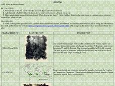
What is the Rainforest?
Students investigate rainforests. For this rainforest lesson, students brainstorm on a KWL chart about what they already know about the rain forest. Students are shown pictures of the rain forest and describe what they see in the photos....
Curated OER
Waldseemuller's Map: World 1507
Students investigate the 1507 word map. In this world geography lesson, students examine the details of each section of the map and then draw conclusions about how the people of 1507 understood the world. Students are evalated on...
Curated OER
Waldseemüller’s Map: World 1507
Students take a closer look at historical maps. In this primary source analysis lesson, students examine the first world map produced by Martin Waldseemuller. Students complete the included map analysis worksheet and then write letters...
Curated OER
Pollutants on Coral
Students consider the effects of acid pollution on coral reefs. They brainstorm previous knowledge about coral reefs, examine a piece of coral and observe its reaction to acid and list ways we can prevent pollution from reaching the reefs.
Curated OER
Map Puzzles
Students make puzzles from world maps, dramatizing how much of the globe is covered by ocean.


