Curated OER
We've got the whole world in our hands
Students explore spatial sense in regards to maps about the globe. In this maps lesson plan, students label oceans, locate the continents and poles, follow directions, and explain the symbols on a map.
Curated OER
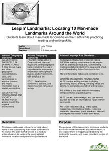
Leapin' Landmarks: Locating 10 man-made landmarks around the world
Third graders engage in a lesson which addresses their curiosity about some of the outstanding people-made landmarks of the world. They explore the geographical themes of location and place through literature.
Curated OER
NIGHT AND DAY: DAILY CYCLES IN SOLAR RADIATION
Students examine how Earth's rotation causes daily cycles in solar energy using a microset of satellite data to investigate the Earth's daily radiation budget and locating map locations using latitude and longitude coordinates.
Curated OER
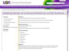
Making Sense of a Round World on a Flat Surface
Students explain the world in spatial terms
Curated OER
Where In the World Am I?
Learners identify their location in the world after studying latitude, longitude, relative location, and absolute location. They use assigned web site to find information to make a flipbook that answers questions about their location in...
Curated OER
Food Webs in the Barnegat Bay
Students investigate the food webs in the Barnegat Bay. In this organisms lesson, students use a graphic organizer to illustrate the types of consumers in the bay. Students use reference books to continue to research the animals found in...
Curated OER
Through the Forest and Home Again: Maps Help Us Find Our Ways
Learners read Little Red Riding Hood, focusing on her path home to Grandma's house. In this language arts and geography lesson, students perform a reader's theater, re-creating the walk home and possible routes that could have been...
Curated OER
World War I and Its Consequences
Tenth graders decipher the long and short term causes of World War I. They follow through by studying the history of the present day situation in the Balkans and simulating peace talks with presentations.
Teach Engineering
What's Wrong with the Coordinates at the North Pole?
Here is an activity that merges technology with life skills as individuals use Google Earth to explore the differences between coordinate systems and map projections. The self-guided worksheet is the fourth segment in a nine-part unit....
Curated OER
Map a World of Facts
Students mark ten places on a world map while they follow fun facts on the included printable sheet. They research using a variety of resources to determine the location of the ten places.
Curated OER
In My Other Life
Students explore various cultural identities. They conduct Internet research, develop a questionnaire that profiles information from their selected culture, and write a letter to a pen pal in the U.S. explaining what life in their...
Curated OER
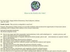
Where in the World is Mr. Fultz?
Young scholars use maps and other geographic resources to learn about their world while problem solving. They read clues each day and use classroom resources to narrow down where the prize is located.
Curated OER
Making Sense Of A Round World On A Flat Surface
Learners engage in a lesson that is concerned with the development of geography skills. They take part in a number of activities that center around finding and traveling to different locations. The lesson has resource links that can be...
Curated OER
World Statistic Day
Eleventh graders collect data about the state they live in. In this statistics lesson, 11th graders collect and analyze data as they compare themselves to students in other states. They analyze data about a person's education level, and...
Curated OER
African Slaves in Haiti
Sixth graders examine how Africans were treated in the Caribbean and Haiti after reading about the Atlantic Slave Trade. From a multicultural information passage, they complete a time line on Toussiant L-Ouverture and write an obituary.
Curated OER
It’s a Big, Big World
Students examine the role of the explorers. In this explorers and conquistadors, students create word puzzles (Wordles) regarding the time period in history. Students conduct research regarding a particular explorer and create foldables...
Curated OER
Honing in on Hummingbirds
Students explore ruby-throated hummingbirds. For this cross-curricular hummingbirds lesson, students listen to the book The Mystery of the Missing Hummingbirds and choose related topics to research with a partner. Students draw or write...
Curated OER
Sandscapes to Landscapes
Students explore landscapes and create their own in a creative project.
Curated OER
World War II - War Comes to Hawaii
Ninth graders use geographic representations to organize, analyze, and present information on people, places, and environments. They use tools and methods of geographers to construct, interpret, and evaluate qualitative and quantitative...
Curated OER
Mapping the News
Students explore cartography. For this map skills and map making lesson, Students work in groups to create wall size world maps including legends, compass roses, latitude and longitude, and physical features. Students collect current...
Curated OER
Where in the World Am I?
Students participate in mapping activities to explore an area from different spatial perspectives. In this mapping lesson, students define the terms needed to understand a map. Students use representations such as a balloon and a...
Curated OER
Role Playing in North America: Mid 1600s-Mid 1700s
Eighth graders apply their knowledge of North American history from the mid 1600's through the mid 1700's to a role-playing scenario. In small groups they plan, write, and perform a dramatic skit of a group that was affected by events in...
Curated OER
Where in the Latitude Are You? A Longitude Here.
Students distinguish between latitude and longitude on the map. In this mapping lesson, students participate in mapping skills to recognize spatial relationships, and where to find natural resources on the map. Students create their own...
Curated OER
Social Changes in America Caused by World War II
Young scholars research and examine the social changes that occured in the United States during World War II. In pairs they conduct research using a variety of resources, and organize and compose a "Guide to Life" for veterans returning...


