Curated OER
New Hampshire Outline Map
In this New Hampshire outline map worksheet, students examine political boundaries of the state and the placement its capital city as well as its major cities. This map is not labeled.
Curated OER
Nevada Outline Map
In this Nevada outline map worksheet, students examine political boundaries of the state and the placement its capital city as well as its major cities. This map is not labeled.
Curated OER
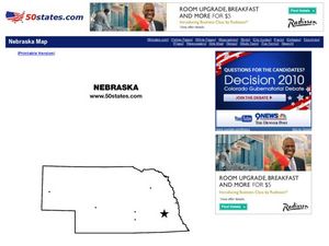
Nebraska Outline Map
For this Nebraska outline map worksheet, students examine political boundaries of the state and the placement its capital city as well as its major cities. This map is not labeled.
Curated OER
Wyoming Outline Map
In this Wyoming outline map learning exercise, students examine political boundaries of the state and the placement its capital city as well as its major cities. This map is not labeled.
Curated OER
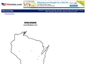
Wisconsin Outline Map
For this Wisconsin outline map worksheet, students examine political boundaries of the state and the placement its capital city as well as its major cities. This map is not labeled.
Curated OER
West Virginia Outline Map
In this West Virginia outline map worksheet, students examine political boundaries of the state and the placement its capital city as well as its major cities. This map is not labeled.
Curated OER
Utah Outline Map
In this Utah outline map activity, students examine political boundaries of the state and the placement its capital city as well as its major cities. This map is not labeled.
Curated OER
Tennessee Outline Map
In this Tennessee outline map worksheet, students examine political boundaries of the state and the placement its capital city as well as its major cities. This map is not labeled.
Curated OER
South Dakota Outline Map
In this South Dakota outline map worksheet, students examine political boundaries of the state and the placement its capital city as well as its major cities. This map is not labeled.
Curated OER
Rhode Island Outline Map
In this Rhode Island outline map worksheet, students examine political boundaries of the state and the placement its capital city as well as its major cities. This map is not labeled.
Curated OER
Map It!
Fourth graders collect and explore different maps and their uses before using the program Pixie to create maps of geographic features, political features, and economic information for the state in which they live.
Curated OER
The State Seal Offline Lesson
Fourth graders discover the meaning of the different objects on the State Seal. They identify changes in the State Seal over time students hypothesize why elements have changed students suggest what elements should represent the State of...
Curated OER
Map It With Pixie
Fourth graders use the computer program 'Pixie' to create a topographic, detailed map for the state they live in. In this mapping skills lesson, 4th graders use Pixie to make a map of their state that includes topographic features, state...
Curated OER
Summertime Travel
Third graders write about a summer event they participated in. In this paragraph writing instructional activity, the teacher models how to write about a place they have visited. Students then write their own paragraphs. Students...
Curated OER
The Sands of Arabia
Sixth graders apply geographic information to the study of World History. In this Geography lesson, 6th graders create a political/physical map of the Middle East, develop questions and answers about the culture of the Middle East,...
Curated OER
Introduction to Maps
Students develop their map skills. In this geography instructional activity, students participate in an activity that requires them to survey their social studies book in order to find different types of maps and purposes for their uses.
Curated OER
What Do Maps Show?
Students discover the uses for various types of maps. In this geography skills instructional activity, students discuss the type of maps that exist and what their individual features are. Students then practice using different types of...
Curated OER
Mexico Map
In this blank outline map worksheet, students study the political boundaries of the North American country of Mexico. The capital cities of each state are denoted with stars.
Curated OER
Countries of the World
Students define the meaning of the word country. In this countries of the world map lesson, students identify boundaries, countries, and symbols within countries on the map. Students distinguish the words country and continent.
Carolina K-12
Who the People? Representative Democracy in North Carolina and Congress
Our elected officials are supposed to represent us, but what does it mean when they aren't like us? Budding citizens explore the demographic makeup of the US Congress, the role of money in political elections, and the Citizens United...
C-SPAN
The Electoral College and the Constitution
What is the purpose of the Electoral College? Is it antiquated, or does it have a place in today's political climate? High schoolers view a series of video clips as they analyze the parts of the United States Constitution that address...
ProCon
Electoral College
The Electoral College's role in elections is sometimes confusing and controversial. Pupils use a debate topics website to research the pros and cons of the practice to debate whether the United States should still use the Electoral...
New York State Education Department
US History and Government Examination: June 2018
Ready to test your learners about anything and everything related to United States history and government? The resource uses multiple-choice and essay questions to assess knowledge.
Smithsonian Institution
Borders with the World: Mexican-American War and U.S. Southern Borderlands
The Mexican-American War created social borders—not just physical ones. Scholars learn about the effects of the Mexican-American War on the people living in the borderlands using text excerpts, maps, and partnered activities. Academics...


