Curated OER
Lots of Lakes: Greater Than, Less Than
To set up this activity, your class explores Minnesota's nickname as the Land of 10,000 Lakes, and the back of the state quarter that features a Minnesota lake. Young mathematicians compare the number 1 to the number 10,000 with support...
ReadWriteThink
Biography Project: Research and Class Presentation
I Have A Dream ... that after the lesson, all individuals master the reading, writing, researching, listening, and speaking skills the biography project helps them develop. Martin Luther King, Jr. serves as a topic example for a model...
Novelinks
The View From Saturday: Concept/Vocabulary Analysis
Design your unit on The View From Saturday by E.L. Konigsburg with a concept and vocabulary analysis resource. It outlines the plot, literary elements, vocabulary issues, and any possible considerations for planning a differentiated...
Curated OER
Election Results Map
Students use election night returns to create a map of the results. They can represent popular vote results or electoral votes received. They use the internet to gather information about the electoral college and results.
Curated OER
BOUND TO BE NEW HAMPSHIRE
Students identify neighborhood, town, and state boundaries. They distinguish between natural and man-made boundaries. They identify major state geological features and explain how NH boundaries have changed over time.
Curated OER
The End of United States' Occupation of Japan
Ninth graders examine and discuss reasons for end of U.S. occupation of Japan in 1952, locate surrounding Asian countries on map, explore changes to Japan after World War II, and discuss how changes in Japan impacted other countries.
Curated OER
Geography: African Floor Maps
Students explore the African continent and identify the various countries there. They examine the history, geography, environment, and inhabitants of the countries. Students create maps of Africa using a variety of materials.
Curated OER
What's in a Name?
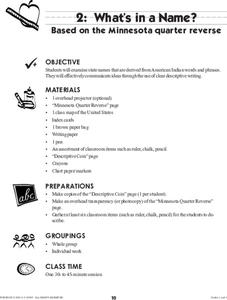
Students examine state names that are derived from American Indian words and phrases. They effectively communicate ideas through the use of clear descriptive writing. The reverse of the Montana Quarter is used as inspiration for this...
Curated OER
I Can Compass, Can You?
Students discover how to use geographic tools. In this compass lesson, students identify cardinal directions by appropriately using compasses along with a number of various maps.
Curated OER
The Greatest Educational Change America Has Ever Seen
Young scholars connect the symbols from the design of the United States Mint Fifty State Quarters Program to our country's history in this five-lesson unit. The culture, unique heritage, and geography of the individual states are probed.
Curated OER
Quilt? What Quilt? I Don't See a Quilt!
Students analyze maps and cultures of major cities in the state of Arizona and designate different regions within the state according to geography and economy.
Curated OER
Move Around the Map
Fourth graders, while working with a partner, label and identify on a tarp map six major cities and five major rivers in Indiana. They traverse along the rivers utilizing a different locomotor skill (hop, skip, walk, run, leap, gallop,...
Curated OER
Life of Lincoln
Students describe the social and political life of Abraham Lincoln with a focus on his contributions and how they changed the United States of America.
Curated OER
History of the West using the Digital Atlas
Students navigate the digital atlas of Idaho. They research the unique features of south central Idaho and the geological events which have shaped it over the past 17 million years. Afterward, they write an essay on an aspect of changes...
Curated OER
Roles of the President
Students read a document which explains the roles and responsibilities of the President of the United States. In groups, they tour the George Bush Presidential Museum and participate in a Presidential scavenger hunt. Once back in the...
Curated OER
Riding With Alice
Student listen to Don Brown's, Alice's Grand Adventure before discussing cross country travel. They trace Alice's travels on an outline map of the US and focus on the state of Indiana. They color and label the counties that Alice...
Curated OER
Cookie Topography
Students construct a cross section diagram showing elevation changes on a "cookie island." Using a chocolate chip cookie for an island, they locate the highest point in centimeters on the cookie and create a scale in feet. After tracing...
Curated OER
Preparing for the WPE
Prepare your soon-to-be graduates to take the Writing Proficiency Examination given at Cal Poly. These slides cover everything from the various types of questions to writing thesis statements. This is more like an overview than a...
Curated OER
Weather Watchers
Students are introduced to an Underground Weather Stations. In groups, they use the internet to research the weather in different parts of the United States locating each city. To end the lesson, they summarize the information they...
Curated OER
The Sweet Connection
Students use maps to find what crops are dominant in areas where honey bees are raised and discuss possible correlations. They mark the top ten honey- producing states on a US map.
Curated OER
Where Life Is Too Short
Students predict how a pandemic would affect aspects of South Africa's society. In this world issues and geography lesson, students read a letter outlining the problems affecting South Africa. Students discuss and analyze how resource...
Curated OER
Invasives and Marsh Birds
Young scholars are taught that invasive plant removal can have a variety of impacts. They are shown this by using graphs. Students view maps of vegetation change on Iona Island. They discuss implications of changes on marsh birds using...
Curated OER
Local Area - Is the Land Connected to Us?#144
Students examine how human influences have affected the Connecticut River Valley. They determine what a region is in relation to its human influences. They label the important human features of this region including dams, canals, and...
Curated OER
Sense of Place Through the Eyes of an Inuit Children's Author
Students read books by Michael Arvaaluck Kusugak to explore life in the Artic Circle. After reading the books, students compare and contrast life in the Artic Circle to life in the United States. They write and illustrate a story about...


