Curated OER
Garb and Grub Across the Globe
First graders discuss what part of the world their ancestors came from. They locate the locations on a map and discuss the differences and similarities of each continent and their people. They become familiar with the traditional...
Curated OER
Music to Learn Countries and Capitals Around the World: Learning Countries and Capitals in Asia
Students use musicto explore the countries and capitals of Asia.
Curated OER
America Grows - Trailblazers Pave the Way
Students study the time period after the Revolutionary War when people were striving to move away from the coastal areas and look for pathways to the west. Westerward expansion is a central theme and students use a variety of resources...
Curated OER
Can You See What I See?
Students gain an understanding of the methods used to explore the earth's surface. Students create a time line leading to the first satellite image of the Earth that includes the various methods utilized to observe the earth's surface.
Curated OER
Trees of Mississippi
Young scholars research tree species found in Mississippi, and record the tree types, numbers of trees, and locations. Students then research the forest industry sites, and determine possible relationships between industry location and...
Curated OER
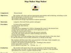
Map Maker, Map Maker
Map maker, map maker, make me a map! Your class can sing this tune as they work to create their own regional maps by taping paper to the wall, projecting an overhead transparency image, and tracing. Where this lesson plan intends for the...
Curated OER
Read a Fall Foliage Map
Students examine the purpose of a color key and use a color key to help them read a map.
Curated OER
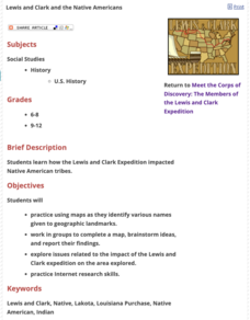
Lewis and Clark and the Native Americans
Pupils practice using maps and identifying landmarks on the Lewis and Clark expedition. They research Lewis and Clark's relationship with the Native Americans and report their findings to the class. They identify the impact of the...
Curated OER
Magical Maps
Second graders discuss the importance of using maps and how they are used. After they listen to a folktale, they develop their own story line maps and write their own folktale to accompany a map. They also identify and locate the seven...
Curated OER
Where is the Trail? The Journey of Lewis and Clark
Students explore the trail followed by Lewis and Clark on their journey across the United States. For this United States History lesson, students complete several activities to establish the Lewis and Clark Expedition, including a class...
Curated OER
Create a City: An Urban Planning Exercise
Middle schoolers explore the effects of population growth in Arizona. In this history lesson, students work in small groups to create a "perfect" city. Activities include examining the Arizona census results then discussing the...
Curated OER
Understanding Latitude, Longitude, and Time Zones
Students take an imaginary world tour by locating cities with latitude and longitude. They plan an itinerary and calculate the time zones from which they would call home. Then they construct word problems involving travel across time zones.
Curated OER
Map Your State: Regions of Arizona
Fourth graders define vocabulary and locate physical features on maps. In this mapping lesson plan, 4th graders explore regions of Arizona through landforms found on topographic maps. Students research the history and culture of the...
Curated OER
Where in the World is Mr. Fultz?
Students use maps and other geographic resources to learn about their world while problem solving. They read clues each day and use classroom resources to narrow down where the prize is located.
Curated OER
Barnegat Bay Watershed
Students design a model watershed. In this watershed lesson plan, students learn the needed parts of a watershed and how they work. Students evaluate how watersheds effect communities.
Curated OER
Aquifers and Groundwater
Students understand the purpose of an aquifer. In this aquifer and groundwater activity, students build a model aquifer find its relationship to water usage. Students record observations as they build the layers of the aquifer.
Curated OER
Food Webs in the Barnegat Bay
Young scholars investigate the food webs in the Barnegat Bay. In this organisms lesson, students use a graphic organizer to illustrate the types of consumers in the bay. Young scholars use reference books to continue to research the...
Curated OER
Simulated Underground Railroad Experience - Part B
Third graders travel throughout many stations learning about the Underground Railroad.
Curated OER
Geographic Luck
Students examine why some countries are rich while others remain poor. They view a video on the website, Guns, Germs and Steel, analyze primary sources to conduct research about plants and animals, and create a game based on their research.
Curated OER
Learning About Location: Charting the Path of the George W. Elder
Students acquire a working knowledge of the geographical concepts: absolute location, relative location, longitude and latitude. They analyze primary sources that shows the physical and human characteristics of the places along the 1899...
Curated OER
Read a Map ... It's a Snap!
Students are introduced to map and globe skills. They use grids and are able to construct their own simple maps of familiar places. Students are able to define a map, globe, and symbol and use the direction words north, south, east,...
Curated OER
Making Sense Of A Round World On A Flat Surface
Students engage in a lesson that is concerned with the development of geography skills. They take part in a number of activities that center around finding and traveling to different locations. The lesson has resource links that can be...
Curated OER
Blame It On El Nino
Students understand what the weather phenomenon El Nino is and what causes it. Students recognize how remote sensing technology can detect and predict El Nino. Students discover how El Nino effects weather conditions throughout the globe...
Curated OER
African Slaves in Haiti
Sixth graders examine how Africans were treated in the Caribbean and Haiti after reading about the Atlantic Slave Trade. From a multicultural information passage, they complete a time line on Toussiant L-Ouverture and write an obituary.


