Facing History and Ourselves
Social Media and Ferguson
How can social media help or hinder civil dialogue? How can information shared on social media be verified? As the investigation of media reports of the events surrounding the shooting of Michael Brown continues, class members read...
Curated OER
What Can a Map Tell You?
Students investigate how maps can provide useful information about health issues. They study a map to draw conclusions about cholera death in London.
Curated OER
A Map Mystery
Second graders solve a map mystery. In this technology lesson plan, 2nd graders develop an awareness of maps and the symbols associated with maps as they the "Neighborhood Map Machine."
TED-Ed
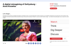
A Digital Reimagining of Gettysburg
Why would Robert E. Lee order Pickett's Charge, an action that changed the course of the Civil War? Geographer and historian Anne Knowles uses digital technology to explain what she thinks is the missing piece in trying to understand...
Curated OER
Online Behavior: Privacy and Ethics
Over the course of three classes, tech-saturated youth review their cyber portraits, map their virtual lives, examine their relative anonymity, and establish a "virtual conscience" to guide choices that foster privacy protection and...
Population Connection
The Human-Made Landscape
Agriculture, deforestation, and urbanization. How have human's changed the planet and how might we mitigate the effects of human activity on the planet? To answer these questions class members research the changes in human land use from...
Edgate
Native Americans of the Lewis and Clark Trail
As part of a study of the Corps of Discovery expedition, class groups research the different Native American tribes Lewis and Clark encountered on their journey and share their findings with the class.
Curated OER
Where I Live…
Second graders explore their community. In this social studies lesson plan, 2nd graders use Internet tools to locate their community on a map and then locate where they live.
Sharp School
Geography Project
This very simple geography project can lead to a lot of useful referential information that can be displayed in your classroom! Learners construct a poster-size map of a country, identifying major demographic points and including pie/bar...
Curated OER
Geography Puzzles
Learners study the continents of the world. In this Internet geography lesson, students connect to online mapping games. Learners collaborate in order to develop their understanding of world geography, including countries and capital...
Curriculum Corner
Holidays Around the World
Let's focus on a holiday from around the world! Young researchers choose a holiday from somewhere around the world, and conduct research to answer questions about the holiday. It can be used anytime during the year!
Arizona Cooperative Extension
Geocaching
Using GPS units, small groups participate in a scavenger hunt to find an object that you have hidden. They use coordinates for stopping points along a pre-planned path to get to the final cache. This is a terrific activity to include in...
iCivics
Drafting Board: Military Intervention
Should countries use their militaries to stop humanitarian crises in other countries? Learners make claims, organize their reasoning, and provide evidence for their arguments with this rich resource.
Speak Truth to Power
Marina Pisklakova: Domestic Violence
After reading Article 3 of the Universal Declaration of Human Rights and discussing background material about domestic violence, class members create a map showing where in their community survivors of domestic violence can get help and...
Curated OER
Where Is Rome?
Third graders discover Ancient Rome through maps and worksheets. In this world history instructional activity, 3rd graders locate Rome on a world map and identify the scope of the Roman Empire. Students label an entire map of...
Curated OER
Instruments From Around the World
How much does the environment affect how and what man creates? Children explore the effect of the environment on primitive man as they research raw materials from a specific location. They use their findings to write a short essay about...
Curriculum Corner
Australian Christmas
Where is Australia? How is an Australian Christmas from other Christmases around the world? Learners participate in a mini-research project where they discover what an Australian Christmas is like.
Library of Congress
Industrial Revolution
Could you live without your phone? What about cars, steel, or clothing? Class groups collaborate to produce presentations that argue that either the telephone, the gramophone, the automobile, the textile industry, or the steel...
Curated OER
European Elevation Sort
Given a prepared database of European countries, sixth graders sort the countries in ascending order by elevation and identify the five countries with the highest elevations. This cross-curricular lesson combines elements of computer...
Curated OER
Electronic Survey Activity
Fifth graders conduct a class survey and share the results with a class in another state via an electronic bulletin board. This technology-rich lesson is an ideal way to have learners practice communicating with others through the use of...
Curated OER
Our 50 States
Students identify the location of the 50 states using an interactive map. They practice geography skills by playing a fun game. Pupils become familiar with the state abbreviations for the US states. Students become familiar with the...
Curated OER
An Internet Activity for The Introduction Of The Civil War
Students research, using the Internet, specified Civil War battles in order to prepare an oral presentation for the class. They, in small groups, present using images and maps. They take a quiz on the subject matter and evaluate the web...
Curated OER
Master of His Domain
Young scholars investigate the basic elements that comprise the Internet. They create illustrated posters demonstrating their understanding of how the Internet works and develop maps of their personal Web communities.
Curated OER
Land or Sea?
Sixth graders access a database to search for desired information, using "and" or "or" connectors where necessary. They choose a connector and search a prepared database of European countries to locate which countries border certain...


