Smithsonian Institution
Who's in Camp?
Pupils complete readings, a group activity using cards, and a writing activity to better understand people's lives during the American Revolution. The resource emphasizes people such as the militiamen, women, officers, and children,...
Global Oneness Project
Citizen Photojournalism
Matt Black's photo essay, "The Geography of Poverty" provides a shocking reminder of the poverty that exists in the United States. The resource not only focuses attention on poverty but also conditions that have given rise to situation...
Curated OER
California Geography
Fourth graders explore geography of four distinct regions of California: mountains, coast, central valley, and desert. They locate California on map, identify state's boundaries and borders, and explore agriculture, a major economic...
Curated OER
Map the Civil War
Students explore the Civil War through original maps. In this mapping lesson, students calculate distance and show it on an original map. Students examine the type of landscape and its landmarks and draw symbols on the map.
Curated OER
Waldseemuller's Map: World 1507
Students investigate the 1507 word map. In this world geography lesson, students examine the details of each section of the map and then draw conclusions about how the people of 1507 understood the world. Students are evalated on...
Curated OER
Thematic Maps of Your School
Young scholars are able to list the essential elements of a thematic map, understand and use scale effectively to represent a geographic area, use research skills to develop a body of information, plan and draw an accurate thematic map...
Curated OER
Read a Map ... It's a Snap!
Students are introduced to map and globe skills. They use grids and are able to construct their own simple maps of familiar places. Students are able to define a map, globe, and symbol and use the direction words north, south, east,...
Curated OER
Latitude and Longitude
Students demonstrate how to locate places on a map using a grid. In this map skills lesson plan, students are introduced to latitude and longitude lines. Students define these terms and view a large map of a state. Students come up to...
Curated OER
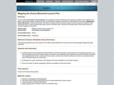
Mapping the Human Movement
Students research data on African-American emigration, place the data in a chart and create a human movement map. They also create another map using research on current immigration information.
Curated OER
United States Map
Students access prior knowledge and locate the North and South Poles on the map. In this mapping lesson, students understand the position of the United States relative to the poles. Students answer questions about the globe.
Curated OER
Mapping School Grounds
Middle schoolers map and analyze the natural and cultural environment of the school grounds. In small groups, they sketch the natural and cultural features of each side of the school building, create a map, participate in a class...
Curated OER
Rock Around the Map
Students research the geographical histories of various musical genres and make maps that note important places in music history. They Write geographical biographies about one of their favorite musical artists.
Curated OER
Map Your Community
Learners study their community's assets and needs to create a service project that would meet the needs. In this community project lesson, students research their community and look for the strengths and weaknesses of the community. As a...
Curated OER
Fall Around the World
What is autumn like in Shanghai? How much rain falls during September in Sydney? Is Moscow cold in October? Take a virtual trip around the world with a research assignment on autumn in different countries. After learners answer questions...
Curated OER
Strategic Planning - Lesson Plan: 2 x 1 hour lessons
Students view a Powerpoint presentation about strategic planning. Students use a case study to analyze the strategies used by Tesco, a successful UK business.
Curated OER
Judges in the Classroom Lesson Plan: Cultural Defense
Students define defense to crime, identify various defenses to crime in Washington State, examine cultural defense and apply it to case studies, and identify arguments for and against a cultural defense.
Curated OER
Hoboes on Harvest
Learners study the role Oklahoma's wheat fields played in the history of labor movements in the US. They write imaginary letters describing their experiences on a wheat harvest. They research on the internet or in encyclopedias to find...
Curated OER
Lesson 4: Fighting for Peace: The Fate of Wilson's Fourteen Points
Students analyze foreign policy. In this Fourteen Points lesson, students examine Wilson's Fourteen Points, explore Allied reaction to the Points, and compare Wilson's foreign policy to the Versailles Treaty.
Curated OER
Maps In Our Everyday Lives
Young scholars break into groups and complete a chart about information on maps of their hometown.
Curated OER
Cardinal Directions
Students explore cardinal directions. In this social studies instructional activity, students create maps of home and school using the cardinal directions.
Curated OER
It's Happening, Where? Find the Absolute and Relative Location of News Articles
Students read newspaper articles. In this social studies lesson, students locate the latitude and longitude of the location where the news article takes place. Students write a summary of the news article.
Curated OER
Social Studies: Religions and Folktales of India
Students examine the world's major religions, focusing on India as presented in folktales. They take notes while reading the stories and retell them orally. Students research belief systems and write one-paragraph reflections about them.
Curated OER
Social Studies: Cultural New Orleans
Students observe the PBS film, "New Orleans," to explore such topics as race relations, cultural history, and urbanization. After examining n interactive map displaying the city at various dates in its history, students role-play as...
Curated OER
NATO Geography & Language
The class receives background information on NATO, an atlas, and a blank world map. They color the original 1949 countries in red, the 1952 additions in green, and the 1990 additions in blue. This exercise would be a good starting point...


