Curated OER
Setting Boundaries
Students investigate the determination of the boundaries of various countries. They work in small groups to research a country's political history and past boundary issues and territorial disputes.
Artisan Global
QuakeFeed Earthquake Map, Alerts and News
Amateur seismologists explore Earth's earthquakes in real time using a variety of map styles and parameter selections.
Curated OER
United States Regions
In this United States political map worksheet, students examine regional census boundaries of the US. State boundaries are also included.
Curated OER
American Indians of the Local Region
Students describe the American Indian nations in their local region long ago and in recent past. They research religious beliefs, customs, and various folklore traditions.
Curated OER
Is A Nation Always A Region?
Students define the term, "nation," and analyze the boundaries established in Africa by colonial powers. In small groups, they participate in a simulated United Nations, develop a list of questions, analyze the nations of Africa, and...
Curated OER
California Regions Map
For this California regions outline map worksheet, students examine the coastal, mountain, central, and desert regions of the state.
Curated OER
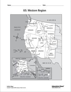
US: Western Region Map
In this United States Western Region activity, students examine the state boundaries and landforms found in this region. The map also highlights each of the state capitals.
Curated OER
US: Midwest Region
In this United States political map worksheet, students examine the state boundaries of the Midwestern Region. The map also highlights each of the state capitals denoted by stars.
Curated OER
South US Region
In this United States political map worksheet, students examine the Southern Region state boundaries. The map also highlights each of the state capitals denoted by stars. The states, capitals and major landforms are labeled.
Curated OER
South US Region Map
In this United States regional outline map, students examine the state boundaries of the states in the Southern Region. Capital cities are denoted with stars.
Curated OER
US: Northeast Region Map
In this United States political map instructional activity, students examine the state boundaries of the Northeast Region. The map also highlights each of the state capitals denoted by stars.
Curated OER
US: Northeast Region: Unlabelled
In this United States political map worksheet, students examine the Northeast Region state boundaries. The map also highlights each of the state capitals denoted by stars.
Curated OER
US: Western Region Map
In this U. S. Western Region outline map worksheet, students examine boundaries of each of the states and the placement of the capital cities. This map is not labeled.
Fremont Unified School District
4th Grade California Relief Map Project
Bring life to your next California geography lesson with this great project! Learners design a three-dimensional wall relief map of California, painting and decorating regions using a variety of materials and labeling major geographical...
Curated OER
Basic U.S. Geography
Provide your 11th graders with a basic understanding of U.S. Geography. They label the state, regions, and boundaries found in the contiguous U.S. as well as Hawaii and Alaska. Then, they complete two Internet related activities.
Curated OER
Treasure Hunt Region
Students are introduced to new geography related vocabulary words. In groups, they focus on a different region of the school and develop a new name for it. They create a treasure map for another group to use in the region of the school...
Polar Bears International
Top of the World
Learn about polar bears and the Arctic circle with a lesson about the countries and conditions of the region. After examining how the area differs from Antarctica, kids explore climates, animals, and geographical position...
Curated OER
Boundaries
Students are introduced to the term of mental mapping. Individually, they develop their own mental map of Washington state and discuss as a class what makes a boundary. They draw their mental map on paper and compare it with their...
Curated OER
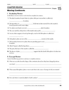
Moving Continents
In this moving continents worksheet, students review the different types of plate boundaries, what causes earthquakes, and where volcanoes are formed. This worksheet has 10 fill in the blank and 9 short answer questions.
Curated OER
Mapping Where Animals Live
What type of reptiles live in New York State? This lesson gets the class thinking about what factors determine where particular animals live. They analyze the Hudson Valley environment, identify specific reptile and amphibian...
Curated OER
What's the Difference?
High schoolers investigate volcanic processes at convergent and divergent
tectonic plate boundaries. They read and analyze diagrams, complete a worksheet, and write an essay.
Curated OER
Cruising the Mantle
Learners explore the plate boundaries of the earth. Through the use of video, internet and hands-on activities, students examine the types of plate boundaries. They create a model to illustrate the movement and interaction of the...
Curated OER
The Cherokee: Trail Where They Cried
Learners read the Trail of Tears about the Cherokee Nation removal and write a letter pretending they are the grandparent of a Cherokee child. In this Trail of Tears lesson plan, students understand the changing of boundaries.
Curated OER
Building an Empire Mapping China
Learners create travel brochures of China's nine regions and make a bulletin board display with them.


