Global Oneness Project
Highways and Change
What is the cost of change? Roberto Guerra's photo essay "La Carretera: Life and Change Along Peru's Interoceanic Highway" asks viewers to consider the impacts of the 1,600 mile-long highway through Peru and Brazil that connects Pacific...
Curated OER
Capitals, Oceans, And Border States
Students investigate geography by completing games with classmates. In this United States of America lesson, students examine a map of North America and identify the borders of Mexico and Canada as well as the Pacific and Atlantic....
Curated OER
European Exploration, Trade and Colonization
Students complete many activities including mapping, reading books, and Internet research to learn about European exploration. In this European lesson plan, students study geographical mapping, trade, and colonization.
Tech Know Teaching
5th Grade Constructed Response Question
New to constructed response question worksheets? Here's a model that demonstrates how to construct questions that require readers to interpret graphics found in informational text.
Curated OER
Coiling Geography "On the Pampas"
First graders are introduced to the rope coiling form of art used by the gaucho culture of South America. They read "On the Pampas" by Maria Cristina Brusca, view the illustrations of the coiling technique and create original pieces.
Curated OER
Boa Constrictors
In this expository comprehension worksheet, students read a 1-page informational article about boa constrictors and then answer 3 short answer and 2 multiple choice questions.
Polar Trec
Swan Savvy
Just like so many other birds, swans migrate during the cold winter months. Your class can gain a better understanding of migration and bird life as they act out some of the activities common to the tundra swan. They make a nest, sit on...
PHET
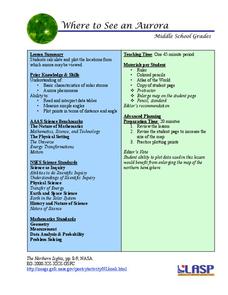
Where to See an Aurora
Where can you see an aurora in North America? After completing an astronomy activity, scholars can locate the exact coordinates. Pupils plot points of the inner and outer ring of the auroral oval and answer questions based on...
Curated OER
Brazilian Animals
Students research the animals of Brazil. In this animal science lesson, students locate Brazil on a map and discuss the types of animals that can live in its tropical climate. They research a Brazilian Carnaval and see the roll the...
Curated OER
Maps that Teach
Students study maps to locate the states and capital on the US map. Students locate continents, major world physical features and historical monuments. Students locate the provinces and territories of Canada.
Curated OER
Globe Lesson 5 - Latitude - Grade 6+
In this latitude learning exercise, students read a 3-paragraph review of latitude and respond to 12 short answer questions.
Curated OER
Jamestown Journey Part 3
Fourth graders study the economy of Jamestown. In this early settlers lesson, 4th graders read about the trade between the English and the natives in Jamestown. This lesson is part of a larger unit and coincides with the novel The Double...
Curated OER
Jamestown Journey Part 4
Fourth graders review their prior knowledge from the previous lessons of this unit on Jamestown. After reading a novel, they examine and discuss the life of Pocahontas. Using the internet, they answer comprehension questions and write...
Alabama Department of Archives and History
La Mobile: A Case Study of Exploration and Settlement
The Le Moyne brothers, Jean-Baptiste and Pierre, were among the first explorers of the Gulf Coast. Class members read biographical information and journal entries about these men, study maps showing where the settlements they established...
Curated OER
Describing A Place - Part I The British Isles
In this describing place worksheet, students label the cardinal and ordinal directions on a compass rose using the drop-down menus. They complete a matching activity by matching an item from column C with one in A and B. They read an...
Curated OER
A Place for the Birds
Students reflect on bird migrations and develop a project to collect data on bird species from across North America to further investigate the ranges and migrations of common birds. They create a field guide of North American birds.
Curated OER
Yo-ho, Yo-ho a Viking's Life for Me
Students complete a unit of lessons on the Vikings. They analyze maps, read and discuss myths, summarize the main ideas from resource materials, watch videos, sing a song, draw a picture to illustrate Norse mythology, and define key...
Curated OER
Columbus wants to find a shorter route to Asia
Eighth graders identify the reasons why Columbus wanted to find a shorter route to Asia. They make a timeline of the sequence of events surrounding his explorations. Students draw a map of the routes taken by early explorers around...
Curated OER
The Whiningdingdilly
Students read the book The Whiningdingdilly and complete a Venn Diagram, write a friendly letter, find misplaced animals, and morph animals and humans. In this The Whiningdingdilly lesson plan, students practice reading, writing, map...
Curated OER
Traveling Southern Style: A Lesson on the Jim Crow Laws
Third graders create a poster of a travel route. In this discrimination lesson, 3rd graders read The Gold Cadillac and use it to discuss the problems African Americans faced while traveling south in the 1950's. Students compare three...
Curated OER
The Good, The Bad, The Ugly
Sixth graders examine the causes of the stock market crash of 1929. For this integrated math/history unit on the stock market, 6th graders study, research, and read stocks, visit a local bank, and create a PowerPoint to show the...
Curated OER
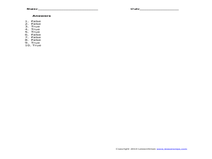
Utah: State History
In this Utah state history learning exercise, students read two and a half pages of information about Utah and complete 10 true and false questions.
California Polytechnic State University
Australian Geography Unit
At the heart of this resource is a beautifully detailed PowerPoint presentation (provided in PDF form) on the overall physical geography of Australia, basic facts about the country, Aboriginal history, and Australia culture and lifestyle.
Curated OER
Book: Latinos Today: Facts and Figures
Students, after reading Chapter 1 in the book, "Latinos Today: Facts and Figures," identify and characterize the four main ethnic/racial groups in America. They calculate and design a bar graph showing their populations by their...


