Curated OER
Beam Me Up Scotty#153
Students analyze population and land use data to predict future environmental problems. They use fictitious data for this exercise while pretending that they are helping aliens who have come to them for advice.
Curated OER
Go West My Class
Students find data that can be mapped on the Factfinder Web page. They analyze the data from the web site and state recommendations on whether a person should live in Illinois or not based on their preferences.
Curated OER
Planet Earth
Pupils explore and analyze data from different maps in order to explain geographic diversity among the continents. Student groups research continents' physical features and examine how they contribute to quality of life for inhabitants.
Curated OER
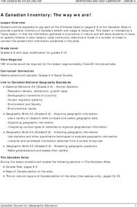
A Canadian Inventory: The Way We Are!
Students use the Canadian Atlas to discover an inventory of Canada's wealth and usage of resources. Using charts and graphs, they produce a wall of selected data of importance to the country and identify one issue of sustainability. ...
Curated OER
Parts of an Ecosystem
Fourth graders study the Great Salt lake and the ecosystem that encompasses it. They study the relationship between an individual of a species, a population of that species, a community that includes that population, and the...
Curated OER
Where We Live
Students forecast future population growth of the U.S. Virgin Islands. In this U.S. Census lesson plan, students explain the factors that influence population density on the U.S. Virgin Islands, including geography and economic activity.
Curated OER
Making Sense Of A Round World On A Flat Surface
Young scholars engage in a lesson that is concerned with the development of geography skills. They take part in a number of activities that center around finding and traveling to different locations. The lesson has resource links that...
Curated OER
Continents Game
Students study geography. In this geographic terms lessons, students compare the continents based on their different features. They work as a class to put the continents in order from least to greatest based on the different geographic...
Curated OER
Cultures and Cuisines WebQuest
Young scholars create and present a powerpoint presentation. In this cultures and cuisines research lesson, students select a country, interview someone from that country and visit a restaurant from that country. Young...
Curated OER
Louisiana Regional Foodways
Students strengthen their research techniques in locating, selecting, and synthesizing information from a variety of texts, media, references and internet resources to study regional food way traditions in Louisiana. They assess the...
Curated OER
Cancer City USA
Pupils investigate a phenomenon known as the cancer cluster. Students determine potential cancer clusters given real data and support their findings using mathematical calculations. Pupils Create a graphical representation of the...
Howard Hughes Medical Institute
Natural Selection and the Evolution of Darwin's Finches
Darwin explained the connection between species of finches 150 years before scientists understood DNA. Technology and progressing science proved he was right, yet many struggle to understand how natural selection happens. Scholars use...
Howard Hughes Medical Institute
Understanding Variation
Does where we live influence how our bodies express genetic traits? Explore variation in human skin color with an activity that incorporate video and hands-on learning. Individuals model the relationship between phenotypes and genotypes,...
Curated OER
Biggest Cities in Each State Quiz
In this online interactive geography quiz worksheet, students examine the chart that includes the names of 50 U.S. states. Students identify the names of the two largest cities in each state in 8...
Curated OER
City to Country Quiz
In this online interactive geography quiz instructional activity, students examine the chart that includes 20 world cities. Students identify the names of the countries where the cities are located in 4 minutes.
Curated OER
Canadian Provinces Quiz
In this online interactive geography quiz learning exercise, students examine the map that includes 13 Canadian provinces. Students identify the names of the provinces in 3 minutes.
Curated OER
Country Flags Quiz
In this online interactive country flag quiz instructional activity, students examine the 20 pictured country flags and try to name all of the countries represented in 4 minutes.
Curated OER
South America Map Quiz
In this online interactive geography quiz worksheet, students examine the map that includes all of South America's countries. Students identify the 13 countries in 2 minutes.
Curated OER
Middle East Map Quiz
For this online interactive geography quiz worksheet, students examine the map that includes 26 Middle Eastern countries. Students identify the names of the countries in 4 minutes.
Curated OER
Central America Map Quiz
In this online interactive geography quiz learning exercise, learners examine the map that includes 22 Central American countries. Students identify the names of the countries in 3 minutes.
Curated OER
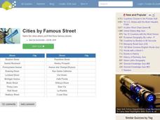
Famous Streets Quiz
In this online interactive geography quiz worksheet, students examine the chart that includes the names of 18 famous streets in the world. Students have 4 minutes to identify the names of the cities where the streets...
Curated OER
State Nicknames Quiz
In this online interactive geography quiz worksheet, students examine the chart that includes the names of 49 states. Students identify the nicknames of the states in 6 minutes.
Curated OER
California Cities Map Quiz
In this online interactive geography quiz worksheet, students examine the map that includes 12 California cities. Students identify the names of the cities in 3 minutes.
Curated OER
Famous Lakes Quiz
In this online interactive geography quiz worksheet, students examine the chart that includes details about 15 famous world lakes. Students identify the names of the lakes in 3 minutes.


