Curated OER
Where is Everybody?
Students collect data from different grade levels at their school and develop thematic maps which show population density, and determine how this might affect the school and themselves in the future.
Curated OER
Oh, What A Day
Students listen as the teacher reads A Country Far Away. They predict what they will do and what they think their partner student will be doing. Students create a KWL chart for Japan. They collect information about their activities on an...
Curated OER
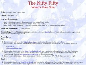
The Nifty Fifty-What's Your Size?
Students explore state populations. In this state geography lesson, students use a variety of technology tools to research and graph population and area of assigned states.
Curated OER
Geography of China (Tibet)
Sixth graders study the geography of Tibet. They create maps of Tibet. Students predict population, land area, water area and coastline length of the United States and Tibet. Students compare and contrast the day-to-day lives of people...
Curated OER
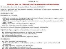
Weather and its Effect on the Environment and Settlement
Students, after choosing two diverse cities, collect data on weather for a month and construct a graph on temperature and precipitation. After collecting population data of said cities, and graphing it, they plot population on a large...
Curated OER
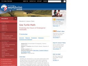
Sea Turtle Math
Students consider the future of endangered species. For this conservation lesson, students view a slide show and use mathematical data to construct a prediction for the survival of an endangered species. This lesson includes, personal...
Curated OER
The Cultural Geography of Australia, Oceania, and Antarctica
Students use information from the Australian Department of Immigration and Multicultural Affairs Web site to explore multiculturalism and immigration in Australia. They create graphs and charts from immigration data.
Curated OER
Mapping the changes in Canada's population
Students find and analyze data found in the census. They compare the population from 1996 to 2001. They explore the type of data they can find in the Census of Population.
Curated OER
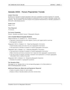
Canada 2050: Future Population Trends
Students analyze population data and a population pyramid projection for Canada. Using this information, they predict what the future trends in the population might be and its effect on Canadian society as a whole. They compare and...
Curated OER
Neighborhood statistics
Students examine statistics relating to neighborhoods. They use the data to explain how a population affects their environment. They discuss how businesses use statistics to find out information about their clientele.
Curated OER
Analyzing the Job Market for Babysitting in Your Neighborhood
Learners conduct research on a neighborhood in Canada. In this data analysis instructional activity, students use data from the 2006 Canadian census to draw conclusions about a population group.
Curated OER
Data Comparison And Interpretation: North Korea, South Korea, And the United States
Ninth graders brainstorm "what they know about North Korea and South Korea." They determine the approximate distance from the United States to North and South Korea and create a graph comparing the birth rates, death rates, infant...
Curated OER
Take Me Out To the Ball Game
Young scholars use a map to graph and locate major league teams of different sports. In groups, they analyze the population data of the United States and compare it with the amount and location of the major league teams. They share their...
Curated OER
Most Populous Countries Quiz
In this online interactive geography quiz worksheet, learners respond to 20 identification questions about the world's most populous countries. Students have 3 minutes to complete the quiz.
School Improvement in Maryland
Demographic Investigation
What are the factors that influence voting patterns? How do these factors influence government funding? Is participation the squeaky wheel gets the grease? Class members interpret graphs and analyze trends to determine what...
Pulitzer Center
Revolution in Tunisia
How much do your pupils really know about the revolution in Tunisia? In order to inform your class and spark discussion, first create a country profile, comparing and contrasting Tunisia with the United States. Learners then analyze the...
Curated OER
The Aging Population of Canada
Students analyze age-group population data and make inferences on the impact of the aging population in Canada. They, in groups, focus on health care, social programs and labor issues.
Curated OER
Water, Water Everywhere?
Students discover the relationship between water availability and population growth. They change variables in a computer model using a worksheet to guide their hypotheses and conclusions. In small groups they choose a country undergoing...
Curated OER
Postcards from California: A Unit on Geography, Social Studies, History and California's Resources
Fourth graders examine patterns that influence population density in the various regions of California. The unit's three lessons utilize graphic organizers for the interpretation and presentation of data.
Curated OER
Introduction to Population Statistics
Students examine population statistics. In this population lesson, students navigate the Internet to locate Canadian statistics regarding population.
Population Connection
The Carbon Crunch
Carbon is in the air; should we care? Teach the class why it is important to pay attention to carbon levels and how the world population and various countries across the globe affect the carbon levels in the atmosphere. High schoolers...
Curated OER
What's For Dinner?
Eighth graders discover how the location of restaurants affects the future location of different restaurants. Using a fictionous town, they map the locations of all current restaurants and analyze the data to determine what type of...
Curated OER
Saskatchewan's Population Distribution
Students explore landforms, vegetation, climate and population distribution in Saskatchewan. After discussing an atlas of Saskatchewan, students create their own relief map and climagraphs of Saskathewan. Using specified websistes,...
Curated OER
Population Counts
Middle schoolers investigate the analytical processes used to interpret the 2001 Canadian census. They examine the population statistics and trends.


