Curated OER
Pennsylvania Watersheds
Students identify the major watersheds of Pennsylvania. In this forestry lesson, students learn what a watershed is and are assigned one of the major watersheds of Pennsylvania. Groups then need to determine the boundaries of the...
Curated OER
"Potato Mountain": Reading/Understanding Topographic Maps
Middle schoolers investigate how to read topographic maps. In this map reading lesson students complete a topographic map activity.
Curated OER
Forest Fun
Learners explore orienteering and how to use a compass. They explore the importance of forests and identify some of the trees in a local forest.
Curated OER
Creating Station Models
Students review weather conditions at various cities and create station models on a weather map.
Carnegie Mellon University
Marcellus Shale: Who Pays?
After viewing short clips of unfortunate events, your class will consider two sides of a homeowner's court case, and then learn about the Marcellus shale deposit beneath the state of Pennsylvania and the hydraulic fracturing process. In...
Curated OER
Project Map: Latitude And Longitude Worksheet
In this latitude and longitude worksheet, students find the coordinates of 14 cities around the world and use this information to complete 14 short answer questions. This worksheet includes online atlas web links.
Curated OER
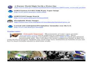
A Comparison Study of Water Vapor Data to Precipitation over North America
Students use NASA satellite data to compare water vapor over the United States. In this data analysis instructional activity students use an Excel spreadsheet to map their data.
Curated OER
Scaling the Map
Middle schoolers practice determining map distances using the map scales. They discover how much an area represents on the map in relation to the actual area. They decide on the best place to build their cavern.
Curated OER
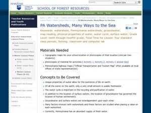
PA Watersheds, Many Ways to the Sea
Students examine the water cycle and the factors that interact with watersheds. In this watersheds lesson students describe the purification process, trace the flow of infiltrate water through aquifers, and research the Internet to...
Curated OER
The Formation and Value of Temperate Grasslands
Students study the Temperate Grasslands biome of North America. They explain that it is an endangered ecosystem because the rich soils have been converted to farming in most areas. They view videos imbedded in this plan, then complete...
Curated OER
PLATE MOVEMENTS AND CLIMATE CHANGE
Students label three geological maps with continents provided to analyze the relationships between the movement of tectonic plates and the changes in the climate. In small groups, they discuss their findings and form hypotheses about the...
Curated OER
Climate in Our Back Yard
Students construct a "A Year in Pennsylvania" poster on which they creatively describe at least three examples of how the climate they live in shapes their lives during every season of the year.
Curated OER
Birds on Wade Islands
In this birds on Wade Islands worksheet, students read a 1 page passage about the state of the birds on Wade Islands and answer 1 short answer questions about it. Students answer "What actions should the wildlife agencies take?"
Curated OER
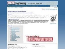
Communications: To the Rescue!
Students role-play as soldiers rescuing lost mountain climbers. Working in teams, they interpret maps to locate the climbers and use flashlights to send and receive coded messages about the rescue. Their goal is to complete the task in...
Curated OER
Volcanoes:How Safe Are They?
Students explore volcanoes, locate them on maps, record general information about volcanoes, and organize information on a fact sheet.
Curated OER
Possible Locations
Middle schoolers create maps with cutout pieces of paper that represent caverns. They develop a scale for their map and decide where the best location is to live. They discover the importance of map reading skills.
Agriculture in the Classroom
Design 'Y'er Genes
How do changes in DNA affect an organism? Scholars explore chromosomes, genes, DNA, and mutations by modeling the DNA of a strawberry. They build a DNA model, then manipulate it to show how changing the genes transforms the strawberry...
Curated OER
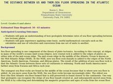
The Distance Between Us and Them: Sea Floor Spreading in the Atlantic Ocean
Students examine how geologists determine rates of sea floor spreading between two tectonic plates. They apply mathematical concepts such as the calculation and use of velocities and conversion from one set of units to another.
Curated OER
Living in a Watershed
Fourth graders examine watersheds. In this ecosystem lesson, 4th graders discover what a watershed is and identify the local watershed they live in. Students investigate the attributes of a watershed as well.
Curated OER
Exploring Our Watershed System
Students study watersheds and examine how they are composed. In this watershed system activity students explain how water enters a watershed and the concept of stream order.
Curated OER
So -- What's Happening Here, On This Old Christmas Tree Farm?
Students review their prior knowledge on biomes and ecosystems. At a local Christmas tree farm, they work together in groups to identify the changes occuring in the area. They participate in solving a mystery in which they determine the...
Curated OER
Dinosaurs - Online Research
Second graders familiarize themselves with dinosaurs through online research.
Curated OER
So -- What's Happening Here? On this Old Christmas Tree Farm
Students take a field trip to an old Christmas tree farm near their school. In groups, they gather data at the site and analyze the data in an attempt to discover what happened to the area. They identify human activities that led to the...


