Curated OER
Border to Border
Young scholars use the Internet to gather information on the country of Mexico. They also discover the culture of their people and compare them with the United States population. They take a virtual tour of some of Mexico's most...
Curated OER
Where in the Latitude Are You? A Longitude Here.
Students distinguish between latitude and longitude on the map. In this mapping lesson, students participate in mapping skills to recognize spatial relationships, and where to find natural resources on the map. Students create...
Curated OER
United States: Physical Features Fun
In this map worksheet, learners color and trace eleven listed features on a map of the United States. Students answer six additional questions about the map. A United States map is not provided. However, websites are provided to find...
Curated OER
Learning European Geography
Sixth graders discover locations and countries in Europe by identifying them on a map. For this European geography lesson, 6th graders read the book The Lost Little Elephant, with their class and discuss the geography referenced in...
Curated OER
Cacao Tree Geography
Students use a map to learn about where chocolate comes from. In this lesson on the cacao tree, students locate various regions where the cacao tree grows. They will discuss why the cacao tree grows more favorably in particular climates...
Curated OER
Celebrate Hanukkah in Israel
Explore Hanukkah and its origins with a social studies lesson. Learners discover the history of Hanukkah and its traditions. They locate Israel on a map, hear the story of the menorah and create their own...
Curated OER
Where in the World Is ...
Students locate and place countries and continents on a large map using tag board and yarn. They locate a new geographic location on the map each morning.
American Museum of Natural History
Being an Archeologist: Chuck Spencer
Meet Chuck Spencer, an archeologist who studies the Zapotec people who lived in the Valley of Oaxaca, Mexico over 2000 years ago. Spencer shares in print his response to questions posed by kids.
Curated OER
Volcanoes: Sixth Grade Lesson Plans and Activities
Bring a set of pre-lab, lab, and post-lab lesson plans on volcanoes to your earth science unit. Sixth graders explore the three types of volcanoes found on Earth, plot the specific locations of these volcanoes on a map, and...
Curated OER
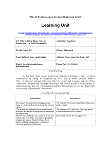
A Visit to Mexico City: An Introduction to World Communities
Third graders complete a variety of activities as they take an imaginary trip to Mexico City, complete with passports, maps, and Spanish dictionaries. They write postcards to send home and create items to sell at the market. The unit...
Curated OER
International Festival: Mexico
Students explore the culture of Mexico through music and food. In this multicultural instructional activity, students read the book Mexico and listen to samples of Mexican music. Students use ingredients to make tacos.
University of New Mexico
New Mexico Land of Enchantment
Third graders research Native American Cultures surrounding New Mexico. They analyze the history and geography of the state. They play a guessing game that incorporates the indigenous plants and animals of New Mexico. In groups, learners...
Curated OER
Africans in Mexico
Students read case studies to examine the role of Africans in Mexico. Using maps, they research the areas that are discussed in the text and map out movement maps of Africans to and from Africa. They research the history of the Mexico...
Curated OER
Temperature and Daily Life: Mexico City and Indianapolis
Learners compare the effect of temperature on daily life of a citizen in Mexico City, Mexico with that of a citizen of Indianapolis, Indiana.
Curated OER
Mapping the Border
Students create maps of the borderland region. They decorate their maps with colors, pictures, icons, scenes, words that reflect their understanding of the character and history of the borderland.
Curated OER
Christmas in Mexico
Young scholars identify how Christmas holidays are celebrated in Mexico, compare Mexican holidays with U.S. holidays, and learn Mexican customs. Lesson includes many downloadable activities to try with students.
Curated OER
Mexico History Worksheet
In this Mexico history worksheet, students examine a map of the states in Mexico and a blank timeline from 3000BC to the future. There are primary lines provided to write on, but no student directions.
Curated OER
Reading a Map
Third graders become familiar with the vocabulary and skills related to mapping. In this guided reading instructional activity, 3rd graders find proper nouns on from the map. Students read Goldilocks. ...
Curated OER
Moving West with the Forts: Using an Interactive Map
Seventh graders practice reading maps and locating the forts stationed in Texas. Using the internet, they analyze westward movements from statehood to the Civil War. In groups, they complete a worksheet about the forts and share their...
Curated OER
Mexican Metal Tooling
Metal work can be a wonderful way to expose learners to Mexican folk art. This resource provides all the necessary steps for creating Mexican metal tooling with your art class. Images, web links, recommended books and products make...
National Endowment for the Humanities
The Mexican Revolution
The legacies of the Mexican Revolution are visible today—even if some history classes don't cover them. Using primary sources from leaders in Mexico at the time of the popular uprising and other evidence, such as railroad maps, young...
The Alamo
The Alamo
Remember the Alamo! Scholars investigate the Battle of San Jacinto during the Texas Revolution. Using models, maps, quotes, biographies, and the Oath of Allegiance, the Alamo comes to life as the stories of those who fought and died in...
Curated OER
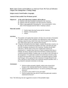
Immigration: Creating Change
Students explore how immigration has changed the culture of America. After identifying the foods and diets of Europeans and Native cultures, students create a map indicating where foods came from. Students design a restaurant menu,...
Curated OER
The Bread of the Sandwich
Students create relief maps of Canada and Mexico out of everyday objects like dried macaroni, dry rice, sand, etc. They create a clue card for a location game and try to stump their classmates. They host a travel fair to display their...


