Curated OER
Etc: Texas Controversy and Territorial Adjustment, 1836 1850
A map of the western United States between 1836 and 1850 showing the Texas controversy and territorial adjustments at the time. The map is color-coded to show the unorganized territory of the Louisiana Purchase and the boundary line with...
Curated OER
Etc: The Growth of the United States, 1776 1867
A map of the United States showing the growth of the nation from 1776-1867. The map is color-coded to show the thirteen original states, the territory acquired by conquest during the revolution and the Treaty of 1783, the Louisiana...
Curated OER
Etc: Territorial Development of the United States, 1783 1867
A map of the United States showing the growth of the nation from 1783-1867. The map is color-coded to show the thirteen original states, the territory acquired by conquest during the revolution and the Treaty of 1783, the Louisiana...
Curated OER
Etc: Routes of Lewis and Clark, 1804 1805
A map of western North America showing the routes of exploration by Meriwether Lewis and William Clark (1803-1806), and Zebulon Pike (1806-1807). The map shows the newly purchased Louisiana Territory, the Indian Territory east of the...
Curated OER
Etc: Oregon Trail and Other Routes, 1832 1842
A map of western North America between the opening of the Oregon Trail in 1832 to 1842, prior to the establishment of the Provisional Government of Oregon by American settlers in 1843. The map shows the boundary of the Oregon Country,...
Curated OER
Etc: Expansion of the United States, 1783 1853
A map from 1912 of the United States showing the territorial acquisitions up to the Gadsden Purchase in northern Mexico in 1853. The map is color-coded to show the territory of the original United States and the Northwest Territory...
Curated OER
Etc: Territorial Development of the United States, 1783 1889
A map from 1889 of North America showing the expansion in the region of the United States from the original Thirteen Colonies at the end of the Revolutionary War in 1783 to the time the map was made, around 1889, before the territories...
Curated OER
Etc: Original Range of the Bison, 1720 1903
A map of North America showing the original range of the American bison. The map shows the dates of local extermination, location, and numbers of wild animals in 1903 (Central Canada and the Rockies). "Beyond all doubt the most...
Curated OER
Etc: French Explorations and Settlements, 1611 1764
A map of southern Canada, the Great Lakes region, and Mississippi River Valley to the Gulf of Mexico, showing the French explorations and settlements with dates given from between the establishment of Montreal by Champlain in 1611 to the...
Curated OER
Etc: Central America and Isthmian Routes, 1846 1860
A map of Central America during the period of westward expansion in the United States when the need to find a shorter practical shipping route from the east coast to the west coast was a principle concern. This map shows the proposed...
Curated OER
Etc: The Us at the Outbreak of the Civil War, 1860 1861
A map of the United States at the outbreak of the Civil War (1860-1861) showing the States that seceded to form the Confederate States of America. The map also shows the territorial boundaries of the Washington Territory, Dakota...
Curated OER
Etc: Expansion of the United States , 1783 1853
A map from 1904 of the United States showing the territorial acquisitions up to the Gadsden Purchase in northern Mexico in 1853. The map is coded to show the territory of the original United States and the Northwest Territory defined by...
Curated OER
Etc: Expansion of the United States, 1783 1853
A map from 1904 of the United States showing the territorial acquisitions up to the Gadsden Purchase in northern Mexico in 1853. The map is coded to show the territory of the original United States and the Northwest Territory defined by...
Curated OER
Etc: The Territory of the United States, 1846 1848
A map showing the territory of the United States after the annexation of Texas in 1845, and the acquisition of the Oregon Country by treaty with Great Britain in 1846. The map is color-coded to show the possessions of the United States,...
Curated OER
Etc: Routes of Spanish Explorers, 1513 1565
A map of southern North America, Florida, and the Gulf of Mexico east the Mississippi Delta showing the routes of the early Spanish explorers Ponce de Leon (1513), De Narvaez (1528), and Hernando de Soto (1535-1542).
Curated OER
Etc: u.s. Territorial Acquisitions, 1783 1853
A map from 1910 of the United States showing the territorial acquisitions from the original states and territory established in 1783 to the Gadsden Purchase in northern Mexico in 1853.
Curated OER
Etc: The Campaigns of the Mexican War, 1846 1847
The area disputed by Mexico and the United States, also showing routes taken by various generals during the Mexican War.
Geographypods
Geographypods:freshwater: Issues and Conflicts: Competing Demands for Freshwater
This learning module examines conflicting demands for fresh water around the world. It looks at the water resources that are available, water scarcity, and local and international conflicts over water. Specific cases are explored,...
NOAA
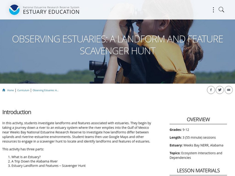
Noaa: Estuaries 101 Curriculum: Observing Estuaries:
Students investigate landforms and features associated with estuaries by taking a journey down a river to an estuary system where the river empties into the Gulf of Mexico near Weeks Bay. They will use Google Maps and other resources to...
Curated OER
Bbc: Bp Oil Disaster
Up to the minute news on the disastrous Gulf of Mexico oil spill of 2010. The BBC reports on the impact on the environment and provides an interactive guide to stopping the leak itself. In addition, find maps that clearly define the...
Smithsonian Institution
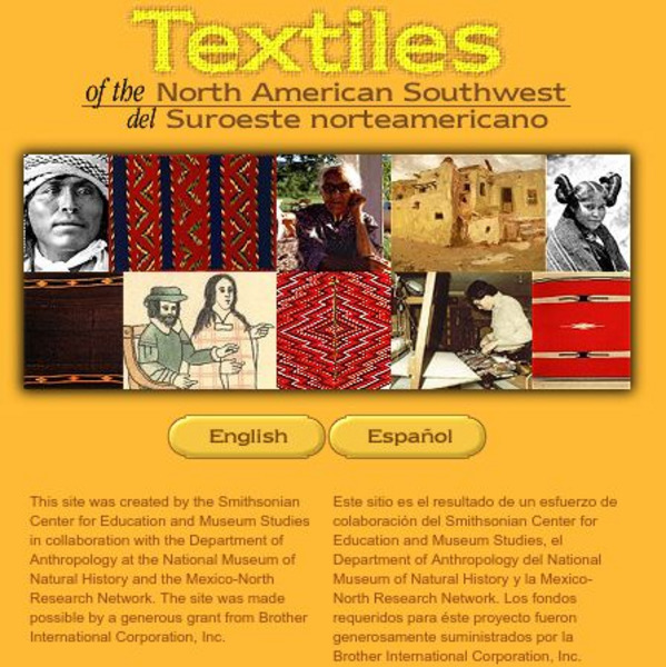
Smithsonian: Textiles of the North American Southwest
This site explores the weaving traditions of the Native American and Hispanic peoples of northern Mexico and the southwestern United States. A gallery of artifacts, timeline, map glossary, and textual descriptions are included. This is a...
Curated OER
Map of New Mexico
Use this site to learn the history of the controversial creation of the atomic bomb in the United States. Sound clips from National Public Radio and a photo gallery help to give you a first hand experience of the making of the atomic bomb.
ClassFlow
Class Flow: Texas Revolution
[Free Registration/Login Required] This flipchart gives an overview of the Texas Revolution. Using a mind map and a time line, students are visually drawn in to the events leading up to Texas gaining independence from Mexico. Links to...
Other
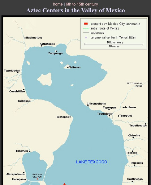
Aztec Centers in the Region of Lake Texcoco
A map of Lake Texcoco, showing the Aztec centers in the region at the time of the Spanish conquistadors. The entry route of Cortes into the city of Tenochtitlan, the Aztec capital, is designated along with causeways into the city. A few...
Other popular searches
- Map of Mexico
- Maps and Flags Mexico
- Topographical Map of Mexico
- Blank Map of Mexico
- Map of New Mexico
- Bm Map of Mexico
- Map of Mexico Activity
- Maps of Mexico
- Outline Map of Mexico
- Blanca Map of Mexico
- New Mexico Maps
- Us Mexico Maps


