Curated OER
Life on the Border
Students discuss different types of boundaries. They research the United States/Mexico border and answer questions about their findings. They create collages, posters, or multimedia presentations showcasing various areas of concern...
Curated OER
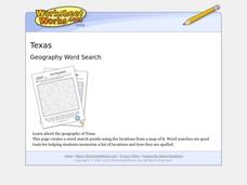
Texas Location Word Search
In this Texas location worksheet, students identify, locate and label twenty six significant Texas locations on a Texas map. Students also complete a word search containing the twenty six key locations.
Curated OER
An Excursion to Cities of Mysterious Pasts
Students use the encyclopedia sources on the computer or in the library to research the historic sites and history of Mexico City. They make notes of what they find to be the most interesting for their visit. They make a large map of...
Curated OER
Old Man River
Learners place the four reservoirs of the Kansas-Lower Republican Basin correctly on a map adding creeks and rivers flowing into them. Students explain uses for the reservoirs.
Curated OER
Mississippi Under British Rule
Students construct appropriate maps to depict the following information: changes in European territorial claims as a result of the French and Indian War; boundaries of British East and West Florida; significant rivers and settlements of...
Curated OER
Possible Locations
Students create maps with cutout pieces of paper that represent caverns. They develop a scale for their map and decide where the best location is to live. They discover the importance of map reading skills.
Curated OER
Diabetes
Students use maps, phone books and newspapers to determine how much health information and health services exist within their home, school and community regarding Type 2 Diabetes. Students review the available information.
Curated OER
States of Fitness
Young scholars participate in physical activities coordinating to divisions on a map.
Curated OER
Finding Your Way Around the I & M Canal
Fifth graders utilize a map of the I&M Canal (imbedded in this plan), and perform a series of tasks. They calculate distance, find specific points of interest and solve a set of story problems about the canal.
Curated OER
Big Apple, Here We Come
Students role play the role of immigrants coming to America for the first time. They complete an imaginary trip with their family and must rent a car and make seven stops along the way. They calculate distances and use maps to...
Curated OER
Latin America: Places and Regions
Seventh graders create a Latin American portfolio in the form of a country presentation using PowerPoint software. They use their knowledge of geographic concepts to interpret maps, globes, charts, diagrams, and timelines.
Curated OER
Lost on Superstition Mountain
Students review the concept of responsbility and relate it to the own lives. Using the internet, they research the search for gold on Superstition Mountain in Arizona and locate it on a map. They also examine the culture of Mexico and...
Curated OER
Pablita Velarde: A Biography
Students listen to Pablita Velarde: Painting Her People, a story by Marcella J. Rich. They discuss the book and why they think the author wrote it. They make a concept map of their ideas using Kidspiration software.
Curated OER
Establishing Borders: U.S. Expansion
Pupils interpret historical maps and locate territories annexed by the United States in the 1840. In groups, they research the war with Mexico over Texas from both perspectives and answer on a worksheet about expansion.
Curated OER
Regions of the US: Gulf Stream, States and Their Capitals
Fifth graders identify one way of dividing the US into geographical regions and then consider alternate ways of doing the same. They locate each of the fifty states and their capitals on a map. They research the Gulf Stream region.
Curated OER
Texas Weather Report
Students use provided links to observe selected weather sites and collect temperature and precipitation data for listed cities. They enter the information onto their spreadsheet. Students study maps of the Texas natural reagions,...
Curated OER
Old Mayan Mural
Students read a story called Scientists Discover Oldest Mayan Mural and answer vocabulary and comprehension questions about it. In this current events Mayan mural lesson plan, students respond to literature by answering questions,...
Curated OER
Create A Travel Brochure
Learners identify the different landforms in the State of Oaxaca, Mexico and create a travel brochure highlighting Oaxaca's attractions.
Curated OER
Korea Cultural Lesson Plan
Students engage in a study of geography and maps of Korea. They examine charts and graphs. Students are expected to interpret the information accurately and completely. The geography skills can be used on other countries as well.
Curated OER
Shelby County: The Regulator-Moderator War
Seventh graders comprehend the importance of the Regulator-Moderator War through John W. Middleton's memoir. They comprehend how the different motivations held by each faction began the conflict. Students are shown the map of Shelby...
Curated OER
Geography: How do Louisiana Rice Farmers Help the Environment after they Harvest Rice?
Third graders study maps of the United States locating Louisiana, the East Coastal Plain, the Mississippi Alluvial Plain, the West Gulf Coastal Plain, and five of the main rivers. In this geography lesson, 3rd graders create a...
Curated OER
Lone Stars and Gun Smoke
Seventh graders assess the significance of the Texas Ranger Frontier Battalion Company 'D' in maintaining law and order along the Texas-Mexico border. They study the importance of Ranger actions and utilize primary sources and maps to...
Curated OER
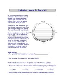
Latitude
In this latitude worksheet, students answer questions about latitude that include absolute locations of countries and coordinates. Students complete 12 questions.
Curated OER
Zip Codes
Young scholars discover how a zip code is used. In this zip code lesson, students use the parts of a zip code to find where a letter is going, then find the first number of zip codes based on geographic regions.
Other popular searches
- Map of Mexico
- Maps and Flags Mexico
- Topographical Map of Mexico
- Blank Map of Mexico
- Map of New Mexico
- Bm Map of Mexico
- Map of Mexico Activity
- Maps of Mexico
- Outline Map of Mexico
- Blanca Map of Mexico
- New Mexico Maps
- Us Mexico Maps


