Curated OER
Map Keys
Third graders examine maps and map keys. In this locating map features lesson, 3rd graders use crayons, markers and colored pencils to label maps. Students work in partners to read map keys and locate given places and things.
Curated OER
Story Map Book Report
This is an example of what a story map book report can look like using mind wing teaching concepts. Consider this idea as a way to provide special needs or those with learning disabilities a way to communicate what they know or learned...
Curated OER
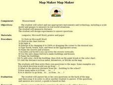
Map Maker, Map Maker
Map maker, map maker, make me a map! Your class can sing this tune as they work to create their own regional maps by taping paper to the wall, projecting an overhead transparency image, and tracing. Where this lesson plan intends for the...
Curated OER
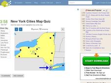
New York Cities Map Quiz
In this online interactive geography worksheet, students examine a map of New York and identify the 11 noted cities on the map using a pull down menu within 3 minutes.
Curated OER
Comprehension: Identify Story Grammar
This fully scripted lesson could be a big help for someone new to teaching Kindergarten. It outlines what you should do and say as you teach grammar and literary elements such as, main character, setting, and events through reading. The...
Curated OER
Listening Comprehension: Retell Main Events of a Story
Story retell is a very important skill. Little learners use a story map and a previously heard story to walk through the retell and story sequencing process. They complete this activity as a whole class and then on their own.
Cornell University
Too Much of a Good Thing?
Continuing their study of beneficial insects, young entomologists discover where in the world some of these bugs are. By labeling, coloring, and using the scale on a map, pupils explore the territories and arrival of the Asian lady...
Curated OER
Mapmaker, Mapmaker, Make Me a Map!
Learners evaluate the different types of historical and geographical information that one can gather through close study of historical maps from the 16th through the 19th centuries. They create their own maps.
Curated OER
Learning About the Map's Legend
Students draw a map of a room in their house and place a legend on it. They explain the legend orally.
Teach Engineering
Where Are the Plastics Near Me? (Mapping the Data)
The last activity in a nine-part series has teams create a Google Earth map using the data they collected during a field trip. Using the map, groups analyze the results and make adjustments to the map to reflect their analysis. A short...
CK-12 Foundation
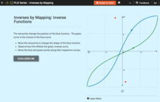
Inverses by Mapping: Inverse Functions
Map your way to successfully understanding inverse functions. Pupils use an interactive map to investigate how changes in the graph of a function affect the graph of its inverse. The results of the activity lead to the conclusion that...
Curated OER
You Can Depend On me
Discover the natural beauty of California. With a conservation bent, this activity delves into some of the attributes that make this state unique. Learners discuss Yosemite and the forest habitat. They focus on the things plants and...
CK-12 Foundation
Location on the Earth: Longitude and Latitude
To what degree do learners understand coordinates? Get them some practice in Yosemite National Park in a simple, fun interactive. Pupils explore a map and locate coordinates of popular sights within the park, then answer questions to...
CK-12 Foundation
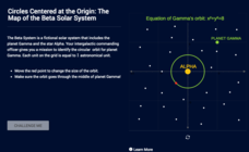
Circles Centered at the Origin: The Map of the Beta Solar System
Calculate galactic orbits in a far-out resource. Pupils drag a point on a circle to graph the orbit of a fictional planet. Using the equation, they find points through which the orbit passes. To finish the simulation, users determine the...
Southern Nevada Regional Professional Development Program
Pardon Me, Your Modifier is Dangling
Lost! (or misplaced) a modifier. Last seen dangling at the end of a sentence! Reward offered! To underscore the humor, class members are each given a sample sentence to illustrate (A woman passed by, leading a Springer Spaniel, in a long...
Curated OER
Map Analysis Worksheet
For this map analysis worksheet, students decipher what type of map they are using based on a complete list of criteria. Students then answer multiple questions based on their discoveries.
Curated OER
Maps! Maps! Maps!
Third graders examine and identify different types of maps. They review the types of projections and which maps are better for different information. They answer comprehension questions at the end of the instructional activity.
Curated OER
Lesson Design Archaeology- USGS Maps
Students research USGS maps and identify the major features. In this map skills lesson, students identify low and high elevations on a USGS map and practice finding latitude and longitude.
Curated OER
Meet Me in Austin
In labeling maps practice worksheet, students label the 11 landmarks in the city of Austin that are highlighted on the provided map.
Curated OER
Tasty Mapping
Students create an edible map. In this civics and geography lesson, students research their town's features and local government. Students work in groups to design and create a physical map of their town based on research.
Polar Trec
The Amazing Antarctic Trek
This resource provides two ways to engage learners in using latitude, longitude, and research skills. In pairs, or on their own, learners will locate several Antarctic regions on a map. They will write the name of the place and a few key...
Goodwill Community Foundation, Inc.
Directions and Distances
Describe where you are—and find out where you are going—with a beginning Spanish resource on directions and maps. Spanish learners repeat and practice direction words such as norte, este, and oeste, as well as measurement terms such as...
Curated OER
The Eagle Has Landed: Aztecs Find a Home
Students investigate the Aztec civilization and locate it on a map. They explain the legend of the city of Tenochtitan and investigate the symbolism of the Mexican flag.
Curated OER
Summertime Travel
Third graders write about a summer event they participated in. In this paragraph writing lesson plan, the teacher models how to write about a place they have visited. Students then write their own paragraphs. Students will point out on...


