Space Awareness
The Sun Compass of the Vikings
Evidence shows the Vikings likely navigated by using a simple sundial to find their course. Videos, a short story, and discussion help bring this time period to life as they study European history with a hands-on experiment. Scholars...
Curated OER
Science: Reading a Compass
Students demonstrate how to take bearings using a compass. In pairs, they select objects in the classroom then write down its first initial and bearing. They exchange papers and try to disciver their partner's object.
Curated OER
TE Activity: Northward Ho!
Students design a simple compass. They examine how the Earth's magnetic field has both horizontal and vertical components. They determine how a compass works and work with cardinal directions.
Space Awareness
How To Travel On Earth Without Getting Lost
Have you ever wanted to travel the world? Take a virtual trip with a geography lesson that uses longitude and latitude, the position of the sun, an astronomy app, and a classroom globe.
Curated OER
All About the Animals
Whose footprints are those? After reading Janet Halfmann's book, Little Skink's Tail, young scholars use footprints to determine where on a gridded map certain animals have been spotted. They use the map to answer 3 questions, one...
Energy for Keeps
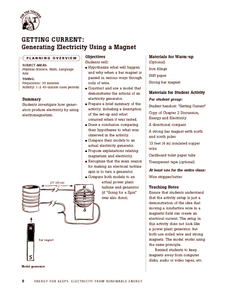
Getting Current: Generating Electricity Using a Magnet
Give your class a magnetic charge with this creative experiment designed to teach emerging scientists about electromagnetism. Pupils construct a model that demonstrates the function of an electrical generator and test this creation in a...
Curated OER
Shadows and Skyscrapers
Eighth graders explain the relationship between the position of the sun, a city's latitude and shadow length. Ratio's, geometry, and algebra are used to determine the shadow lengths and building heights. A sun angle (altitude) charts to...
Science Matters
Finding the Epicenter
The epicenter is the point on the ground above the initial point of rupture. The 10th lesson in a series of 20 encourages scholars to learn to triangulate the epicenter of an earthquake based on the arrival times of p waves and s...
Curated OER
What Can the Wind Blow?
Students observe math and science concepts no matter which way the wind blows. In this early childhood problem solving lesson, students will develop science, math, and observation skills as they learn about the wind.
Intel
Plugging into the Sun
What's cooking? A sizzling STEM unit challenges scholars to build a solar cooker that can successfully cook an egg. The unit opens with a study of Earth's rotation, the sun's energy, and shadows. Pupils use a compass and thermometer to...
University of Colorado
Looking Inside Planets
Researchers use scientific data to understand what is inside each of the planets. The first in a series of six, this lesson builds off of that concept by having pupils use a data table to create their own scale models of the interiors of...
Teach Engineering
Circuits and Magnetic Fields
Have your class use compasses to try to find the magnetic field around an electric current. Groups use the same technique to visualize magnetic fields as they did in the second activity in the series, but this time, the field is...
Teach Engineering
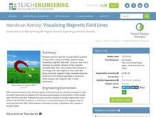
Visualizing Magnetic Field Lines
Magnetic fields might not be a field of dreams but they are useful. Class members observe the reactions of magnetic fields using a compass, iron filings in a paper container, and iron filings suspended in mineral oil.
Curated OER
Radial Design Mandala
Students design original radial art designs.In this radial design instructional activity, students use compasses and a nature inspired idea to create radial art. Students understand the use of symmetry, balance and design shapes in...
Curated OER
Marshmallow Moosy
Students stack several different colored marshmallows-one on top of the other-in the tall cylindrical container. They ct a cardboard disk to fit snugly inside of the container on top of the marshmallow stack using a compass if necessary....
Curated OER
Space Science:Wherever You Go, There You Are
Students explore navigation principles by observing, measuring, and interpreting data to determine locations. Using a compass, compass rose, and a transit, they plot courses and discover the workings of the Global Positioning System...
Curated OER
Weather Report Chart
Students complete a weather report chart after studying weather patterns for a period of time. In this weather report lesson, students measure temperature, precipitation, cloud cover, wind speed, and wind direction for a month. Students...
Curated OER
Mapping A Stream
Students participate in mapping an actual waterway. They include reach lengths, transects, compass reading, and scale determinations. They include windfalls, plant cover, types of streambed composition, and landmarks such as trees and...
Curated OER
Make Your Own "Weather" Map
Students create their own "weather" map using data from x-ray sources. They analyze and discuss why it is important to organize data in a fashion in which is easy to read. They compare and contrast different x-ray sources using a stellar...
Curated OER
Cartography
Students research about cartography and how to be a cartographer. In this math lesson, students draw a map of their classroom. They use a robot to explore navigation using a compass rose.
Curated OER
Quad Squad
Students pretend they have visited a forest research station on an overnight field trip. They study forest fires, use compass directions, read maps, interpret imagery, and think about the impact of fire on ecosystems.
Curated OER
Introduction to Scientific Methods
Sixth graders distinguish between an observation and an inference distinguish between quantitative and qualitative observations of a scientific experiment. They record and organize data collected during an experiment.
Curated OER
Seeing Solar Storms in STEREO-I
In this geometric calculations of solar storms worksheet, students use a diagram indicating the location of 2 STEREO satellites, the earth and the sun to calculate the distance between a Coronal Mass Ejection and the Earth. They use...
Curated OER
Science Inquiry Lesson: Mapping Project
Pupils explore the methods of creating maps. They create a map of Animas River Park using a compass and measuring tape, develop a single map from the team map sections, and devise another map of the Animas River Park using a GPS unit.


