Curated OER
Natural Features
Learners identify natural features on a map. In this map skill lesson, students use a landscape picture map to identify mountains, hills, islands, lakes, and rivers. Learners use post-it notes to demonstrate their location.
University of Wisconsin
Noting Notable Features for Rain Gardens
Eight groups in your class are each responsible for a different aspect of surveying the campus for a suitable rain garden location. Features to consider include water flow, topography, sun/shade patterns, land surface, vegetation,...
Curated OER
U.S. Political Map
Students explore the symbols found in a map legend. In this map skills lesson, students locate the legend on a political map and explain what each of the symbols mean. Students locate and identify several symbols on the map.
Curated OER
Map Activities
In this geography worksheet, students follow the directions and shade 3 different regions of a UK political map, shade European Union countries on a political map of Europe, match 4 physical feature of Africa to their descriptions, and...
Curated OER
Kansas State Map
In this map of Kansas worksheet, students color and label major cities and physical features of this state. Students also study the location of Kansas in relation to the other states in the U.S. by studying the background map.
Curated OER
Indiana State Map
In this Indiana state map worksheet, students color and label the important cities and physical features on this outline map. Students also learn of Indiana's location in the U.S. by studying the background map.
Curated OER
Iowa State Map
In this Iowa state map worksheet, students color and label the important cities and physical features. Students also study the background map that shows the location of Iowa in the United States.
Curated OER
Washington State Map
In this Washington map worksheet, students color and label the major cities and important physical features on the map. Students also study a second map that shows the location of Washington in the United States.
Curated OER
Idaho State Map
In this Idaho state map worksheet, learners color and label important physical features and cities. Students also study the background map to learn the location of Idaho as related to the rest of the U.S.
Curated OER
Hawaii State Map
In this Hawaii state map worksheet, students color and label important locations and physical features on the map of the 8 islands of Hawaii.
Curated OER
South Carolina State Map
In this map of South Carolina worksheet, students color and label major cities and physical features in South Carolina. There is also a map showing the location of the state in the U.S.
Curated OER
Tennessee State Map
In this Tennessee state geography activity, students color and label major cities and physical features on the map. Students also study a second map of the U.S. that shows the location of the state of Tennessee.
Curated OER
Virginia State Map
In this geography of Virginia worksheet, students color the map and label major cities and physical features. Students also study a second map showing the location of the state of Virginia in the United States.
Curated OER
Delaware State Map
In this geography of Delaware worksheet, students color the map and label major cities and physical features. Students also study a second map showing the location of the state of Delaware in the United States.
Curated OER
California State Map
In this geography of California worksheet, students color the map and label major cities and physical features. Students also study a second map showing the location of the state of California in the United States.
Curated OER
Georgia State Map
In this geography of Georgia worksheet, students color the map and label major cities and physical features. Students also study a second map showing the location of the state of Georgia in the United States.
Curated OER
Florida State Map
For this geography of Florida worksheet, students color the map and label major cities and physical features. Students also study a second map showing the location of the state of Florida in the United States.
Midnight Martian
Moon Globe
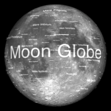
Not just a simple globe of the moon, this interactive version allows you to choose lighting according to the location of the sun, views from different positions on Earth, and more! Satellite images and topographic data have been combined...
Curated OER
Kid Maps: Reading and Creating Maps with Human Characteristics
Young scholars look at maps. In this map lesson, students listen to the book My Map Book by Sara Fanelli and they see the difference between human characteristics (buildings, etc.) and natural characteristics (rivers, etc.). They create...
Curated OER
Map It With Pixie
Fourth graders use the computer program 'Pixie' to create a topographic, detailed map for the state they live in. In this mapping skills lesson plan, 4th graders use Pixie to make a map of their state that includes topographic features,...
Curated OER
Map Keys
Third graders examine maps and map keys. In this locating map features instructional activity, 3rd graders use crayons, markers and colored pencils to label maps. Students work in partners to read map keys and locate given places and...
Curated OER
Mountain Magic: Identifying the Basic Physical Characteristics of Mountains
Students read about and identify on maps the physical characteristics of mountains. In this mountains lesson plan, students also write about the characteristics using personification.
Curated OER
Finding Your Way Using Maps and Globes
Students identify the similarities and differences between different maps and globes. Individually, they create a map of their classroom along with a compass rose. They also practice reading maps as a class and finding specific locations.
Curated OER
Rivers, Maps, and Math
Students use maps to locate and label the major rivers of North and South America. Using the internet, they identify forests, grasslands, mountain ranges and other landforms on the continents as well. They compare and contrast the...


