Curated OER
Where Am I, and How Do I Get Where I am Going?
Students describe geographical places through art, music, writing, and math. They compile information in booklets which may be published.
Curated OER
Welina's World
Students living in Hawaii draw a picture of themselves in their neighborhood. They draw their neighborhood in relation to their district and then in relation to the island they are from. They compare their pictures to their classmates'...
Curated OER
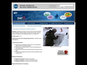
Great Lakes Snow Analysis Collaborative Network
Students interpret data on snow cover and analyze trend patterns. In this snow lesson students compare data and locate their school's GPS coordinates.
Curated OER
Ecosystems Lesson Plan
Students research ecosystems (rainforest, desert, grassland, woodland, and arctic tundra). Students compare the seven continents and the importance of proximaty to the equator.
Curated OER
The Pacific and El Niño
El Nino, and the climate changes that go along with it, are the focus of this Earth Science lesson. Learners pay particular attention to the wind patterns that are established on Earth, and look at weather maps to see how El Nino can...
Curated OER
Micro-Climate
Atmosphere aces investigate the microclimates that exist within a larger area. They use a thermometer to record the varying temperatures and identify the microclimates on a map that they have drawn. This exercise helps them to understand...
Curated OER
Early Civilizations of Ancient India
Taking your class through one of the richest and most influencial histories on earth, these slides detail the development and characteristics of Indian culture. Full of pictures of ancient relics, maps of migration and settlement...
Science 4 Inquiry
Edible Plate Tectonics
Many people think they can't observe plate tectonics, but thanks to GPS, we know that Australia moves at a rate of 2.7 inches per year, North America at 1 inches per year, and the Pacific plate at more than 3 inches per year! Scholars...
National Wildlife Federation
Quantifying Land Changes Over Time Using Landsat
"Humans have become a geologic agent comparable to erosion and [volcanic] eruptions ..." Paul J. Crutzen, a Nobel Prize-winning atmospheric chemist. Using Landsat imagery, scholars create a grid showing land use type, such as urban,...
Science 4 Inquiry
An Investigative Look at Florida's Sinkholes
In May of 1981, the Winter Park Sinkhole in Florida first appeared and is now referred to as Lake Rose. Scholars learn about the causes of sinkholes through an inquiry project. Then, they analyze recent data and draw conclusions to...
Chicago Botanic Garden
Historical Climate Cycles
What better way to make predictions about future weather and climate patterns than with actual climate data from the past? Young climatologists analyze data from 400,000 to 10,000 years ago to determine if climate has changed over...
Global Oneness Project
A Collapsing City Skyline
Have your high schoolers learn about the modern history of Myanmar by close-reading an article about the city and people of the city Yangon. As they'll learn, the country is going through some dramatic transitions. After...
Curated OER
Convergence with The Cay: Exploring Geographic Concepts Wrapped in a Story
Here's an awesome unit that uses The Cay as the anchor text. The 16-page packet is loaded with teaching ideas, activities, and suggested adjustments.
It's About Time
Renewable Energy Sources - Solar and Wind
There has been a huge solar energy spill! Let's go outside to play in it. This lesson includes multiple experiments showcasing solar and wind energies. Scholars build a solar heater and an anemometer before testing the results. The...
National Wildlife Federation
I’ve Got the POWER Wind Energy Potential at Your School
The 20th lesson in a 21-part series connects the wind data and expectations of a turbine to whether such devices should be built in your area. Scholars begin with estimating the wind potential at school by using long-term climate...
Curated OER
Geology and it’s Influence
Students compare current geological map and the one from 1800's. In this earth science lesson, students discuss differences between the two and explain the factors that caused the change. They write an essay about how these changes...
Curated OER
From Pirates to Pilots to Spies
Sixth graders enjoy this introduction to the world of map projections, globes, aerial photographs, and satellite images. This lesson instructs students on the advantages and disadvantages of each earthly representation.
Curated OER
Exploring Climate Change with GIS
Students investigate climatological changes that are occurring to the Earth. In this climate change lesson, students access an assigned web site to view maps and lessons that show how climate change makes a difference to life on Earth.
Curated OER
States with Attitude, Latitude and Longitude Dude
Sixth graders identify states whose boundaries are formed by lines of latitude and longitude or natural borders such as rivers. They trace a map of the U.S., and fill in borders, rivers and lines of latitude and longitude.
Curated OER
Building a Topographic Model
Students explore Mount Shasta and various locations on Mars to examine ways geographical data can be represented. They study topographic maps and translating data from 2-Dimensions to 3-Dimensions.
Curated OER
Plate Tectonics: Recycling the Seafloor
Students classify earth's layers and plates using Ocean Seismicity data. In this plate tectonics lesson, students outline where the plate boundaries are on the world map. They then compare these predicted boundaries with USGS map of the...
Curated OER
A Model of Three Faults
Learners investigate faults. For this science lesson, students explore the many stresses and strains in the earth's layers and research the types of faults in their state.
Curated OER
Lesson: Journey of a Tree
Third graders explore the operation of a Christmas farm and how trees are shipped. After taking a tour of a Christmas tree farm and researching transportation, location and cost issues, 3rd graders create a map to show the distribution...
Curated OER
Modelling Ocean Currents
Young scholars construct a replica of the Atlantic ocean given certain parameters. In this earth science instructional activity, students draw their own map of ocean currents. They answer questions related to the activity.
Other popular searches
- Earth Scene Concept Maps
- Earth Scone Concept Maps
- Earth Science Mapping
- Earth Sciecne Concept Maps
- Mapping Earths Surface
- Mapping Earthquakes


