Curated OER
Regents High School Examination: Physical Setting Earth Science 2009
Junior geologists address 50 multiple choice questions and 35 short answer questions about the earth system. Plenty of visuals are included for interpretation: diagrams, graphs, maps, photographs, laboratory setups, weather symbols, and...
Curated OER
Regents High School Examination: Physical Setting Earth Science 2010
Every topic under the sun is covered in this New York State Regents High School Examination. With the focus of earth science, participants answer 85 quesitons about the solar system, geologic time, rocks and minerals, landforms, and...
Curated OER
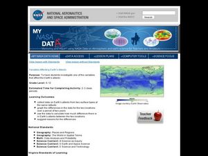
Variables Affecting Earth's Albedo
Students study the variables that affect the Earth's albedo. In this environmental data analysis lesson students interpret and graph information and calculate changes.
NOAA
Mapping the Deep-Ocean Floor
How do you create a map of the ocean floor without getting wet? Middle school oceanographers discover the process of bathymetric mapping in the third installment in a five-part series of lessons designed for seventh and eighth graders....
Curated OER
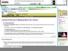
Lesson 2 Activity 2: Mapping Mount St. Helens
Students use topographic map skills to interpret impact of the May 18, 1980 eruption of Mount St. Helens on the volcano's topography, and draw profile views of Mount St. Helens before and after the May 18, 1980, eruption.
PBS
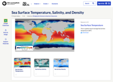
Sea Surface Temperature, Salinity, and Density
Earth's vast ocean is full of mysteries! Science scholars discover the big-picture properties that influence its characteristics at different latitudes using a lesson from PBS's Weather and Climate series. After completing a background...
NASA
Earth's Global Energy Budget
Introduce your earth science enthusiasts to the earth's energy budget. Teach them using an informative set of slides that include illuminating lecturer's notes, relevant vocabulary, embedded animations, colorful satellite maps, and a...
Mr. E. Science
Introduction to Earth Science
From the layers of Earth's spheres to latitude and longitude to looking at topographic maps, learners discover the elements of Earth's systems.
Keep it Simple Science
The Earth in Space
Skim the surface of the earth with this brief, compact, summary of outer space. The sun, stars, galaxies, planets, and phases of the moon can be found in this all-in-one resource. Seventh graders will enjoy these simple worksheets to do...
Curated OER
Floating Plates on the Earth
Fourth graders construct a concept map about Plate Tectonics. They include types of movement, names and effects of boundaries. They research plate tectonics, describe and name 3 types. They analyze the effect on the earth's surface of...
Curated OER
Explore Surface Types on a Journey Around Earth
Students explore satellite data. In this technology cross-curriculum math and world geography lesson, students locate specific map areas using a microset of satellite data. Students use technology and math skills to determine percentages...
Curated OER
Earth's Water
If the majority of our planet is covered with water, why do we need to bother conserving it? With a thorough and varied investigation into the location and types of water on the earth, learners will gain an understanding of why this...
NOAA
Plate Tectonics I
Young geologists get a glimpse beneath the earth's surface in this plate tectonics investigation. After first learning about the different layers of the earth and the constant movement of its plates, young...
PBS
Insolation on Earth
In 2017, the world increased the capacity for using solar energy by a whopping 32 percent. Is solar energy the future for the planet? Approach this topic from the idea of how much solar energy reaches the surface of Earth. Individuals...
Curated OER
Observation and Inference
Assess your young scientists' understanding of the difference between observation and inference with this 20-question multiple choice quiz. It reviews a variety of physics and astronomy concepts, such as solar eclipses and sunspots, the...
California Academy of Science
Which Way is North?
Who needs a compass to find cardinal directions? Just place a stick in the ground and record the movement of its shadow over the course of a day. Then, measure the shadow lengths in order to determine a north-south line. A simple...
Curated OER
How Much Ocean?
In this ocean worksheet, students are given a map of the world and they predict the amount of water that covers the Earth's surface. They count the total number of squares on the given map that represent the water and they land and they...
Curated OER
Identifying Watersheds with Topographic Maps
Students model a watershed and delineate one using topographic maps. In this hydrology lesson, students use aluminum foil to model a landscape and observe how water moves on it. They also observe the features of a topographic map and use...
Glynn County School System
Earth's Magnetic Field and the Moon
The surface of the moon has an amazing tale to tell. Learn about the moon's story with a PowerPoint presentation that describes the unique features of the moon's surface as well as explains its movement in relation to Earth.
Curated OER
Maps Reinforcement
In this map worksheet, middle schoolers complete 6 multiple choice questions and 5 short answer questions about 3 different map figures.
Curated OER
Plotting Earthquakes
Students plot earthquakes on a map. In this lesson on earthquakes, students will explore recent earthquake activity in California and Nevada. Students will plot fault lines and earthquake occurrences on a map.
NASA
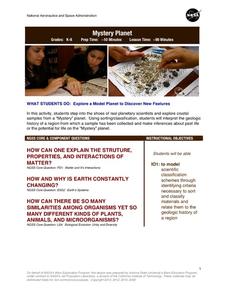
Mystery Planet
What can one learn about a planet based on a small surface sample? Learners will explore artifacts from a mystery planet and see what they can determine about the planet based on the evidence in front of them.
Curated OER
Pangaea Puzzle
Students explore plate tectonics and the formations of the Earth's surface and why maps are distorted. In this Earth's surface lesson students complete a lab and answer questions.
Curated OER
How Does the Earth's Energy Budget Relate to Polar Ice?
Students use satellite data to see how radiation budget relates to the ice that is present in the North. In this energy instructional activity students correlate data to see a relationship.


