Teach Engineering
Projections and Coordinates: Turning a 3D Earth into Flatlands
Introduce your class to map projections and coordinates, the basics for the work done in a GIS, with an activity that uses Google Earth to challenge learners to think about the earth's shape.
Annenberg Foundation
Geometry 3D Shapes: Surface Area and Volume
Whether you wrap it or fill it, you're using geometric concepts. Classmates use an interactive approach to learn how to find volume and surface area of cylinders and prisms in the second lesson in a five-part series. The online lesson...
Curated OER
Explore Surface Types on a Journey Around Earth
Students explore satellite data. In this technology cross-curriculum math and world geography lesson, students locate specific map areas using a microset of satellite data. Students use technology and math skills to determine percentages...
Curated OER
How Much Ocean?
In this ocean worksheet, students are given a map of the world and they predict the amount of water that covers the Earth's surface. They count the total number of squares on the given map that represent the water and they land and they...
Statistics Education Web
How Wet is the Earth?
Water, water, everywhere? Each pupil first uses an Internet program to select 50 random points on Earth to determine the proportion of its surface covered with water. The class then combines data to determine a more accurate estimate.
Curated OER
Map Grids
Students study map grids and explore how they can be used to locate positions of objects or features on a map. They read a story and then participate in a grid activity using a large map of the setting of the story.
Curated OER
Latitude
Your young geologists generate a graph given a table of values from the context of latitude and percent of the earth's surface north of that latitude. The questions in the activity then focus the learners to a deeper understanding of the...
Curated OER
Lakes of Methane on Titan
In this methane lakes worksheet, students read about the false-color synthetic radar map taken by the Cassini spacecraft indicating methane lakes on Titan. Students solve 4 problems about the surface area of the lakes from the image, and...
Illustrative Mathematics
Latitude
The greater the latitude, the less of the Earth is north. Scholars graph the relationship between the latitude and the percentage of the Earth that is north of the latitude. Using the graph and the table, class members interpret values...
Curated OER
Principles of Flight: Where are We?
Students explore the concept of topographical maps. In this topographical map lesson, students discuss how airplanes know where to fly. Students use topographical maps to simulate a field trip on the computer.
Annenberg Foundation
Geometry 3D Shapes: Test Your Skills
Time to find out what they've learned! The final lesson of a five-part series has learners complete a 39-question multiple choice review. They use what they've learned in the previous lessons to complete questions that include concepts...
NASA
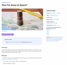
How Far Away Is Space?
Space is about 60 miles from the surface of Earth. Pupils make calculations to model that distance by stacking coins the appropriate height using scale. They then explore the distance to objects in space such as satellites and the space...
Curated OER
Having a Hot Time on Mars!
In this cosmic radiation on Mars activity, students study a radiation map of Mars taken by the MARIE instrument on the Odyssey spacecraft. Students answer 4 questions using the radiation map and they answer questions about the exposure...
Curated OER
Water and Land 207
Young scholars examine maps of different projections, mathematically calculate distortions, and note the advantages and disadvantages of each map. They study the different maps and transfer the map to graph paper.
Curated OER
Home on the Range
Young scholars use maps and mathematics to determine the appropriate panther population in a given area. In this Florida ecology lesson, students research the area requirements of male and female panther and use a map to help calculate...
Curated OER
How far have we traveled?
Learners practice longitude and latitude to determine given position on Earth's surface, convert and calculate angular measurements, and use Pythagorean Theorem to determine change in position or distance traveled between any two locations.
Curated OER
Chain Across the Hudson Lesson Plan A - Locating the Chain
Young scholars read a letter from George Washington requesting them to identify on a map a location that would stop the advance of British warships. They choose a location and justify their choice.
Curated OER
Measuring the Earth
Students identify types of arcs and angles in a circle, find the measure of arcs and angles, and solve real world problems involving lengths of segments in circles, lengths, and areas.
Curated OER
Analyzing Meteorological Data From Mars
Students compare real-time Earth and Mars measurements for temperature, wind speed, humidity and atmospheric pressure by accessing Internet-data resources from NASA. They access real-time weather data and maps for their school location.
Curated OER
Trends of Snow Cover and Temperature in Alaska
Students compare NASA satellite data observations with student surface measurements of snow cover and temperature. They practice data collection, data correlations, and making scientific predictions.
Curated OER
Plotting the Ocean Floor
Fourth graders plot points on a graph, connect the dots to make the ocean floor profile and label the topographical features. They utilize a worksheet and a website imbedded in this plan to plot the ocean floor.
Curated OER
Size It Up
Pupils practice their math skills in determining the water/land proportions of the Earth. Using globes, they locate the seven continents and oceans and determine which covers more space. They use this information to participate in...
Curated OER
A Message in a Bottle
Young scholars investigate the motion of water currents by mapping the possible movement of messages cast into the ocean in bottles.They accurately plot the appearance of bottles on a world map and illustrate the flow of an ocean...


