Curated OER
Floating Plates on the Earth
Fourth graders construct a concept map about Plate Tectonics. They include types of movement, names and effects of boundaries. They research plate tectonics, describe and name 3 types. They analyze the effect on the earth's surface of...
Curated OER
A Walk Around the School: Mapping Places Near and Far
After reading Pat Hutchins’ Rosie’s Walk, have your young cartographers create a map of Rosie’s walk. Then lead them on a walk around the school. When you return class members sequence the walk by making a list of how the class got from...
Curated OER
Let Me Tell You About...
Learners comprehend the differences between flat maps and relief or topographical maps. They recognize how forces such as earthquakes, volcanoes, water, and wind-as well as human actions--have altered the Earth's surface. Students work...
Curated OER
Learning About Maps
Students investigate the many uses and features of maps and globes and locate where they live on both. In this map lesson, student play a travel game and create their own maps to explore states, continents, countries, and islands.
Curated OER
Map Reading in the 21st Century
Students interact with MapPoint tools to view maps of the past and the present in multiple ways. They participate in mini-lessons aimed at locating certain points of interest or famous routes taken in history.
Curated OER
Isoseismal Maps
Young scholars examine the difference between magnitude and intensity in earthquakes. They complete map work and write a first hand account of a person living in each level of intensity on the Modified Mercalli Scale.
Curated OER
Mapping Population Changes In The United States
Learners create a choropleth map to illustrate the population growth rate of the United States. They explore how to construct a choropleth map, and discuss the impact of population changes for the future.
Curated OER
Geo-Journaling with CNN
Young scholars organize daily news with this journaling activity.
Curated OER
Lesson Ten: Direction
Young scholars explore the concept of relative location. In this map lesson, students read I Hate English by Ellen Levine and consider how maps and globes help people to familiarize themselves with an area.
Curated OER
Combining Geography and Literature by Mapping a Story
Students listen to or read a story on their own. Using the text, they describe the relative locations of the main events. In groups, they develop two and three dimensional maps of the story. They create a key and a title for their map.
Curated OER
Ocean Currents
Young scholars discover the geography of Earth by analyzing water currents. In this oceanography lesson, students create visual references on a map of the globe where and why major ocean currents are moving water. Young...
Curated OER
Blast It! (Learning About Copper)
Opening with background information on copper use and mining, this worksheet assesses junior geologists' reading comprehension. A map activity is available, but the map is not. There is a useful set of vocabulary matching cards and a...
Curated OER
Rubber Duckies and Ocean Currents
Students explore marine life by conducting a rubber duck experiment. In this water currents lesson, students practice identifying latitude and longitude coordinates on a map and define the currents of major oceans. Students discuss the...
Prairie Public Broadcasting
Egyptian Pyramids Virtual Field Trip!
A virtual field trip takes enthusiastic travelers to the pyramids of Giza. Using Google, scholars explore the grounds of the ancient pyramids found in Egypt then complete three worksheets: a photo analysis page, a reflection sheet, and a...
Curated OER
Volcanoes: Mount Vesuvius
Students explain how volcanoes form. In this earth science lesson, students identify the different types of volcanoes. They create brochures about Mt. Vesuvius before and after the eruption.
Channel Islands Film
Arlington Springs Man: Lesson Plan 2
West of the West's documentary Arlington Springs Man and a two-page scientific article about the same topic provide the text for a reading comprehension exercise that asks individuals to craft a one page summary of information gathered...
Curated OER
A Model of Three Faults
Learners investigate faults. For this science lesson, students explore the many stresses and strains in the earth's layers and research the types of faults in their state.
Curated OER
Louisiana
Third graders study factual information about Louisiana including the state flag, bird, tree, and important geographical points using the Internet and maps. They explain the different groups that settled the state in this mini-unit.
Curated OER
The Atmosphere Then and Now
Students recall details about the formation of the earth and early atmosphere. They name the layers of the atmosphere and compare amounts of atmospheric nitrogen, oxygen, and argon. Formulate questions about global warming.
Curated OER
The 50 States and its Holidays
Though the format of this ELL lesson is confusing (the standards listed are for plate tectonics, yet the objectives are for American geography and holidays), a teacher could glean some ideas from the main idea. Here, pupils complete a...
Curated OER
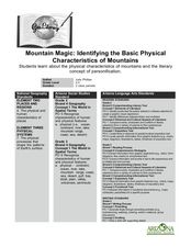
Mountain Magic: Identifying the Basic Physical Characteristics of Mountains
Students read about and identify on maps the physical characteristics of mountains. For this mountains lesson plan, students also write about the characteristics using personification.
Curated OER
Seeing Sound & Sonar
Students make inferences based on different sounds that they hear. In this inferences lesson plan, students will hear sounds of different objects and describe the sounds based on what they hear. They will answer various questions about...
Curated OER
Controlling the Flow of the Colorado River: A Study of Dams
Students research and map the Colorado River and its dams and predict the effects of a dam on an area. They suggest reasons a dam would be built and compare the Colorado River system with other major river systems within the US and...


