Cornell University
Constructing and Visualizing Topographic Profiles
Militaries throughout history have used topography information to plan strategies, yet many pupils today don't understand it. Scholars use Legos and a contour gauge to understand how to construct and visualize topographic profiles. This...
Curated OER
Shaky New Zealand
Students explore geography by answering study questions in class. In this plate tectonics lesson, students identify the earthquake data concerning the country of New Zealand and answer questions regarding the data. Students identify...
Curated OER
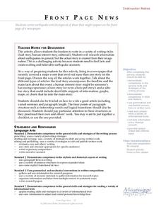
Front Page News
Learners write original earthquake articles typically found on the front page of a newspaper. Each student has the freedom to write in a variety of writing styles (lead story, human interest story, editorials, etc.). They research...
Curated OER
Active Volcanoes, Plate Tectonics and the "Ring of Fire"
In this volcanoes, plate tectonics and "Ring of Fire" worksheet, students view the location of volcanoes on a map of the Earth, they see the "Ring of Fire" and they locate the major plates of the Earth's crust. They use the map as...
Curated OER
Follow the Falling Meteorite
Middle schoolers use triangulation method to locate meteorite landing site on the map. In this earth science instructional activity, students participate in a meteorite treasure hunt set up by the teacher. They explain how this method is...
Curated OER
Lesson on GPS
Students investigate global positioning systems. In this technology and mapping lesson, students view a PowerPoint presentation in which they identify the features of a GPS, state its uses, and follow steps to find a waypoint.
Curated OER
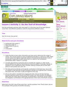
Lesson 3 Activity 1: On the Trail of Knowledge
Students plot the earthquake epicenter data on the base map of the North Atlantic ocean floor using different symbols or colors to characterize different values.
Curated OER
Comparing the New Madrid and San Andreas Fault Zones
In this faults worksheet, students use an earthquake reference sheet to find the numbers for a modified Mercalli and Richter scale. They compare the San Andreas Fault zone and the New Madrid fault zone on the United States map. They...
Curated OER
Plate Tectonics
In this geology worksheet, students will cut a map of California along the San Andreas fault line to see how California might change in the future. Then students will compare a world map from 50 million years in the future with a present...
Curated OER
Earthquakes on the Surface
Students view topographic or relief maps of Southern California and discuss what they see. They make predictions based on the topography of the region.
Curated OER
Earthquake Unit
Eighth graders watch the "Earth, the Environment & Beyond" video on earthquakes. Take notes and give an oral summary. They build a working, two dimensional model of a strike-slip, thrust, or normal fault.
Curated OER
Plate Tectonics: Second Grade Lesson Plans and Activities
Second graders explore convection currents and how they relate to the movement of tectonic plates. Then, young geologists reconstruct Pangaea with a worksheet and pinpoint plate boundaries on a map...
Curated OER
Volcanoes: Second Grade Lesson Plans and Activities
Young geologists explore volcanoes with a series of engaging geology activities. First, they learn the difference between magma and lava before coloring and labeling the parts of a volcano. During the lab, individuals watch a...
Curated OER
Hazards: First Grade Lesson Plans and Activities
Examine the environmental hazards associated with volcanoes with a three-part science lesson. In the pre-lab, first graders learn that gas, landslides, ash, and lava are all hazards that come from volcanoes. They then explore...
Curated OER
The Geography of the Indian Subcontinent
Gloriously adorned with a glimpse of the Taj Mahal, these slides detail important facts and characteristics of South Asian cultures, such as India, Pakistan, Afghanistan, and several other surrounding countries. Slides cover the...
Curated OER
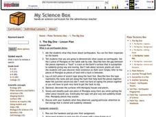
The BIG One
Students observe an earthquake demonstration. They research an earthquake and use color dots to plot the location of each of their earthquakes on the large map.
Curated OER
Looking into Earth with GIS
Students work with data from a seismic wave model in a freely available GIS (geographic information system) program, ArcVoyager SE. Using a GIS, they examine maps and produce graphs to explore variations in seismic wave velocities at...
Curated OER
Active Faulting in Idaho
Students use CAD maps to explore active faults in Idaho. Through observation of maps, they explore the layers of the Quaternary and Holocene faults. Individually, or in groups, they identify characteristics of faults such as scarps,...
Curated OER
A Moving Experience
Learners visit Time Machine's San Francisco Earthquake Era. They understand how the Earth's layers interact to cause changes in the Earth's surface. They review information about earthquakes and Earth's layers.
Curated OER
Drifting Continents, Dynamic Results
Pupils plot earthquake and volcano data using a Compass Rose Plotting. They explain the relationship between plate movement and connection. They draw conclusions that earthquakes and volcanoes occur in predictable locations.
Curated OER
Plate Tectonics
Students simulate the three types of plate boundaries using robots. In this earth science lesson, students explain how earthquakes and volcanoes are formed. They collect real-world earthquake data and plot them on the map.
Curated OER
Plate Tectonics: Recycling the Seafloor
Students classify earth's layers and plates using Ocean Seismicity data. In this plate tectonics lesson, students outline where the plate boundaries are on the world map. They then compare these predicted boundaries with USGS map of the...
Curated OER
Earth's Plate Tectonics
Students identify the different layers of the Earth. In this earth science activity, students create a model of the crusts and continents. They explain how plates movement cause earthquakes and volcanoes.


