A to Z Teacher Stuff
Facts About Australia
Here is a quick printable with some basic facts about Australia, such as its population, area, type of government, and currency, as well as a simple drawing of an outline of the country.
NASA
Outline Maps
Don't miss this gold mine of blank maps for your next geography lesson! Regions include traditional continents such as Asia, Europe, and Africa, as well as other major world areas such as the Pacific Rim and the Middle East.
Curated OER
Orienteering: Map Skills
Students use a map to locate six specific landmarks on a course using a map. They identify how maps can help us and write a paragraph describing how to get from one landmark to another on the map.
Curated OER
Labeling a Map of Australia
Third graders label a map of Australia. Using the internet, they research the history and maps of the continent and print a blank map. They review on how to use a compass rose and legend. In groups, they create a brochure to share...
National Geographic
Australia, Antarctica, and Oceana
Go on a traveling adventure throughout Australia, Oceana, and Antarctica! This textbook excerpt offers a full unit of study that can easily be supplemented by extra projects or research materials. Learners study maps, read about...
Devine Educational Consultancy Services
Geography Student Workbook, Australia
Your youngsters will be experts on the geography of Australia after working with these activities and worksheets, which review the continent's weather, major landforms, dimensions, history, and climate.
Institute for Geophysics
Understanding Maps of Earth
Here is your go-to student resource on primary geography concepts, including facts about the surface of the earth and its hemispheres, latitude and longitude, globes, types of maps, and identifying continents and oceans.
Curated OER
Australia and Oceania Map Quiz
In this online interactive geography quiz activity, students examine the map that includes 23 countries, territories, and dependencies of Oceania. Students match the names of each to the appropriate...
Curated OER
Topographic Mapping Skills
In this geography worksheet, students read an excerpt about topographic maps and why they are useful for various jobs. They also respond to eleven questions that follow related to the excerpt and locating specific map points on the map...
Curated OER
Mapping Australia
In this mapping Australia activity, students locate and label various features and places on a blank map, 10 total. A reference web site is given for additional activities.
Curated OER
Australia/Oceania Outline Map
In this Australia and Oceania outline map worksheet, students explore the region of the world as they label the 14 countries. The countries are numbered and lines for the answers are provided on the sheet.
Curated OER
Australia
Students discover information about the Aboriginal people of Australia. In this global studies lesson plan, students listen to mini-lectures regarding the history of Australia and the Aboriginal people. Students compare American Indians...
Curated OER
Australia Word Search
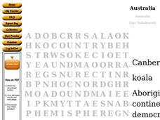
For this social studies worksheet, students find the words that are used to describe the continent of Australia and the answers are found by clicking the button at the bottom of the page.
Curated OER
Australia Map
In this blank outline map worksheet, students explore the political boundaries of Australia. This map is labeled and may be used in a variety of classroom activities.
Curated OER
Australia Map: Labeled
In this blank outline map worksheet, students explore the political boundaries of Australia and its provinces and territories. This map is labeled and may be used in a variety of classroom activities.
Curated OER
Australia Map: Labeled
In this Australia outline map activity, students make note of the political divisions of the 5 provinces and territories of the nation. This map is labeled.
Curated OER
Australia Map
In this Australia outline map worksheet, students make note of the political divisions of the 5 provinces and territories of the nation.
Curated OER
Australia Outline Map
In this Australia and Oceania outline map worksheet, students make note of the major landforms and bodies of water located within this region.
Curated OER
Australia and Oceania: Physical Map
In this Australia and Oceania physical map instructional activity, students make note of the major landforms and bodies of water located within this region.
Curated OER
Choropleth Mapping Skills
In this geography worksheet, students identify and describe how to apply choropleth mapping skills. They examine the map given and convert it into a choropleth map through coloring. Then students use those colors to shade in their key...
Curated OER
Australia: the Land Down Under
Young scholars give a solid history and geographic explanation of the country of Australia and explain why it is important. They use some creativity in designing their own island, by using the physical features of this particular country.
Curated OER
Cultural Mapping
Young scholars are introduced to the cultural diversity in Australia. Using new vocabulary, they define multiculturalism and explore their own cultural backgrounds. In groups, they complete a series of worksheets to develop a better...
Curated OER
Australia
Students participate in activities in which they discover facts about Australia. They examine its climate and history. They complete a worksheet to end the lesson.
Curated OER
Australia Shape Book
In this Australia shape book worksheet, students use a map shape of Australia to make a shape book after printing as many pages they will need for their projects. They fasten the pages together for use in reports, vocabulary words or...


