NOAA
Why is Hawaii's Ocean Important?
Studying the oceans? Focus on Hawaii's ocean with a resource packed with activity-based worksheets. Everything from products that come from the ocean to the abundance of plants and animals that call the ocean their home, Hawaii's ocean...
EngageNY
Analyzing Text Structure & Summarizing Text: “Equal Rights for Women” by Shirley Chisholm
Let me check my schedule! Scholars set up discussion appointments with five classmates to discuss Shirley Chisholm's speech "Equal Rights for Women." Readers then use their Note Catcher guides to analyze the text of the speech more...
Curated OER
Name That Town
Students demonstrate how to locate places on a map using coordinates. In this map skills lesson, students work in small groups and select a name from a map index to locate. Students use coordinates to identify the location on a map....
Curated OER
Mapping the Mediasphere
Students compare/contrast the media messages they see in two different communities in their city. They list the elements of art and the principles of design in the photographs they have taken in those two different communities. They...
Curated OER
once and future MOON
Beyond the phases of the moon, this comprehensive lesson plan covers geologic history and geology. Amateur astronauts examine photos of the lunar landscape, experiment with the creation of craters, and delve into information about the...
Curated OER
Make a Map
In this mapping activity worksheet, students finish the map by following the 5 directions and using the map key. Students the map key, scale, and an inch ruler for help.
Curated OER
Landscape Picture Map
Students design a landscape picture map. In this landscape picture mapping lesson, students understand when and why to use a landscape picture map. Students discuss landscape picture maps.
Curated OER
Making a Two - Colorable Map
Learners make a two - colorable map by following directions given to them. In this map lesson plan, students follow 5 sets of directions and discuss their activity.
Curated OER
North, South, East. or West?
In this cardinal directions practice learning exercise, students find the places mentioned in 10 statements on a map of the United Kingdom. Students apply their map reading skills to identify each statement as true or false.
Curated OER
Introduction to Symbols
Learners study the concept of picture symbols as a way to express ideas without using words. In this picture symbol instructional activity, students place symbols on a U.S. map according to meaning. Learners then review various...
Curated OER
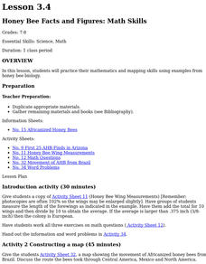
Honey Bee Facts And Figures: Math Skills
Students practice their mathematics and mapping skills using examples from honey bee biology. Discuss why the colonies were found in this pattern. They examine food and water in the area, and how many humans live in the area where...
Curated OER
Putting It on the Map
Students consider the purpose of various types of maps and their different uses throughout history. They create their own maps and reflect on the map-making process.
Curated OER
Natural Features
Students identify natural features on a map. In this map skill activity, students use a landscape picture map to identify mountains, hills, islands, lakes, and rivers. Students use post-it notes to demonstrate their location.
Curated OER
Fishes Concept Map
In this marine science worksheet, students complete a concept map on the different types of fish. They fill in 8 blanks with the correct answer from the word list.
Curated OER
Birds Concept Mapping
In this biology instructional activity, students complete a concept map about birds. They fill in 7 blanks with the correct terminology from the word list.
Curated OER
Organizing Ideas
Eighth graders investigate varous writing skills as part of larger course of study. The lesson is essentially a rough guide for conducting a class for writing. The main focus of the plan is organizing ideas using various strategies that...
Curated OER
Exploring Maps: Navigation
Students engage in a lesson that is concerned with the concept of navigation while research is conducted with the use of a variety of resources. The information is used to expand their perspective of the applications for navigation. The...
Edgate
Great Grids
Learners use grid boxes as a measurement tool and discover how grids are used for mapmaking and scaling down an area. They begin by attempting to draw a model shape drawn by the teacher by using the gridding process. At the conclusion of...
Curated OER
Mapping the Garden
Pupils discuss maps, the features on a map, and why maps are important. They make a map of a garden they will be planting, complete with symbols that represent the various plants they choose to plant.
Curated OER
Maps and Local History
Students study old and current maps of their town. They make connections between the geography of a town and the activities of its inhabitants.
Curated OER
Directions on a United States Map
Pupils generate directions for an imaginary trip. In this map lesson, students review the four main directions and how to use a map legend. Pupils locate destinations based on directions given by classmates.
Curated OER
Adventures With Maps And Globes
First graders examine the differences between a map and a globe. They discuss and identify the symbols on maps and globes, then in small groups complete a worksheet. Students then complete a Venn Diagram comparing maps and globes.
Curated OER
Map Activity: Place Name
In this map worksheet, students locate given words on a map of the United States, then answer a set of 4 related short answer questions.
Other popular searches
- Map Skills Lesson Plans
- Map Skills Worksheets
- Elementary Map Skills
- Geography Map Skills
- Basic Map Skills
- Social Studies Map Skills
- Globe and Map Skills
- Beginning Map Skills
- United States Map Skills
- Map Skills, Continents
- Early Explorers Map Skills
- Free Map Skills Worksheets


