Curated OER
The Global Grid System-World Map Activity
Students demonstrate how to use the global grid system. In this map skills lesson, students use a world map to locate various locations. Students identify locations based on the global grid system. Students complete a worksheet as an...
Curated OER
Introduction to the Globe
Students investigate how to use a globe. In this map skills lesson, students define what a globe is and locate the various continents on the globe. Students are also asked to locate the four oceans on the globe.
Curated OER
In Mr. Lincoln's Shoes
Students demonstrate basic map skills. In this US history lesson, students review cardinal directions and use a compass rose while at the same time discuss what life was like for Abraham Lincoln.
Curated OER
Post Roads
Students locate the major cities in the colonies during the Revolutionary War. For this map skills lesson, students use a globe to locate cities such as Charleston and Boston using latitude and longitude coordinates.
Library of Congress
Investigating the Building Blocks of Our Community’s Past, Present, and Future
As Ken Jennings said, "There's just something hypnotic about maps." Certainly, the longer you look at them the more you can learn. In this project-based learning lesson, individuals study both historic and present-day maps of...
Curated OER
Charting Neptune's Realm:
Students explore how to construct and interpret maps and globes and find information about people, places, regions, and environments.
KOG Ranger Program
Fire Behavior in Forests
Understanding the ways a fire will act is a key factor in fire safety and fire prevention. Young campers focus on how the weather and terrain can affect the behavior of a fire with topographic maps and different...
Scholastic
Volleyball Road Trip
Review coordinate mapping with your young geographers by matching cities on a volleyball team's road trip itinerary to their appropriate coordinate locations.
Huntington Library
The Corps of Discovery: The Lewis and Clark Expedition
Don't miss this fantastic comprehensive lesson plan on the Lewis and Clark Expedition, packed with instructional guidance, worksheets, map work, informational texts, and secondary source materials.
Province of Manitoba
The Outdoors Camping and Survival Skills
Equip young campers with the tips and strategies for a safe trip to the outdoors with a series of lessons. They learn how to start fires with and without firewood, keep warm in snowy weather, and purify water to make it safe for drinking.
Curated OER
Map It!
Fourth graders demonstrate map making skills by using the computer to create maps of the geographic features, regions, and economy for their state.
Curated OER
2nd Grade - Act. 21: Me On the Map
Second graders read book, Me On the Map, and create map of their bedroom and of their house.
Curated OER
Let's Build a Map
Students gain an understanding of maps while studying the map of the Louisiana Purchase and the trail of Lewis and Clark and the Corps of Discovery. They demonstrate understanding of maps by creating a basic classroom map.
Curated OER
Why All Maps Lie
Eighth graders discover the fundamental advantages/disadvantages of both maps and globes. They see that maps may distort size, shape, distance and direction. They discuss the advantages and applications of 5 types of map projections and...
Curated OER
From Maps to Models
Students explore watersheds through the use of a topographic map. They observe topographical maps and discuss their characteristics. In groups, students create a model clay island and make a topographical map of it. Afterward, groups...
Curated OER
Nazi Concentration Camps -- Map and Chart-Reading Activities
Students use an informational chart about Nazi concentration and death camps to complete a mapping activity and a chart-reading activity.
Curated OER
Mapping National and Geographic Identity
Learners analyze geographic maps. In this map analysis lesson, students analyze the symbols in geographic maps and the impact of cultural, historical, and political concepts. Learners compare and contrast maps in various mediums by...
Curated OER
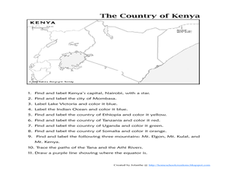
The Country of Kenya
In this map completion worksheet, learners observe a map and map scale of Kenya to find and label bodies of water, cities, countries, and the equator. Students answer 11 questions.
Curated OER
Make Your Map
In this map making worksheet, students make their own maps, draw symbols and place them in the map key area, and draw a compass rose to show directions for the map.
Curated OER
Concise Directions: Pictures in School
Learners practice giving directions. In this descriptive writing activity, students create maps and other visual aids that provide sets of directions for learners to get from one location of their school building to another.
Curated OER
Map Exploration
Are you looking for a terrific lesson on map activities for your second graders? Then, this resource is for you! The activities range from decoding, to fill-in-the-blank, to read-and-search. There is a website activity related to maps...
Baylor College
Mapping the Spread of HIV/AIDS
Where is HIV/AIDS most prevalent and what are the current trends regarding HIV? Have groups work together to map the world's HIV/AIDS rates, then create a class map with all the data. Lesson includes cross-disciplinary concepts including...
Curated OER
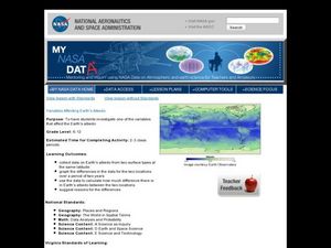
Variables Affecting Earth's Albedo
Students study the variables that affect the Earth's albedo. In this environmental data analysis lesson students interpret and graph information and calculate changes.
Curated OER
Second Graders on the Map
Second graders explore the various types of maps. They examine the differences between street maps and aerial photographs. Students identify various features on each map. They use cardinal directions and the compass rose. They write...
Other popular searches
- Map Skills Lesson Plans
- Map Skills Worksheets
- Elementary Map Skills
- Geography Map Skills
- Basic Map Skills
- Social Studies Map Skills
- Globe and Map Skills
- Beginning Map Skills
- United States Map Skills
- Map Skills, Continents
- Early Explorers Map Skills
- Free Map Skills Worksheets


