Curated OER
Agriculture Shapes Kentucky History
Students explore the lives of early American Indians and settlers in Kentucky. They describe the agricultural practices of Indians native to Kentucky and develop a supply list for a group of settlers coming to the state to establish...
Curated OER
Kentucky State Map
In this map worksheet, students will study a map of Kentucky. Students will use this map to label and/or familiarize themselves with various aspects of the state.
Curated OER
Analyzing Two Dances and Making a Dance Map: The Nutcracker
Students discuss dance elements and create a dance map. They choose a dance theme and incorporate movement into their dance maps and choreography. They also experiment with different types of music.
Curated OER
Kentucky Outline Map
In this Kentucky outline map worksheet, learners examine political boundaries of the state and the placement its capital city as well as its major cities. This map is not labeled.
Curated OER
Water Features - Lesson 2 - U.S. Political Map Grade 4-5
Students locate water features on maps. In this geography lesson, students complete worksheets that require them to identify water features on a U. S. political map.
Curated OER
Mystery State #10
In this mystery state worksheet, students answer five clues to identify the state in question. They then locate that state on a map.
Curated OER
Export-Import Game
Students recognize how international trade affects them as consumers and become familiar with basic agricultural crops grown in Kentucky. They identify items used in their daily lives and .heir place of origin and examine export/import...
Curated OER
State Map Locations
For this four state map locations worksheet, learners match up the following four state names to their actual locations on a United States map: Vermont, Tennessee, Kentucky and Rhode Island.
National Endowment for the Humanities
African-American Communities in the North Before the Civil War
Middle schoolers may be surprised to learn that before the American Civil War there were more slaves living in New York than there were in Kentucky! Young historians examine maps and census data to gather statistics about...
Curated OER
Third Grade Social Studies Quiz
In this social studies worksheet, 3rd graders complete multiple choice questions about communities, maps, distances, and more. Students complete 11 questions.
Curated OER
State to State Scavenger Hunt
In this states instructional activity, students utilize the Internet to access one specific website to locate the answers to five fill in the blank statements about the states found on a United States map.
Curated OER
Do You Know Your 50 States?
Learners use the names and abbreviations of the 50 states to label a blank map of the United States.
Curated OER
Introduction Lesson to the Book Where the Red Fern Grows
An excellent lesson plan on the classic book, Where the Red Fern Grows. Learners view the W. Wilson Rawls website and engage in a series of activities generated by the website. They write in their reflective journals, watch a video, and...
Curated OER
Ozark Folk Culture and Geography in the Mountain View, Arkansas Area
Upper grade through early high schoolers develop an understanding of Ozark culture, and the geography of the Ozark Plateau. They study place, location, human environmental impacts, and movement. This interesting plan incorporates muic,...
American Battlefield Trust
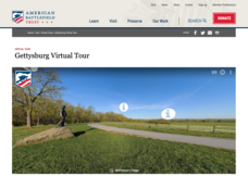
Gettysburg Virtual Tour
Step into one of the most iconic battlefields of the American Civil War with an educational interactive resource. Young historians learn about key moments, locations, soldiers, and turning points in the battle with a clickable map and...
ReadWriteThink
Biography Project: Research and Class Presentation
I Have A Dream ... that after the lesson, all individuals master the reading, writing, researching, listening, and speaking skills the biography project helps them develop. Martin Luther King, Jr. serves as a topic example for a model...
Curated OER
Cartography
Students follow directions to draw a map of an island. They complete the island map adding their own details using symbols and a legend.
Curated OER
Scaling the Map
Students practice determining map distances using the map scales. They discover how much an area represents on the map in relation to the actual area. They decide on the best place to build their cavern.
Curated OER
Mapping the Blue Part
Eighth graders determine the location of specific features of the stimulated ocean floor. The features include the continental shelf, continental slope, an ocean trench, and a mid-oceaniz ridge.
ReadWriteThink
Dear Librarian: Writing a Persuasive Letter
Everyone deserves to read a great book! Here, pupils write a persuasive letter to the school's librarian detailing their favorite story and why it should be found on the shelves. Class members' persuasive reading passages are shared with...
Curated OER
Field Trip to Mammoth Cave
Students, when given a microscope or a camera, write two observations they have seen using technology that they did not see with just their eyes with 100% accuracy. When given a blank map, they mark the location of Mammoth Cave along...
Curated OER
Name the States Worksheet 5
In this name the states instructional activity, students examine 6 state map outlines and identify each of them by writing the state names and postal abbreviations.
Curated OER
Lewis & Clark: The Louisiana Purchase
In this facts about the Louisiana Purchase and the Lewis and Clark expedition online interactive worksheet, students read information and observe a map of the Louisiana Purchase to answer questions showing their comprehension skills....
Curated OER
The Battle of Corydon
Fourth graders study the Battle of Corydon, its military leaders, and its influence on the town. In this Battle of Corydon lesson, 4th graders develop vocabulary needed to complete the lesson, listen as the teacher reads The Battle of...


