Curated OER
Those Particular Plants in Particular Regions
Fourth graders, acting as a botanist, analyze information on different plants in different regions of California. They characterize each plant for each region and answer a variety of question for each plant while doing this study.
Curated OER
A Dollar Goes A Long Way
Investigate life along the Old Spanish Trail! They visit websites and identify the history and environment. They create journals, dramatic enactments, and maps to discover the role individuals played in society. They also explore the...
California Department of Education
Roadmap to Success
Life is a highway ... where will yours lead? Scholars pave the way toward success in the fourth of five college and career readiness lesson plans. Using the SMART system, individuals begin mapping out the steps they will follow to...
Indian Land Tenure Foundation
Respect for Land
Youngsters examine how people show respect and care for the land. Specifically, learners see how the Native Americans truly did care for and respect the land, and still do so to this day! They also explore how they themselves can care...
Curated OER
Molly Pitcher -- "Out of Many, One"
Students research, brainstorm and analyze the events that lead up to the Revolutionary War. They critique a piece of artwork depicting a scene from the Revolutionary War. Each major battle is plotted on a map to show a visual...
ReadWriteThink
Biography Project: Research and Class Presentation
I Have A Dream ... that after the lesson, all individuals master the reading, writing, researching, listening, and speaking skills the biography project helps them develop. Martin Luther King, Jr. serves as a topic example for a model...
Federal Reserve Bank
Piggy Bank Primer: 25 Cents Worth of History
It's all about money. Here's a resource that introduces kids to the Federal Reserve System, different coins produced by the mints, and fun facts about state coins.
Curated OER
Hazards: First Grade Lesson Plans and Activities
Examine the environmental hazards associated with volcanoes with a three-part science lesson. In the pre-lab, first graders learn that gas, landslides, ash, and lava are all hazards that come from volcanoes. They then explore...
Curated OER
People Take Action
Students locate landforms of California on a map. They discuss the problems and solutions that were used to save the lizard from extinction. They discuss how working together to solve problems is useful.
Curated OER
The New Californians
Students identify the groups of immigrants who came to California. They trace the route they possibly took to American on a world map. They discuss the reasons why they left their homeland and what challenges they faced once they arrived.
Curated OER
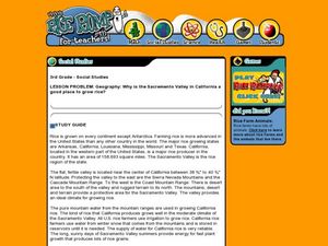
Geography: Why Is the Sacremento Valley a Good Place to Grow Rice?
Third graders locate the Sacramento Valley in California where rice is grown. In this rice growing location lesson, 3rd graders locate the Sacremento Valley, California on a map, and color the mountain ranges and terrain that is around...
Curated OER
Rice Farming History
Second graders map the progress of rice farming by using a map of the United States. In this rice farming lesson plan, 2nd graders draw a line on the map from where rice farming started to the progression of its growth.
Curated OER
Why Do Geese Fly South For the Winter?
Fifth graders examine migration by tracing animal migration routes on a map. In this animal life lesson, 5th graders observe a map of North America and read about the migration patterns of geese. Students trace the path most...
Curated OER
The New Madrid Earthquakes of 1811-1812: Shaking Our Misconceptions about Earthquakes in United States History
Students Examine how earthquakes work and what plate tectonics and fault lines are. For this earthquake lesson students complete an earthquake scavenger hunt.
Curated OER
Westward Expansion
Students locate California and New York on a map and explore available means of travel in the 19th century. Students explore the role of trade in pioneer America and simulate various barter transactions.
Curated OER
The Expansion of The United States, 1846-1848
Students interpret historical maps,identify territories acquired by the United States in the 1840s. Also they identify states later formed from these territories. The primary sources for the lesson are the maps found in the lesson's...
Curated OER
States of Fitness
Learners participate in physical activities coordinating to divisions on a map.
Curated OER
Scaling the Map
Middle schoolers practice determining map distances using the map scales. They discover how much an area represents on the map in relation to the actual area. They decide on the best place to build their cavern.
Curated OER
Across Five Aprils
Eighth graders are introduced to the novel "Across Five Aprils" written by Irene Hunt. They become familiar with the people, places, and events referenced in the story and comprehend the story of the Civil War. Students are given a...
Curated OER
From Sea to Shining Sea
Students study the geography of the United States of America. Students write letters, create travel brochures, make maps, graph population numbers, read fiction and nonfiction selections, complete KWL charts, and watch films.
Curated OER
Preparing for the WPE
Prepare your soon-to-be graduates to take the Writing Proficiency Examination given at Cal Poly. These slides cover everything from the various types of questions to writing thesis statements. This is more like an overview than a...
Curated OER
ESRI Live Earthquake Site
Students examine a World map and find earthquakes near plate boundaries. They locate and describe earthquakes in the United States and California.
Indian Land Tenure Foundation
Indian Trust Lands
An important aspect of studying Native American history is understanding the nature of trust lands. Budding historians will learn that as Native Americans were removed from their home lands, trust lands were provided in the form of...
Curated OER
Then and Now, A Watershed in San Francisco
Students compare recent and historic maps to explore landscape changes. Using photos provided, students identify prominent features on the maps. They discuss differences in landscape, human impact on watershed, and changes in natural...


