Curated OER
Map Directions and the United States
Third graders search TDC database for images of a compass rose, a miles marker, and a US map. They identify cardinal and intermediate directions to help identify their state and other states on a US map.
John F. Kennedy Presidential Library & Museum
Red States/Blue States: Mapping the Presidential Election
Young historians investigate how voting patterns have changed by comparing the outcome of the 1960 election to the outcome of the recent election. A creative final assessment has participants making a news show wherein they provide...
CC Homestead
Summarize
Designed for third graders but appropriate for older learners as well, this packet of materials underscores the necessity of teaching kids how to summarize, how to identify main ideas and supporting details, and how to ask questions...
Crabtree Publishing
Remarkable Lives Revealed
Six lessons make up a unit all about biographies. Scholars read about a remarkable life while taking notes and identifying characteristics of the biographical genre. Readers examine the tale's obstacles, accomplishments, and sequence of...
CK-12 Foundation
Midpoint and Segment Bisectors: Midpoint Map
Discover how to find a midpoint with a conceptual exploration. Scholars manipulate a point to determine the location of a midpoint on a straight line distance between two locations. Later questions extend to determine the...
CK-12 Foundation
Circles Centered at the Origin: The Map of the Beta Solar System
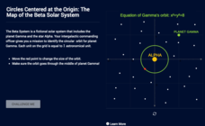
Calculate galactic orbits in a far-out resource. Pupils drag a point on a circle to graph the orbit of a fictional planet. Using the equation, they find points through which the orbit passes. To finish the simulation, users determine the...
Anti-Defamation League
Viewing History from Multiple Perspectives
Celebration or protest song? The full text of Woody Guthrie's "This Land is Your Land" opens a study of the Lewis and Clark Expedition, the Louisiana Purchase, and Western Expansion from various perspectives. Middle schoolers examine...
Curated OER
125 Years of the Central Library in Derby, UK
In this city quiz worksheet, students complete the sentences with one of the listed words relating to the text '125 Years of the Central Library in Derby, UK. Students complete 28 exercises.
Curated OER
New Hampshire Map
In this state maps worksheet, students identify the state map of New Hampshire. Students fill in the state capital, major cities, and other attractions.
Curated OER
Mediterranean Lands: A Pilgrimage Through Time and Space
Students will use context clues and examine several maps to answer series of short answer questions over range of geographical topics, identify specific places, practice using GoogleEarth to compare satellite views to those produced two...
Curated OER
Ancient Egypt: Connecting Literature and Geography
Students brainstorm prior knowledge of Ancient Egypt, locate Egypt on map of Africa and on world map, watch King Tut film, discuss term biography, and map geographical information mentioned in stories and documentaries about Ancient Egypt.
Curated OER
U.S. Geography- The Northeast
Students investigate the geography of the Northeast states. In this map skills lesson, students are shown a map of the Northeast states and identify the state names and borders. Students construct individual maps of the Northeast using...
Curated OER
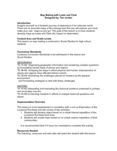
Map Making with Lewis and Clark
Students develop maps based on a virtual internet expedition of The Louisiana Purchase land area. They create the maps based on an actual outdoor expedition of their communities. Student create two maps, one based on the Louisiana...
Curated OER
Map Readng And Giving Directions
Students read a story to create the context for the lesson plan. Then they are given or create a community map. Then students use the scenario of being lost in order to role play giving directions to a partner to find a destination. The...
Curated OER
The Bread of the Sandwich
Students create relief maps of Canada and Mexico out of everyday objects like dried macaroni, dry rice, sand, etc. They create a clue card for a location game and try to stump their classmates. They host a travel fair to display their...
Curated OER
State to State Scavenger Hunt
In this states worksheet, students utilize the Internet to access one specific website to locate the answers to five fill in the blank statements about the states found on a United States map.
Curated OER
20,000 Leagues Under the Sea
Guide your class on an adventure 20,000 Leagues Under the Sea with this Hampton-Brown outline. It provides educators with a guide to increase reading comprehension, critical thinking, literary analysis, and reading strategies. This...
Curated OER
Three Mapping Activities
Pupils label three maps of China after being introduced to background information about the country. In this geography lesson plan, students color two maps and label various points of interest in China. Finally, pupils draw...
Curated OER
Investigating Earthquakes: GIS Mapping and Analysis
Students describes the technique of preparing "GIS-ready" data and shows how to map that data and conduct basic analyses using a geographic information system (GIS).They use latitude and longitude fields to plot the data in a GIS and...
Curated OER
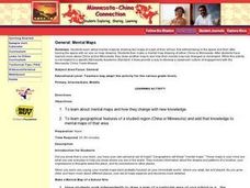
Minnesota-China Connections: Mental Maps
Students examine the concept of mental mapping. They draw a map of their school, before and after touring the space they draw. Then they draw mental maps of China and Minnesota, before and after seeing actual maps of the areas.
Curated OER
Media Center Map Skills
Student demonstrates the ability to locate, retrieve, and handle media and equipment by utilizing the library media center floor plan, symbols, and guides. They then use systems of classification to identify, locate, and retrieve materials.
Curated OER
THE GULF STREAM
Students explore how to describe the Gulf Stream, how Benjamin Franklin charted it, and correctly plot it on a map.
Library of Congress
Marco Paul's Travels on the Erie Canal: An Educational Voyage
Following the book, Marco Paul's Travels on the Erie Canal, readers complete an activity for each chapter, take part in discussions, and respond to several questions. To show what they know, scholars create an alphabet book using primary...
Curated OER
Ecozones Project
Students examine, detail and produce a display about a particular ecozone in Canada. They produce a detailed wall map, written report and a summary sheet.
