Curated OER
Southeast Asia and the South Pacific: Political
In this Southeast Asia and the South Pacific political map worksheet, students examine boundaries of each of the countries and the placement of the capital cities. The major bodies of water are labeled.
Curated OER
United States of America: 1860
In this United States historical map worksheet, students examine the boundaries of the labeled states and territories of the nation in 1860.
Curated OER
Los Estados de Mexico
Students investigate the country of Mexico and its geographical regions. They conduct research using a variety of resources. The information is used in order to create the context for creating a clay model labeled with the geographical...
Curated OER
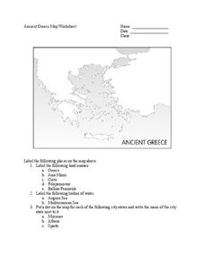
Ancient Greece Map Worksheet
Since the beginning of time, geography has shaped the development of human civilization, and ancient Greece is no exception. This activity supports young historians with exploring this relationship as they first identify key land masses,...
Angel Island Immigration Station Foundation
Where Is Angel Island? An Introductory Geography Lesson
Prepare young historians for a study of Angel Island Immigration Station with a lesson examining primary and secondary source materials, maps, and websites. Using what they have learned, individuals create a map of Angel Island, labeling...
Rainer Goebel
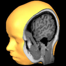
Brain Tutor 3D
The human brain is staggeringly complex, and its structure can seem impossible to grasp. This user-friendly app allows for exploration of the brain's anatomy, providing nomenclature, 3-D mapping, and functions.
Curated OER
Freeform Pennsylvania Map
For this Pennsylvania map worksheet, students research, study and label twenty important cities, physical attributes and the neighbors that surround Pennsylvania on a Pennsylvania map.
Curated OER
Freeform Texas Map
In this Texas map learning exercise, students research, label and discuss the most important cities in Texas, its physical attributes and the states that surround Texas.
Curated OER
Map of Papua New Guinea
In this geography of Papua New Guinea worksheet, students color and label a map with major cities and physical features. Students will need to do their own research to label this blank map.
Curated OER
Map of Austria
In this geography of Austria instructional activity, students color and label a map with major cities and important physical features. Neighboring countries are also shown but are not labeled.
Curated OER
Map of Australia
In this geography of Australia learning exercise, students color and label a map with major states, cities and physical features. The Australian state borders are shown but not labeled.
Curated OER
Outline Map of Guam
In this outline map of Guam worksheet, student see a black line map of the country with the capitol city of Agana labeled on it. There are no questions to accompany the map.
Curated OER
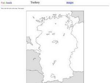
Outline Map of Turkey
In this outline map of Turkey worksheet, students see a blank map of the country with the adjoining countries shaded in gray. There are no labels on the map.
Curated OER
Bow-Wow County
For this maps and reasoning skills worksheet, students use the 8 clues provided to label the towns on the map. Students make sure the towns they have labeled on the map fit all the clues.
Curated OER
Using Four Main Directions in the Classroom
Young scholars identify the four cardinal directions. In this map skills geography lesson, students use a magnetic compass to label the four directions in the classroom. Young scholars use the four directions to locate objects in the...
Curated OER
Country Capitals
Students locate country capitals on a world map. For this map skills lesson, students review the definition of the word country and discuss what a capital is. Students locate and label capital cities on a world map using a map marker.
Curated OER
Name That Continent
Students practice locating the seven continents, four hemispheres, and four oceans using a large world map and a review song. They also import a world map to the Kid Pix computer program then type in proper labels on the map. There are...
Curated OER
Where the Parks Are
Students research major league baseball in United States and Canada. In this baseball history lesson, students use a map of the United States and Canada to find and label each major league team. Students then color the home cities of the...
Curated OER
The Water Around Us
Students discuss importance of reading maps and knowing about the geography of the United States, and locate bodies of water on different types of maps and examine how they are used in the state or local community.
Curated OER
Continents and Oceans
Students identify oceans and continents and their locations on a map. They color-code and label their own map of the world's continents and oceans. They play the game Continents and Oceans to identify specific areas.
Curated OER
Facts, Fictions and Perceptions of Regions
Students examine the different characteristics of the regions of the United States. They discuss places they have visited in the U.S., and in small groups conduct research on a selected region of the U.S. Each group labels a map of...
Curated OER
Getting To Know Germany
In this getting to know Germany worksheet, students use map skills (map not included) to answer 14 questions, then draw a map of Germany labeling the capital and major cities.
Curated OER
Where's the Sand?
Students identify the characteristics of deserts. In this geography lesson plan, students discuss the characteristics of a desert and label a map with the names of deserts.
Curated OER
Geography Skills
Young scholars practice their geography skills. In this geography skills lesson plan, students locate, plot, and label places on maps and globes.
Other popular searches
- Labeling a Map
- Africa Map Labeling
- Midwest Map Labeling
- Geography Map Labeling
- Labeling a Map Continents
- Labeling Map Parts
- Labeling Parts of Map


