Curated OER
Route To School Mapping Assignment
Students create a map showing the route from home to school. Students include a legend, compass, label buildings, and color the map route on the map. They write out specific directions.
Curated OER
Esperanza Rising: Lesson 2
Sixth graders explore adversity. In this summarizing lesson students compare their culture to the Hispanic culture. Students reflect on a time they were met with adversity. Students summarize Chapter 1 of Esperanza Rising.
Miama-Dade County Public Schools
Ancient Rome
This resource outlines several general activities for a study of Ancient Rome, and includes guiding questions, a handout on the story of Romulus and Remus, and ideas for incorporating mapping and timeline activities into your review.
Curated OER
Introducing Literacy Elements in Nonfiction
Explore nonfiction writing with your class. They will identify elements in nonfiction by reviewing elements of fiction. Then they use biographies, memoirs, menus, Time for Kids, and text books to identify elements of nonfiction. They...
Curated OER
The Power of Maps & Native American Cultures
Sixth graders discover where and how five Native American cultures lived in North America in what is currently the United States. They examine their way of life and the regions they inhabited. Additionally, 6th graders will understand...
Curated OER
Arkansas History Lesson Plan: Identifying Arkansas on a Map
Students investigate their hometown of Arkansas. In this U.S. Geography lesson, students identify Arkansas on a map and distinguish it form the other states. Students investigate the history, state line, and personal experiences that...
Curated OER
INTERPRETING MAGNETIC FIELD MAPS
Students interpret magnetic field maps, rotate the coordinates to obtain different views, change the coordinate representation, and produce alternate graphical representations.
Curated OER
Mapping with a Compass: A Simulated Survey
Students use compasses and grids to map the locations of artifacts found in a simulated dig site. In groups, they role-play as future archeologists excavating a school site. Groups begin at their assigned datum and site the artifacts...
Curated OER
Mapping and Excavating a Jello Mold
Fifth graders, in groups, map the three layers of different colored jello layers in molds and note the placement of fruit in them. On the grid paper they draw each grape, raisin, or other object and carefully remove each layer. After...
Curated OER
Coordinate Grid: Mapping Archeological Sites
Fourth graders discover how to apply the Cartesian coordinate system by figuring out the length and width of their school playground. They determine that pacing is an important tool for the initial mapping of a site. Students conduct a...
Curated OER
Do You Need a Map?
Students explain ways marine navigation is important in modern society. For this map study lesson students use a retrieval tool to obtain real-time information on weather forecasts.
Curated OER
What are Mental Maps
Young scholars use mental maps to give directions and become aware of the place in which they live.
Curated OER
Map Studies - Estimate And Measure Distance
First graders explore estimating and measuring distances. They analyze and discuss a map of New York State, make estimations, measure distances using yarn, and calculate total distances between cities on the map.
Curated OER
Places in My World
Second graders explore where they are located on the globe. For this maps and globes lesson, 2nd graders use a map to show where they live and show the cardinal directions. Students identify characteristics of mountains, flat land,...
Curated OER
Understanding Community Environment
In this understanding community environment worksheet, students, after exploring 5 parts of a study unit (link provided), choose a project (make a video, book, game, plan a garden or nature map, collect data, write a rap or crossword...
Curated OER
Creating a Story Map Using Kidspiration
Fourth graders use computer software, Kidspiration, to create a graphic organizer detailing main characters, setting, problem, solution, and theme of their favorite short story. Students also discover how graphic organizers can help them...
Curated OER
Beyond Demographics
Students study the Dominican Republic through watching and discussing a video about the country and its people. They explain life in the Dominican Republic and describe the emerging picture of the Dominican Republic as viewed through...
Curated OER
Papyrus to PDA
What a great project. Graphic arts learners consider the social, political, and economic impact made by a chosen invention. They build an argument to substantiate their reasons for choosing said invention. They create an oral...
Curated OER
Where Has It Been? Tracking the Ivory-Billed Woodpecker
By studying the assumed extinction, and subsequent rediscovery of the Ivory-billed Woodpecker, learners use maps and come up with a scenario for the rediscovery of the bird. This incredibly thorough lesson plan is chock-full of...
Curated OER
Solar Heating in the Himalayas
A fascinating instructional activity on how solar power is utilized by people who live in the Himalayas is here for you. In it, learners perform a case study which will help them understand that solar energy is a renewable resource, that...
Curated OER
Explorers in Kansas
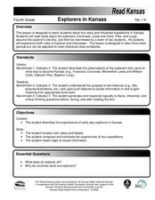
Fourth graders read cards about the explorers: Coronado, Lewis, and Clark, Pike, and Long. In this influential expeditions lesson, 4th graders describe and observe explorers who came to Kansas. Students locate main reasons and details as...
Curated OER
Using the Carbon Cycle Interactive Game in the Classroom
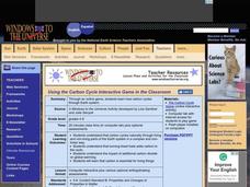
An online reading and interactive game bring the path of a carbon molecule to life for your earth science explorers! As an assessment, learners can map out or write about their experience in the carbon cycle. Thoroughly written...
Discovery Education
Submarines and Aircraft Carriers: The Science of Nuclear Power
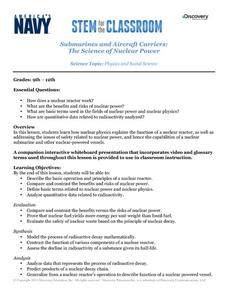
As physics masters view this presentation, they learn how nuclear power is used in submarines. They use Google Maps to plot a course through the ocean and calculate the time required for surfacing and traveling. They learn about fission,...


