PBS
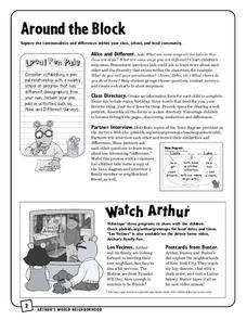
Around the Block
Arthur and his friends help children explore the concepts of family, community, and diversity in a fun series of activities. From performing peer interviews to mapping out the different places students have lived or visited, this...
Kate Stickley
Reading the World: Latitude and Longitude Lesson latitude and longitude, maps, coordinates on a map, prime meridian, reading maps, equator, globes
Find five activities all about longitude and latitude! Use oranges to show the equator and prime meridian, plot birthdays on a map using coordinates, and plan a dream vacation.
Curated OER
Creating a Life Map
Students create their own life map in which they introduce themselves to each other by sharing what they are most proud of. They use a life map to expressive themselves creatively.
Curated OER
John Smith’s Map of the Chesapeake Bay
Young geographers travel back through time with primary source and map analysis and envision Captain John Smith's arrival at the Chesapeake Bay.
Houghton Mifflin Harcourt
Voyagers: Challenge Activities (Theme 5)
Young voyagers face the challenge of the wide dark sea, travel with Yunmi and Halmoni, and even get trapped by the ice as they explore the reading selections offered in these enrichment activities designed for the Houghton Mifflin...
Curated OER
Where Am I? Map Activity
In this map activity worksheet, students determine which countries are shown on a set of 16 maps, then read facts about each country designed to help with a report on that country.
Curated OER
Map Skills
Thirds graders reinforce that a map is a drawing that shows what a place looks like from above. They use a map key and symbols to create a map of the school and its neighborhood.
Curated OER
Current Earthquake Activity
Fifth graders record any earthquake activity throughout the school year on various maps. In groups, they identify a map locating the points given to them by their teacher. To end the lesson, they add the date, strength and damage to each...
Curated OER
Across the United States- Home Learning Activity
In this home-school United States map worksheet, students work with a family partner as they study a map of the United States. They talk about the states they have visited, play a game by giving each other clues about states, and write...
Curated OER
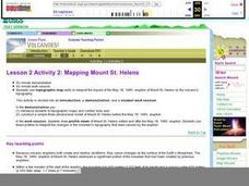
Lesson 2 Activity 2: Mapping Mount St. Helens
Students use topographic map skills to interpret impact of the May 18, 1980 eruption of Mount St. Helens on the volcano's topography, and draw profile views of Mount St. Helens before and after the May 18, 1980, eruption.
Curated OER
Introducing Maps Through Dance
Students are introduced to the key concepts of maps; direction, pathway/line, shape and symbol. They create the pathways and shapes they have "mapped" out on paper on the floor. They dance along the paths.
Curated OER
Weather Maps and Prediction
Young meteorologists read basic weather maps by learning about the symbols that are associated with them. This two-day instructional activity has some excellent demonstrations and activities to get youngsters thinking about the weather...
Education World
Edible Resource Maps!
Young scholars discuss resource maps and examine examples from library resources. Working in groups, they create edible resource maps by drawing examples, such as popcorn on the border of Iowa and Nebraska. Then they use cookies in the...
Curated OER
Isolines on a Weather Map
Ninth graders recognize isolines on a weather map and draw isolines based on temperature data on a weather map. They draw isotherms on a weather map to identify temperature patterns.
Curated OER
Story Mapping
Fill-out a story map to help your scholars with pre-writing. They will use a story map template to pre-write. They also organize their ideas into steps which become the foundation for their first draft. Concrete objects are brought in to...
EngageNY
Reading Maps: Locating the Countries We Have Been Reading About
Show your class how to read a map and decipher all of the markings and features. Start out by connecting maps to their homework from the night before and their current reading, in this case That Book Woman, and a related informational...
Curated OER
Creating a Thematic Map
Students create and analyze a weather-related data table and a thematic map based upon information provided.
Curated OER
Use Google Maps to Teach Math
Capture the engagement of young mathematicians with this upper-elementary math lesson on measuring time and distance. Using Google Maps, students first measure and compare the distance and time it takes to travel between different...
Parkwood Hill Intermediate
Map Skills Project
Young pupils develop their mapping skills and knowledge by designing their own islands, using geographic terms and physical features they have learned as features of their work.
Curated OER
Character Map #1
Here’s a great graphic organizer that can be used with any narrative. Readers select a character and record feelings, descriptions, behaviors, and personality traits. The template could be used for group work or as a prewriting activity...
Curated OER
Map Exploration
Are you looking for a terrific lesson on map activities for your second graders? Then, this resource is for you! The activities range from decoding, to fill-in-the-blank, to read-and-search. There is a website activity related to maps...
National Endowment for the Humanities
On This Day With Lewis and Clark
Walk in the footsteps of Lewis and Clark as they discover the wonders, beauty, and dangers of the American frontier. After gaining background knowledge about Thomas Jefferson and the Louisiana Purchase, young explorers use primary...
Curated OER
Mt. Whitney to Death Valley
This is an intriguing problem that brings together real-world data, technology, and mathematical problem solving. If visibility wasn't an issue, could you see from the highest point in the lower 48 states, Mt. Whitney, to the lowest...
Curated OER
Wisconsin Map Activity
In this Wisconsin map worksheet, students fill in the capital, major cities and other state attractions on a blank map of Wisconsin. A reference web site is given for additional activities.
Other popular searches
- Korean War Map Activity
- Prehistory Map Activity
- Ancient Greece Map Activity
- Us Imperialism Map Activity
- China Map Activity
- Map Activity Europe
- Cold War Map Activity
- Israel Map Activity
- Topographic Map Activity
- Economic Activity Map
- Pangaea Map Activity
- Outline Map Activity


