Curated OER
Christopher Columbus
Help first graders gain an understanding of the beginnings of our nation by learning more about Christopher Columbus. They begin by listening to a read aloud of Christopher Columbus and His Voyage to the New World (another title...
Curated OER
Aerial Photography
Eleventh graders compare the artistic values of Terry Evans' photography with LandSAT images and other images made for purely scientific, government and commercial purposes. They consider the artistic choices made in aerial photography.
Curated OER
Call to Arms: A Service Project
Sick of selling candy and washing cars? How about hosting a Digital Day or a Learning Lunch? The suggestions here make fund raising fun and rewarding. Raise money to preserve important maps and other primary source documents.
Angel Island Immigration Station Foundation
How Do Pictures Tell the Story of Angel Island?
Young historians learn more about the history of Angel Island Immigration Station through their analysis of primary source images. Guided by a list of inferential questions, scholars learn how to make and record observations on a...
K20 LEARN
Show and Tell Museum - Investigating Primary Sources: Read and Interpret Primary Sources
Scholars become detectives in a lesson plan that focuses on primary sources. Learners practice their observational skills by examining the teacher's artifact and visiting the Show and Tell Museum that highlihgts items from...
Curated OER
Arkansas History Lesson Plan: Identifying Arkansas on a Map
Students investigate their hometown of Arkansas. In this U.S. Geography lesson, students identify Arkansas on a map and distinguish it form the other states. Students investigate the history, state line, and personal...
Curated OER
Mapping the Prairie
Fifth graders study maps of the Chicago area looking at defining characteristics and place names. They investigate settlement patterns by looking at the maps.
Curated OER
Things That Stick Out Or: How To Find Your Way Around on a Map
Students explain the meaning of and recognize the map outlines of a peninsula, an isthmus, and a cape.
Curated OER
The Silk Road, An Ancient Internet
Students examine how goods and ideas moved along an ancient trade route between China and Europe. They make charts of items, ideas, etc. that were transported along the Silk Route.
Curated OER
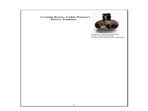
Indian Women in Texas History
Fourth graders study Indian women in Texas. In this US history lesson, 4th graders discuss what each Indian woman's contribution was by completing a timeline and table. Students examine the Caddo Women's pottery tradition...
National Gallery of Art
Islamic Art and Culture
Provided by the National Gallery of Art in Washington, this resource for teachers examines Islamic art, including calligraphy, arabesques, and geometric designs. A recounting of the spread of the faith and the tumultuous political...
Curated OER
Ancient Trade Routes
Learners research details about ancient trade routes such as the silk, amber, tin, and incense routes. They make a map showing the trade routes and add details to maps, such as keys and samples of products traded. They compare ancient...
NIOS Download
The Harappan Civilization
The Harappan Civilization, also known as the Indus Valley civilization (2600 BC-1900 BC), is the focus of a resource packet that details the rise and fall of a culture that existed in India during the Chalcolithic period of...
Curated OER
Family Album
Kids of all ages discover their family histories through pictures. First, flip through the PowerPoint provided (or consider making one of your own). It should show pictures of your family and have clear, easy to understand sentences that...
Curated OER
Mexican Metal Tooling
Metal work can be a wonderful way to expose learners to Mexican folk art. This resource provides all the necessary steps for creating Mexican metal tooling with your art class. Images, web links, recommended books and products make...
Curated OER
China Quest
Read and research information on China. Young researchers complete a knowledge hunt about China then locate and describe each location using directional words. They recognize the word meaning through context clues and application practice.
Agriculture in the Classroom
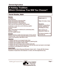
A Holiday Tradition: Which Christmas Tree Will You Choose?
Different varieties of Christmas trees provide an interesting way to combine social studies, science, math, and technology. Class members not only research the history of the Christmas tree holiday tradition, they compare and...
Curated OER
Places in Arkansas: A Tour of Our Unique State
A great instructional activity focuses on important cultural and historical places in the state of Arkansas. Learners are introduced to six important places in Arkansas, then create a report on a place in Arkansas. Some excellent...
Chicago Botanic Garden
Historical Climate Cycles
What better way to make predictions about future weather and climate patterns than with actual climate data from the past? Young climatologists analyze data from 400,000 to 10,000 years ago to determine if climate has changed over...
Curated OER
Whitewater Canal State Historic Site
If you happen to live in Indiana, or a neighboring state, and are planning a field trip to the Whitewater Canal State Historic Site, then this lesson plan will suit your needs quite well. In it, suggestions for activities before, during,...
Core Knowledge Foundation
Columbus Sailed the Ocean Blue
Young adventurers embark on a journey, setting sail along the blue ocean with Christopher Columbus. Teachers will find that this unit makes their lesson planning smooth sailing!
Curated OER
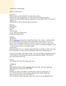
Colonial Maps
Students discover the history of America by identifying the traditional colonies. In this U.S. history lesson, students examine a world map and identify where the voyagers left from Europe to arrive at the United States. ...
Curated OER
Understanding a Geological Map
Students identify different types of maps and observe a geological map. In this geology instructional activity students create a replica map of a geological area that includes a key.
Curated OER
Geological Maps of the Western Regions
Students study the geological makeup of the West. In this geological maps lesson students creat a map that includes a key and present it to the class.


